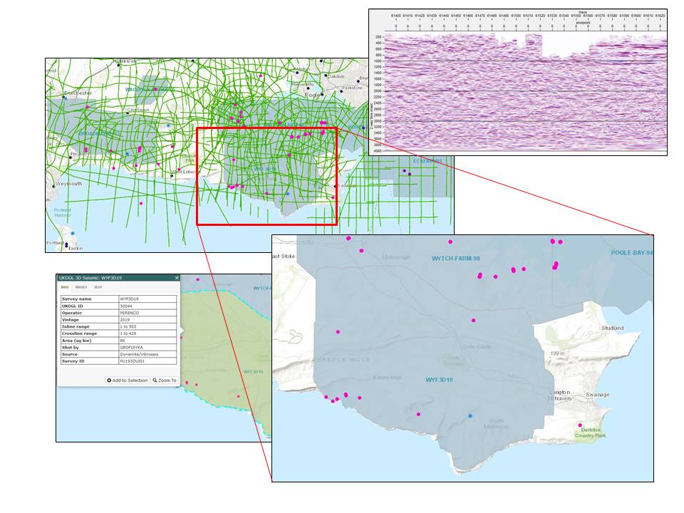
The UK onshore seismic survey WYF3D19 and associated supporting data is now available to access from UKOGL following the end of the proprietary period.
Originally recorded in 2019 by Perenco, the 86km2 3D survey provides additional seismic data coverage over the Dorset South coast with the 1998 Wytch-Farm-98 3D survey situated to the North and Poole Bay located to the East.
Survey data is available for both commercial and academic use (subject to applicable licensing and output charges). Further information about the survey and access to the data is available via the UKOGL website and interactive map.
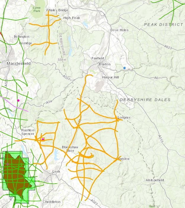
UKOGL Trustees are pleased to announce that we have recently completed the archive and release of previously unavailable pre and post-stack digital data sets from a number of Deepwood Mining exploration surveys, located onshore in the SW Pennines, 40 years after they were recorded.
These original digital seismic data sets were not available to UKOGL when prints of seismic lines were scanned and vectorised for archiving in 2005.
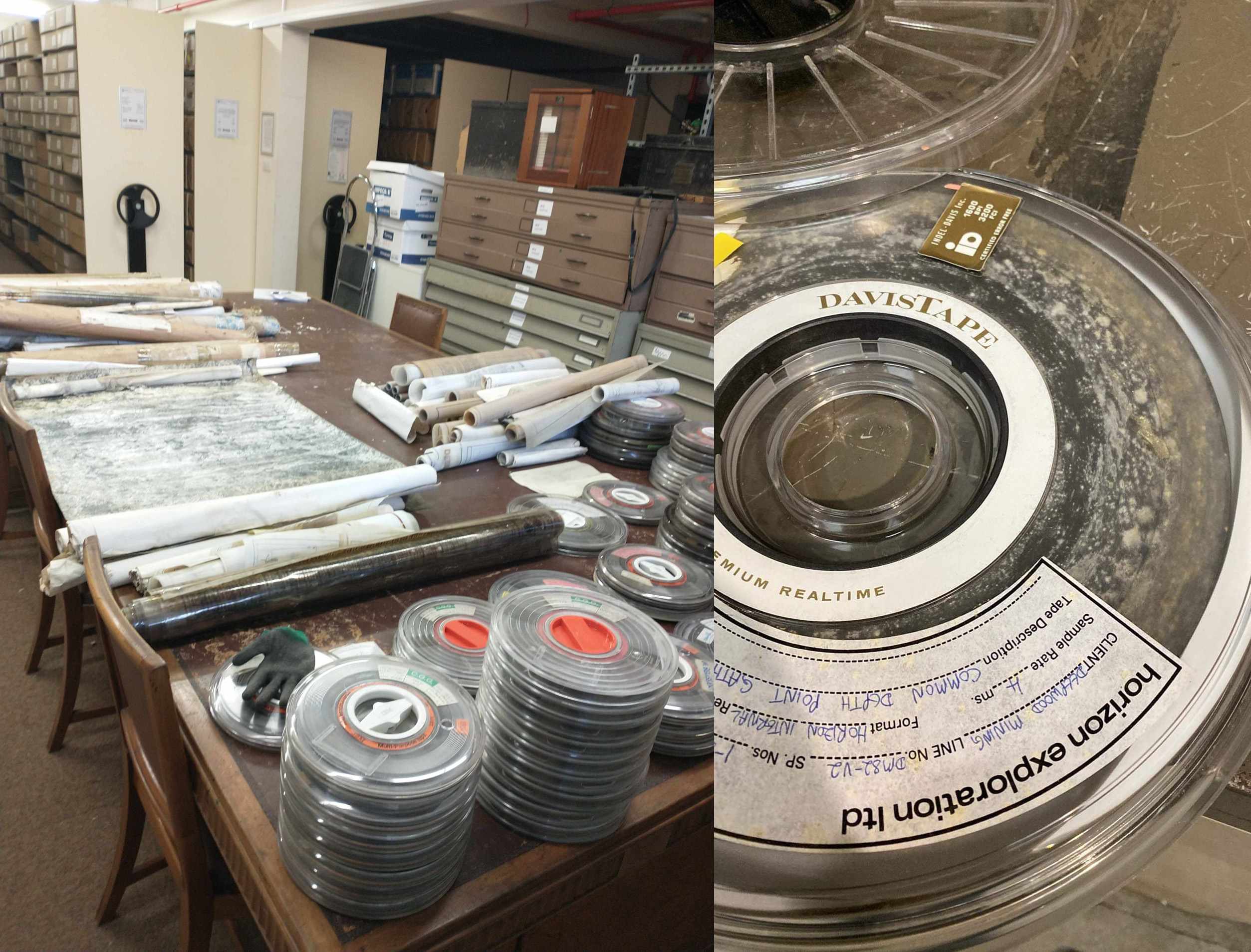
The Trustees would like to thank the British Geological Survey for their assistance in rescuing these data and making them available for archive. The data had been stored in very poor conditions for many years and this was reflected in the state of the media when supplied to UKOGL. Data rescued consisted of a range of media formats, including 9 track magnetic reels, hardcopy paper and sepia sections, navigation plots and contoured base maps. A large proportion of the hardcopy paper and sepia media was damp and covered in mould, having to be dried out and cleaned before any attempt could be made to assess and archive.
The 9 track magnetic reels were in a similar condition and were sent out to Ovation Data for stiction treatment and transcription in order to maximise the data recovery process.
Despite the very poor condition of the data, a large proportion has been recovered and is now available from UKOGL. Please contact us for more information.
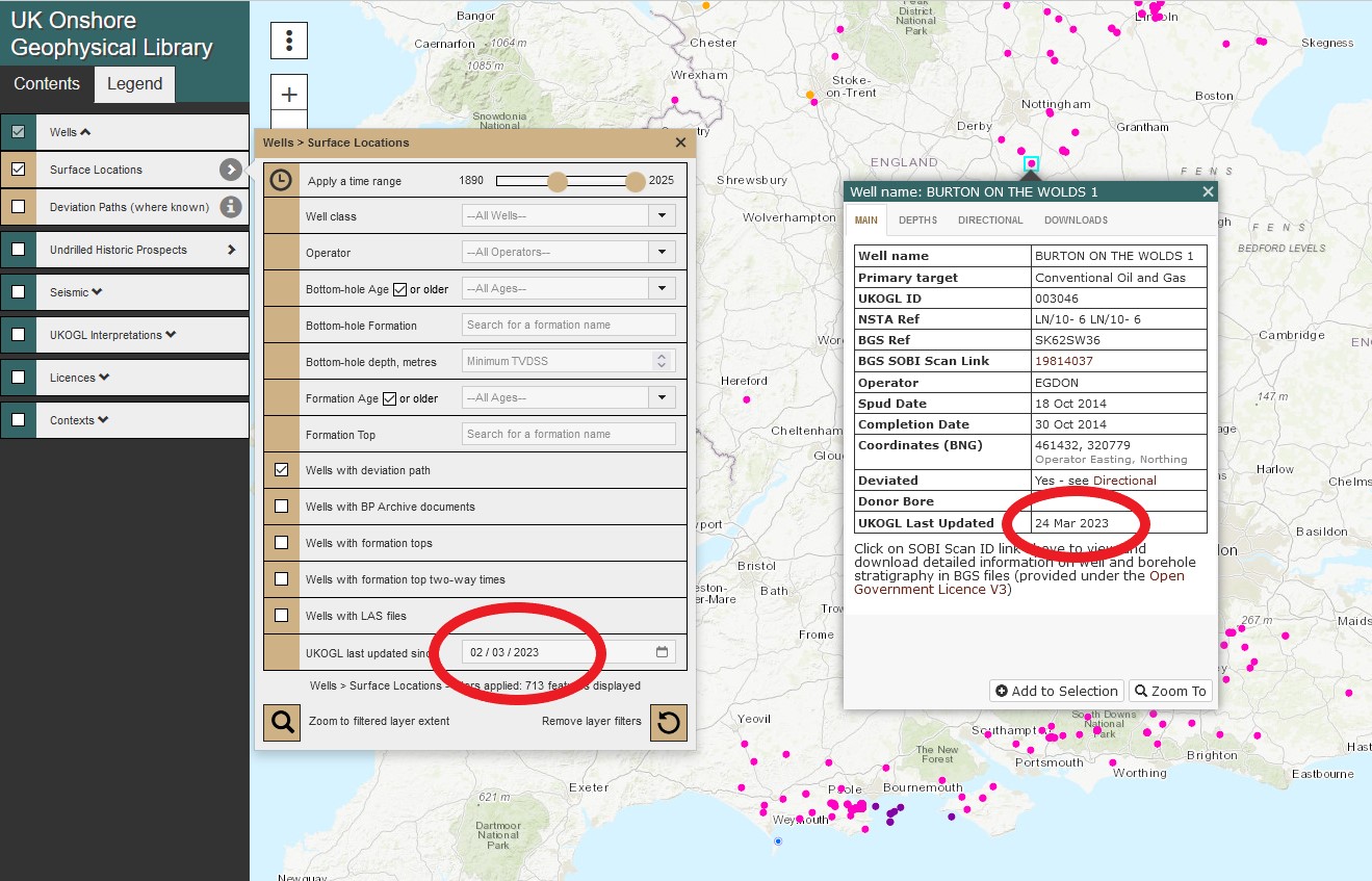
UKOGL have added a new filter option to the Wells layer of the Interactive Map to helps users when searching for UK onshore data. The wells displayed on the map can now be filtered using the ‘UKOGL last updated since’ option to only display the wells that have had new or updated data added to the site since the user defined date.
Wells that haven’t had any new data added after the user selected date will not be displayed. The new filter option can be also be combined with other available search options to further refine a query.
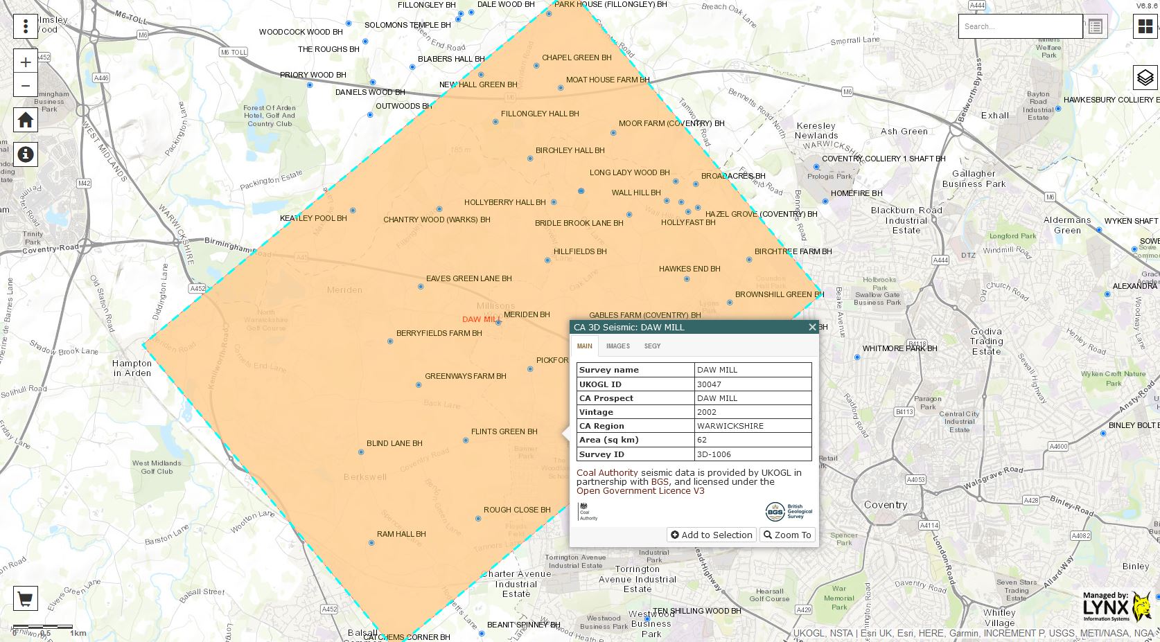
UKOGL are pleased to announce that post stack seismic data and digital LAS data located over the Daw Mill 3D survey in Warwickshire have been added to the UKOGL archive. The data is available to download via the UKOGL interactive map.
The new Coal Authority data over the area displayed in the map below can be accessed for free under the Open Government Licence.
The available post stack data for the Daw Mill survey was originally recorded and processed in 2002, 2004, 2005 and 2011, expanding the coverage to the South West of the original 2002 survey with each subsequent year of recording.
The final 2011 merged and reprocessed post stack 3D data volume provides full seismic data coverage over the Daw Mill survey area.
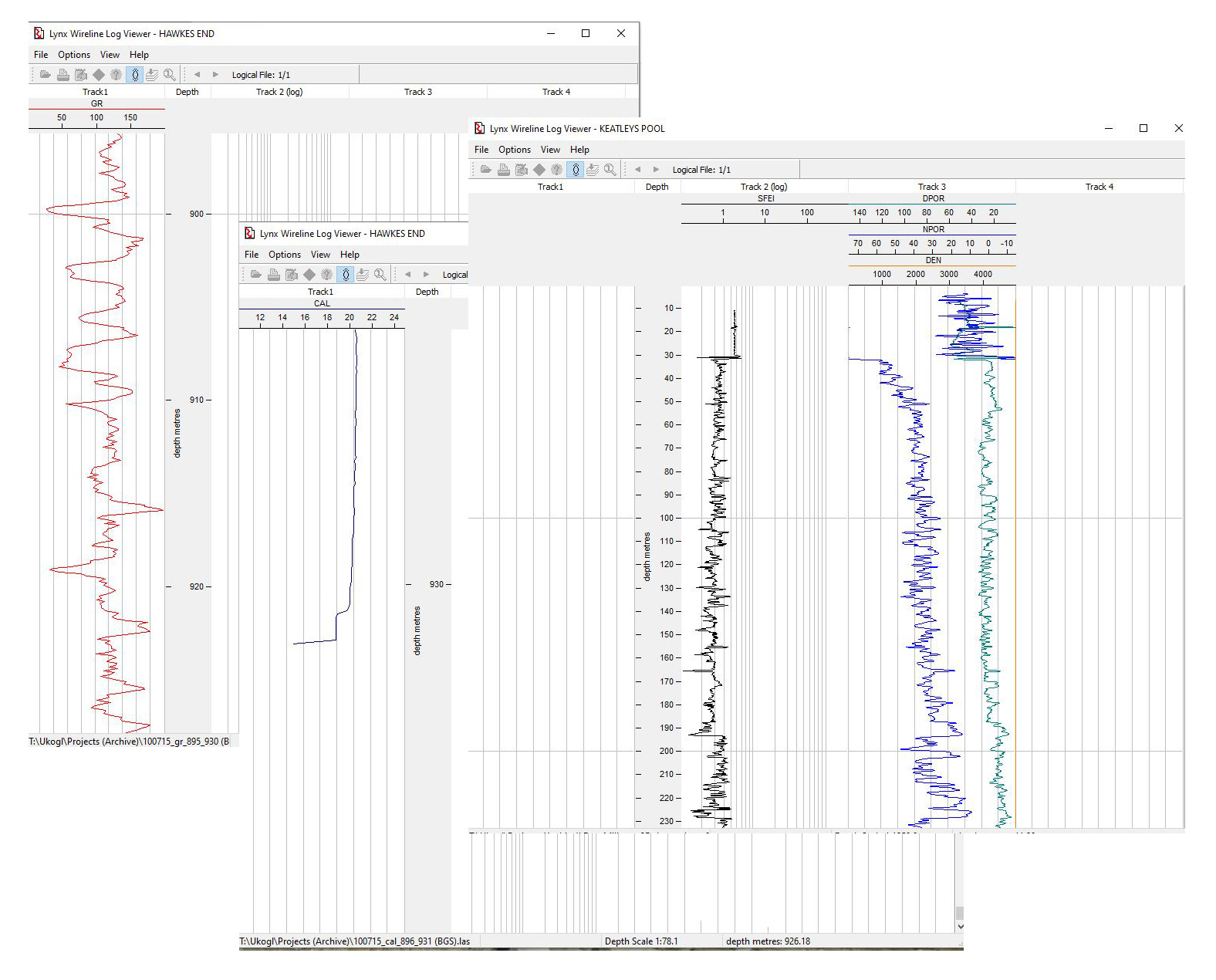
In support of the available 3D seismic, LAS data is available to download for 32 of the 37 coal boreholes that are currently displayed by UKOGL over the area of the Daw Mill 3D survey, and this includes comprehensive logging suites for the newly added Eaves Green Lane BH and Keatley Pool BH.
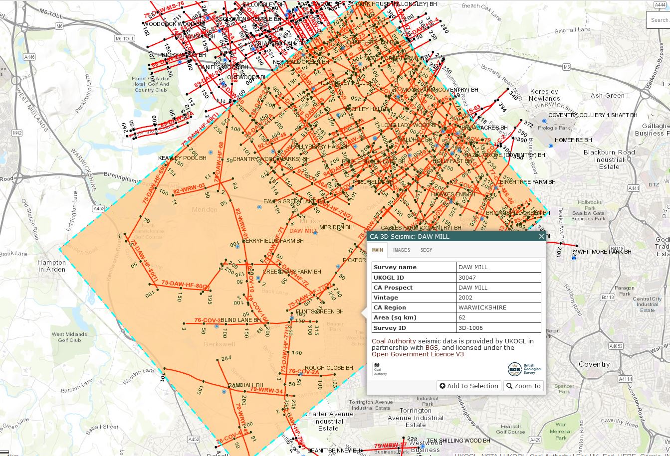
These two new data sets add to the coverage that’s already provided by the 2D Coal Authority seismic data over this area of Warwickshire (displayed in the map below). All Coal Authority data is available to download for free from the UKOGL interactive map.
UKOGL are pleased to announce that in agreement with the British Geological Survey, post stack digital data recorded by the BGS and the Coal Authority can now be accessed free of charge under the Open Government Licence by all users of the UKOGL interactive map.
Post stack data is output under an Open Government Licence by UKOGL to both academic and commercial entities with full confidentiality.
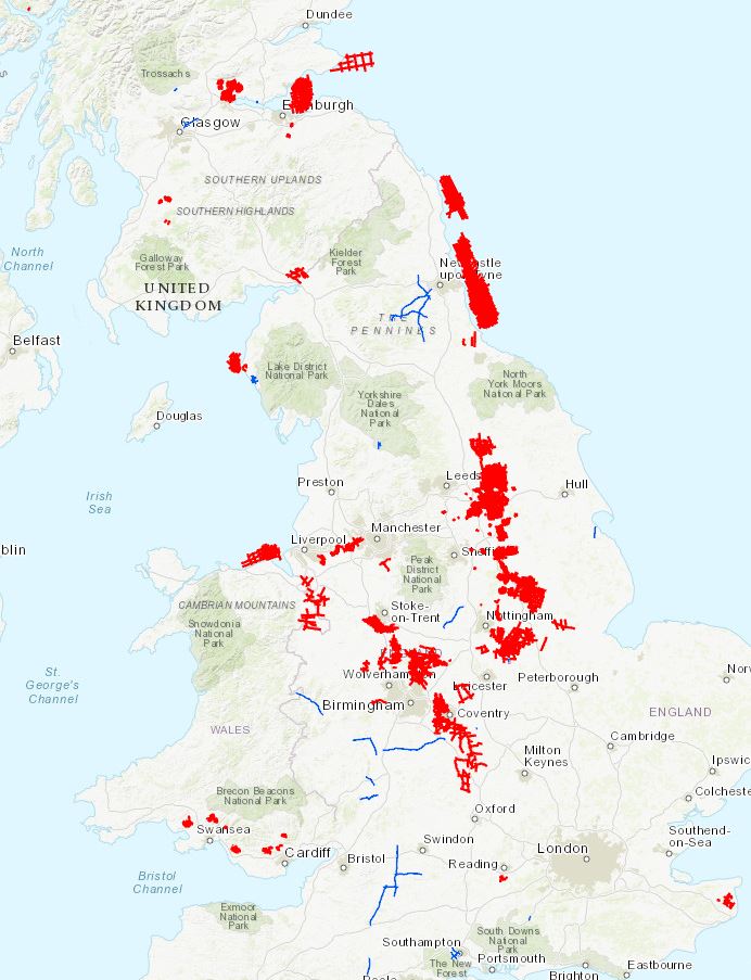
The post stack data coverage that can be accessed under the Open Government Licence via the UKOGL Interactive map is displayed below:
British Geological Survey Data – Blue Coal Authority Data – Red
Lines on the map can be selected individually and added to your ‘Shopping Cart’ or by creating an ‘Area of Interest’ and then adding all lines in a single selection process.
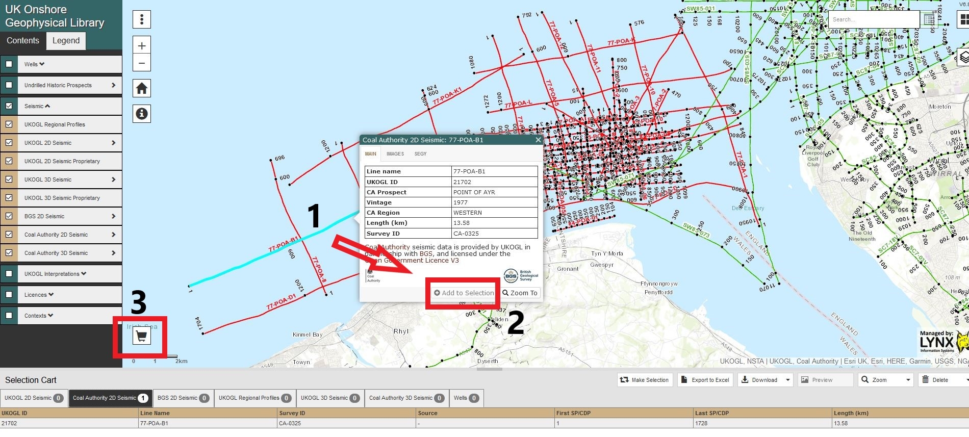
Single line selection:
Select each individual line
Select ‘Add to Selection’ via the line information panel
Select the ‘shopping cart’ icon to display the selected lines
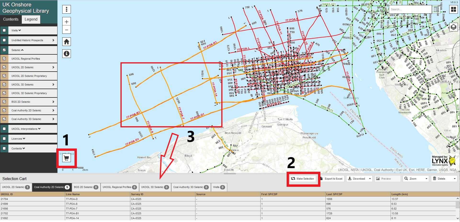
Multiple line selection:
On the map select the ‘shopping cart’ icon
Select the ‘Make Selection’ icon
Create an area of interest over the lines to automatically add them to your ‘basket’
Lines that have been added to your basket can be previewed and removed, allowing the data selection to be refined if required.
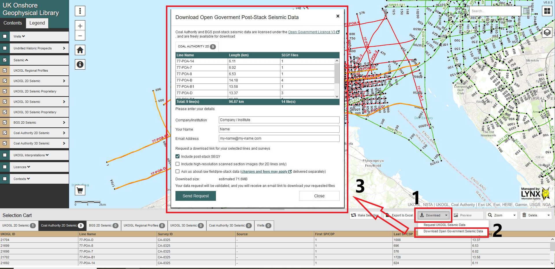
Data Access and Download:
Once all your required lines have been selected:
Select the ‘Download’ icon
Select the ‘Download Open Government Seismic Data’ icon
Fill in your details, data options and email address and select ‘ Send Request’
Your data request for post stack seismic data will be sent to UKOGL and you will receive an email link to enable the data that’s available under the Open Government Licence to be downloaded.
Access to raw and pre-stack data under the Open Government Licence is available, but it may be subject to additional charges and fees and you will be contacted separately if pre-stack data is requested.
All seismic data not available under an Open Government Licence can still be licensed and accessed for both commercial and academic use through UKOGL.
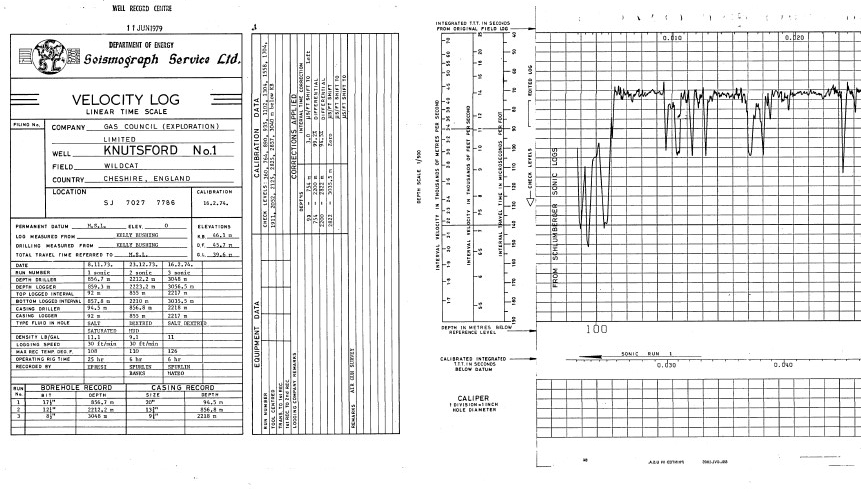
UK onshore velocity well log images are now available to be viewed and downloaded from the UKOGL interactive map.
The velocity well log images for Conventional Oil and Gas wells can be accessed via the well log information panel, where available the images can be accessed by the ‘Downloads’ tab.
Velocity well log images are now available for 422 onshore wells and where available, the data is comprised of:
UKOGL has recently added to its coverage of onshore well data that’s available to download from the interactive map.
Transcribed and reformatted from a collection of National Coal Board data, it was originally supplied on 5 1/4″ floppy disks and is now availble to download as LAS data files.
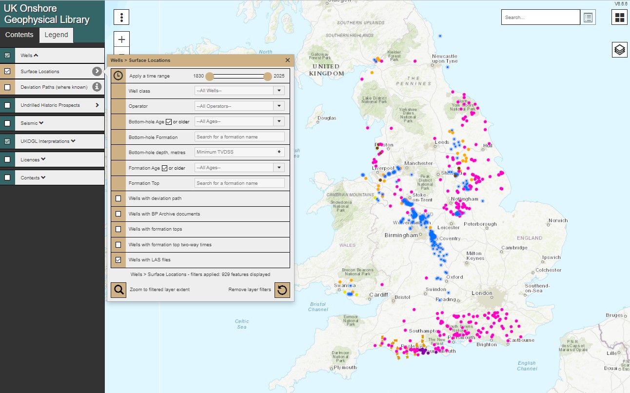
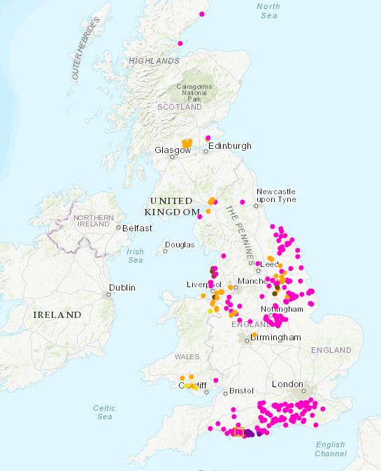
Onshore wells with available LAS data can be filtered to highlight the coveage and provide access to the files via the interactive map.
UK Onshore Well loactions with available LAS data (NCB data in blue)
This data is made available as part of the ongoing project to provide access to UK onshore LAS data via the UKOGL interactive map.
IN ANOTHER MAJOR STEP FORWARD IN THE PROVISION OF ONSHORE DATA, UKOGL ANNOUNCES THE PROVISION OF LAS DATA FOR OIL & GAS WELLS
Following the release of UK Onshore oil & gas well composite logs via the UK Onshore Geophysical Library interactive map, UKOGL is pleased to announce the next stage of its initiative to provide simple free access to deep borehole information. UK onshore digital well data in LAS format can now be downloaded without charge. All wells with available LAS data can be filtered, selected and the data downloaded via the interactive map as part of UKOGL’s ongoing project to make more onshore data freely available. As more LAS data become available the UKOGL map will be updated to display the increased onshore data coverage.
UKOGL Well LAS Data Coverage
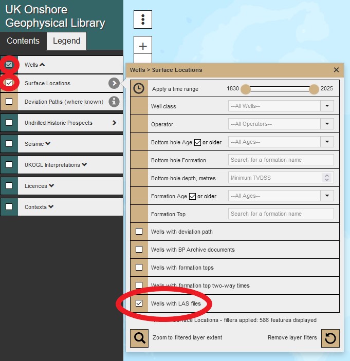
The coverage of UK onshore wells with LAS data can be filtered and displayed separately to aid in data selection via the interactive map ‘Contents Menu’ selection tick boxes.
UKOGL Interactive Map ‘Contents Menu’
From the ‘Contents Menu’ select: ‘Wells’ – ‘Surface Locations’ – ‘Well with LAS’ this will display the latest LAS data coverage.
The ‘Legend Menu’ provides details on the well type displayed, LAS data is available for conventional oil and gas exploration wells, as well as selected coal bed methane and shale gas wells.
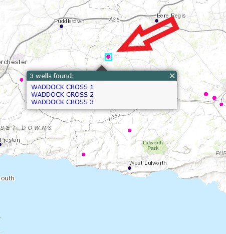
From the displayed coverage zoom to a well over the area of interest and select the well spot.
Well Spots With Available LAS Data
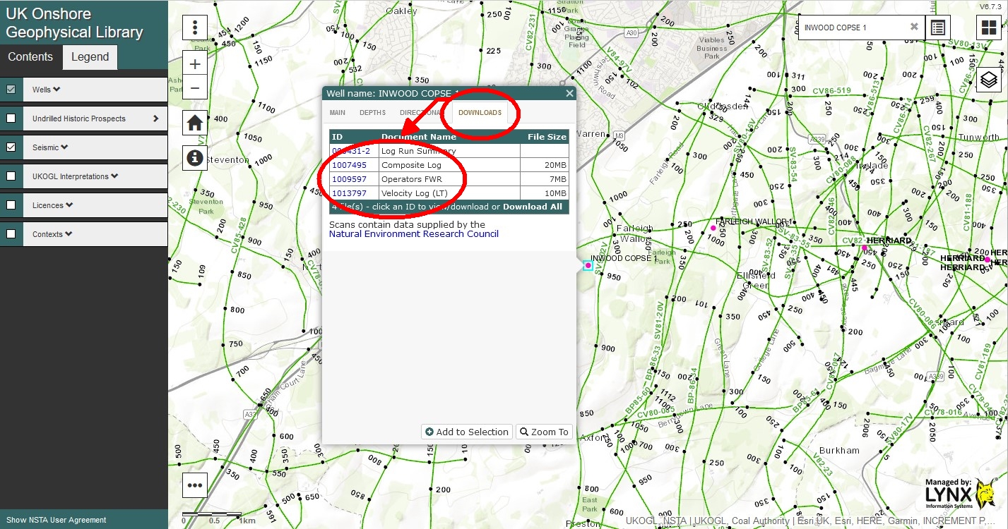
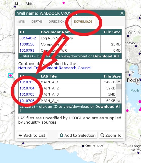
To access the LAS data select the ‘Downloads’ Tab from the information panel to display a list of available LAS files, complete with a summary of the included curves in each file.
LAS Data Listing With Available Curves And File Sizes
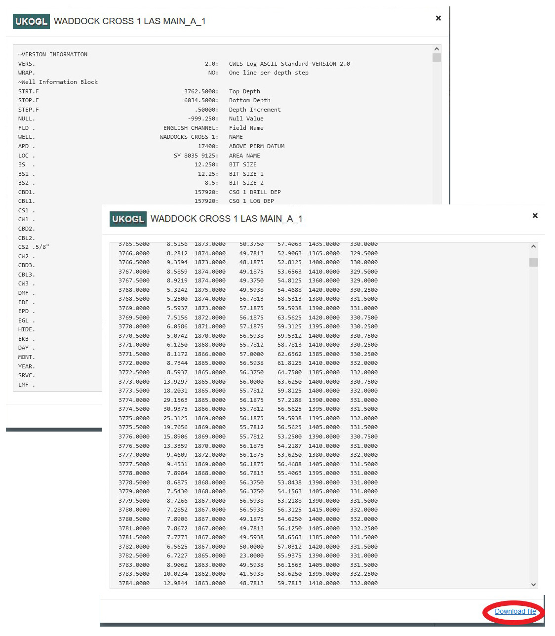
To access the LAS data select the ID hyperlink that lists the curves in each available file, once selected the curves will be displayed as an ASCII text file.
LAS File Data Display
To download the data select the ‘Download file’ hyperlink.
Please note that all LAS files are unverified by UKOGL and are ‘as supplied’ by industry sources.
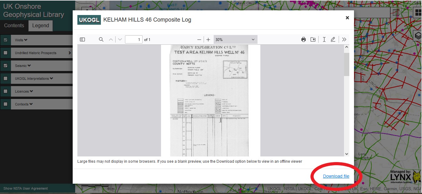
UK onshore composite well log images are now available to be viewed and downloaded from the UKOGL interactive map.
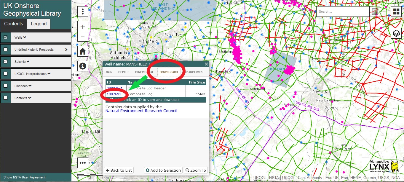
The composite well log images for Conventional Oil and Gas wells can be accessed via the well log information panel, the data is available via the ‘Downloads’ tab.
To view and download the available well log image, locate and select the Conventional Oil & Gas well on the interactive map, select the ‘Downloads’ tab and then select the ‘ID’ link to access the composite log.
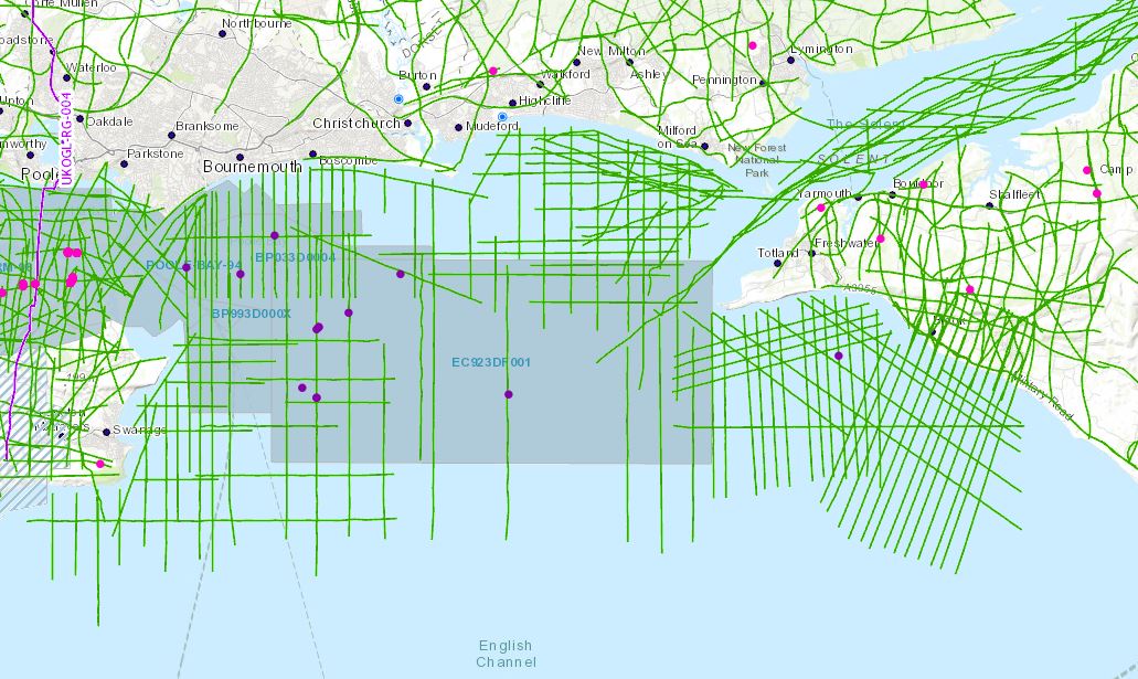
In support of the recent release of 2D, 3D seismic and well data located over Poole Bay, UKOGL have made available for download a selected set of data located offshore to the southwest of the Isle of Wight which provides greater coverage to tie this newly designated landward area to eastern onshore data. 11 of the 37 lines in the OX98-90 survey run onshore to enable seamless interpretation from onshore to offshore. The data set includes reprocessed 2D versions not available in the UK National Data Repository (NDR).
Instructions on how to access this data can be accessed via the Poole Bay Blog post here.
The intention of this exercise is to make it easier for interested parties to study this key area of British Geology. Additional offshore 2D data is available from the NDR but coordinates will need to be transformed to OSGB to match.