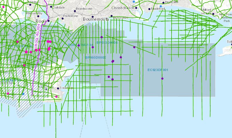
Now that Poole Bay has been designated a “Landward” area, UKOGL has archived and made available for download a selected set of data located in OSGB (National Grid) projection to enable seamless interpretation from onshore to offshore. These data include reprocessed offshore 2D and 3D versions not available in the UK National Data Repository (NDR). Well data, including LAS files, have been copied from the NDR database and relocated in OSGB.
The intention of this exercise is to make it easier for interested parties to study this key area of British Geology. Additional offshore 2D data is available from the NDR but coordinates will need to be transformed to OSGB to match.
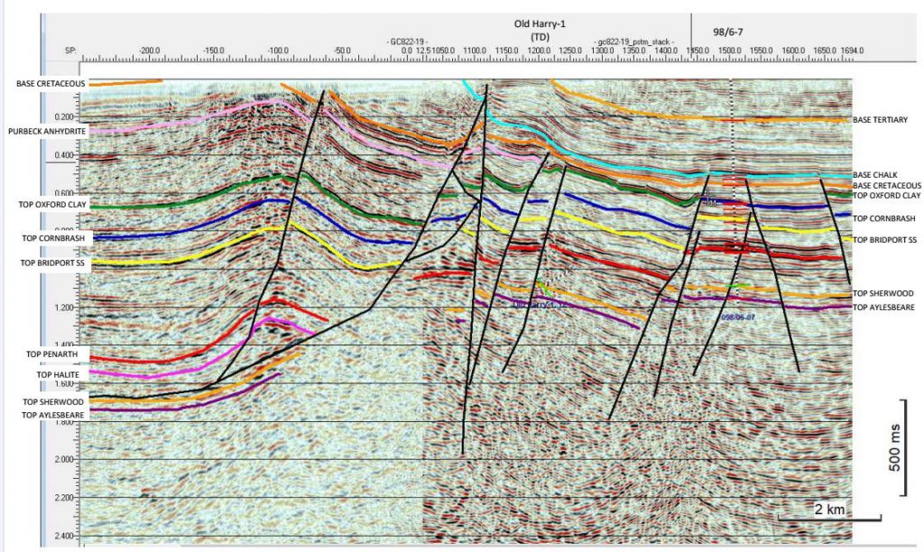
Seismic Data Access:
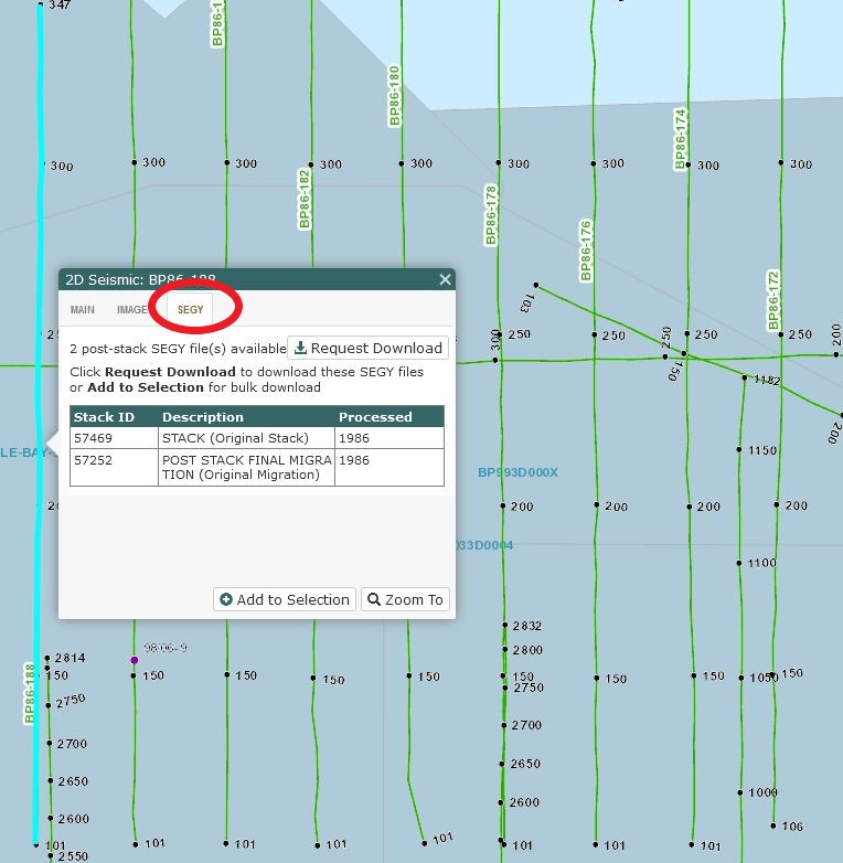
The seismic data can be accessed by selecting the individual 2D lines and 3D surveys or by using the ‘Area Selection’ tool. The seismic data that is available for each line or survey is listed under the ‘SEGY’ tab of the information box. If interpreted versions are available they will be shown under the “IMAGES” tab of this box.
Well Data Access:
Onshore and ‘Offshore’ wells are presented as separate data layers and can be displayed via the options in the Contents Panel – Wells>Surface Locations>Well class>NSTA (Offshore) Wells.
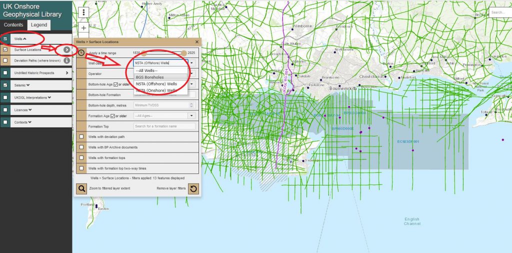
Individual well layers can be displayed and made available for selection by switching each layer ‘on or off’ to filter the well presentation.
To access the available well data, multiple wells can be selected and highlighted using the ‘Area Selection’ tool or individually by selecting just the well spot location.
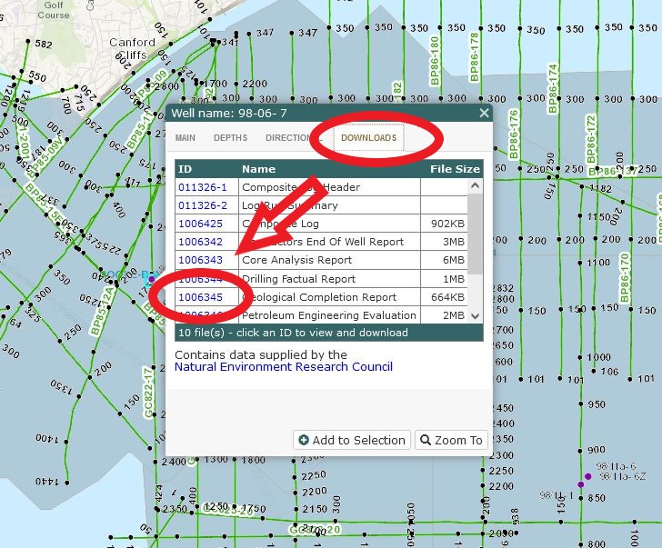
Select the ‘Downloads’ tab in the well information panel to access the list of available files.
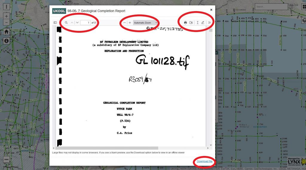
To access, view and download data click on the ‘ID’ information box and follow the instructions provided.
