UKOGL have added a new filter option to the Wells layer of the Interactive Map to helps users when searching for UK onshore data. The wells displayed on the map can now be filtered using the ‘UKOGL last updated since’ option to only display the wells that have had new or updated data added to the site since the user defined date.
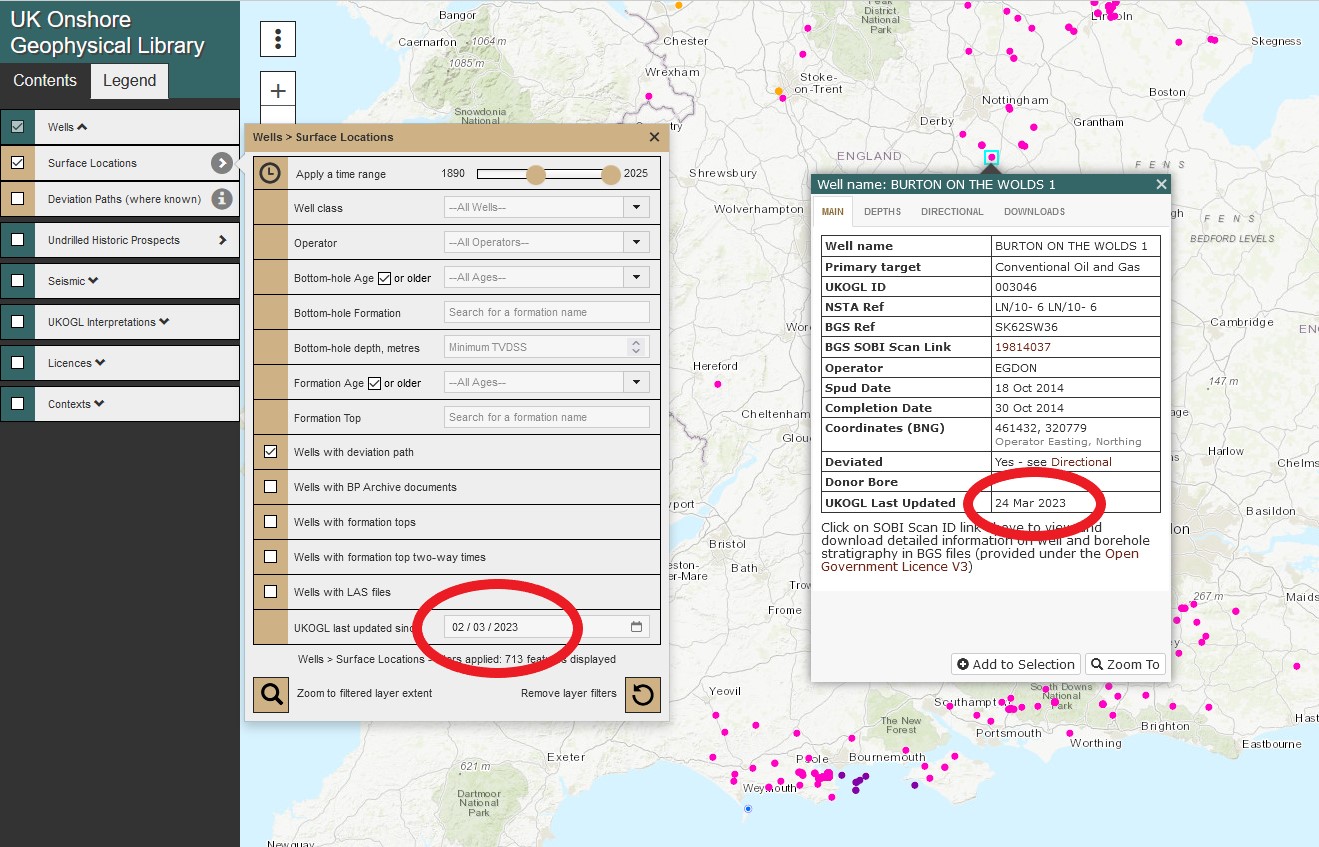
Wells that haven’t had any new data added after the user selected date will not be displayed. The new filter option can be also be combined with other available search options to further refine a query.