Category Archives: UKOGL Map

Poole Bay 2D, 3D Seismic and Well Data now available from UKOGL

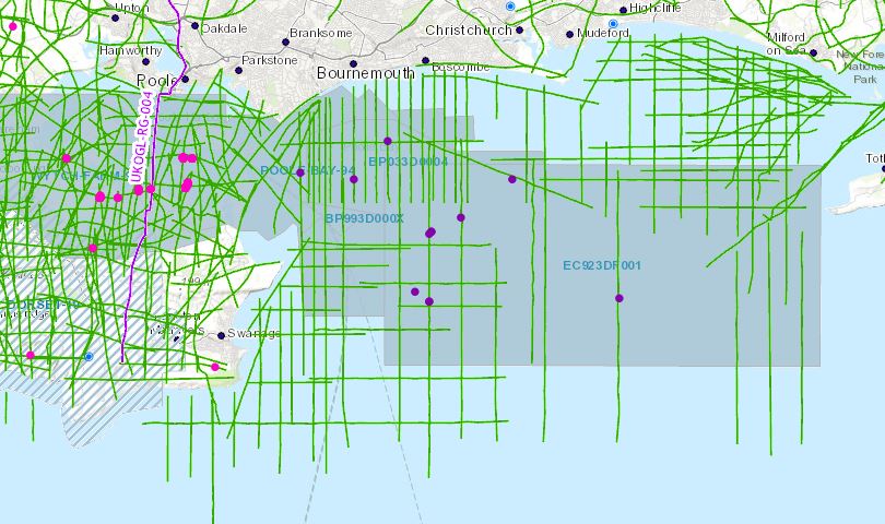
Now that Poole Bay has been designated a “Landward” area, UKOGL has archived and made available for download a selected set of data located in OSGB (National Grid) projection to enable seamless interpretation from onshore to offshore. These data include reprocessed offshore 2D and 3D versions not available in the UK National Data Repository (NDR).  Well data, including LAS files, have been copied from the NDR database and relocated in OSGB.

The intention of this exercise is to make it easier for interested parties to study this key area of British Geology. Additional offshore 2D data is available from the NDR but coordinates will need to be transformed to OSGB to match.

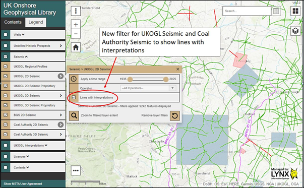
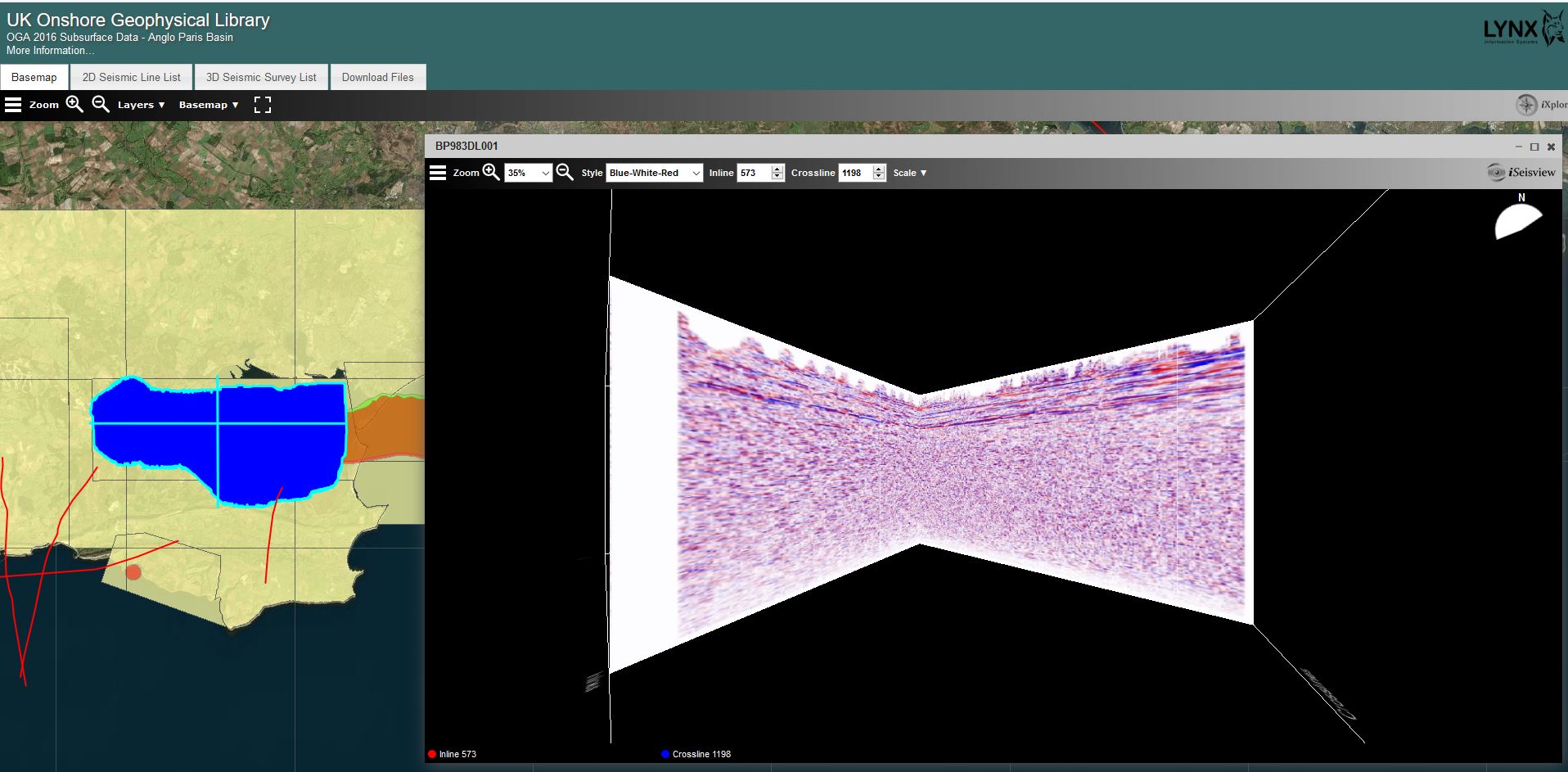
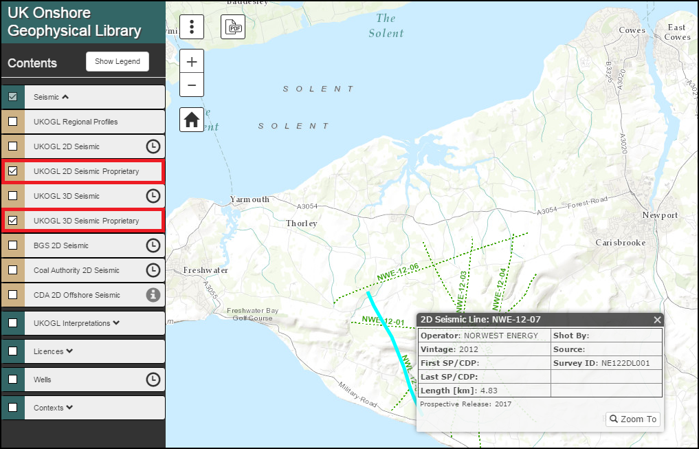
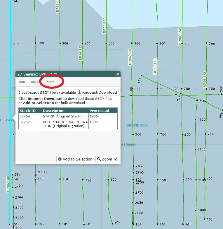
Seismic Data Access:

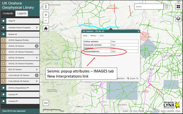
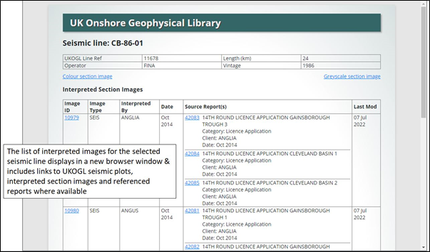
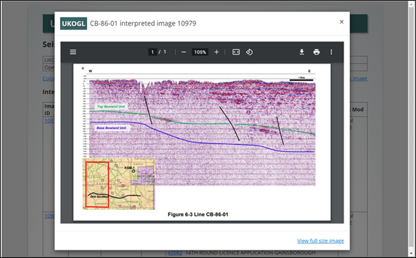
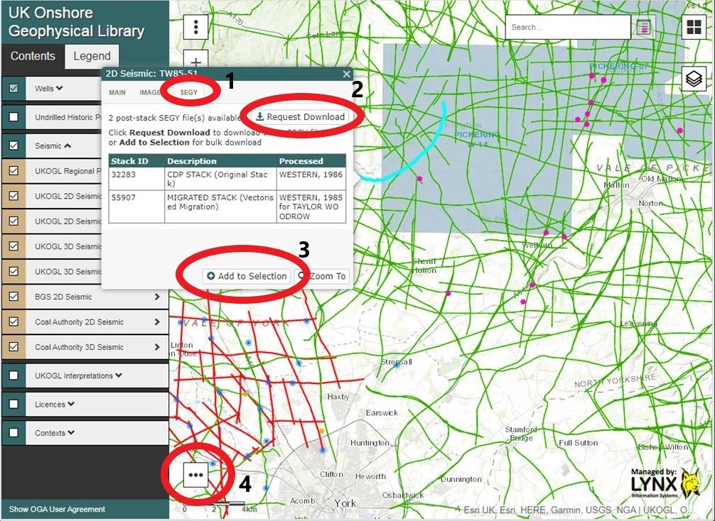
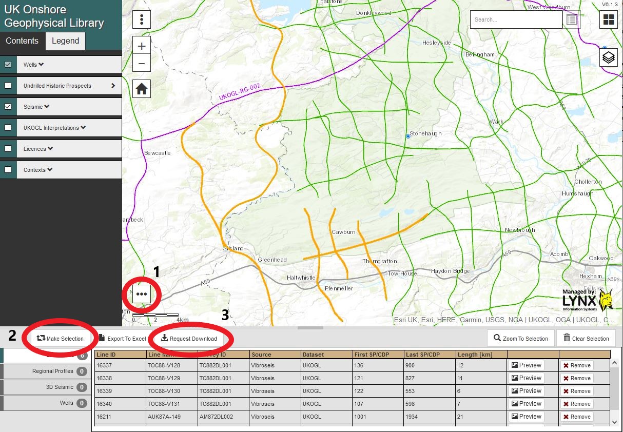
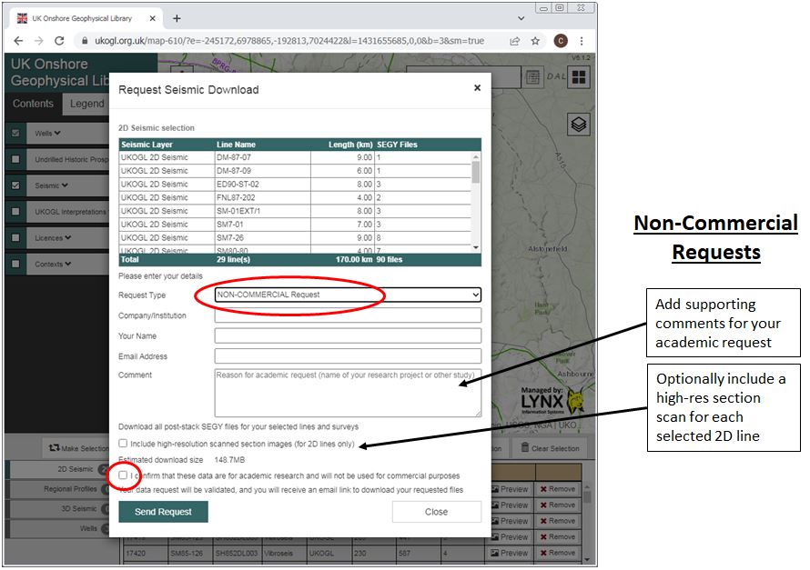
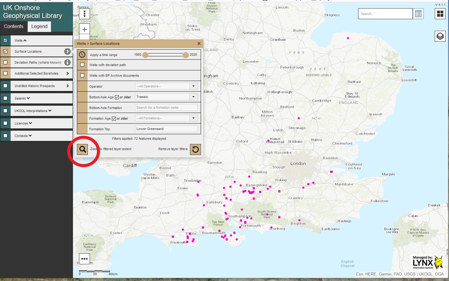
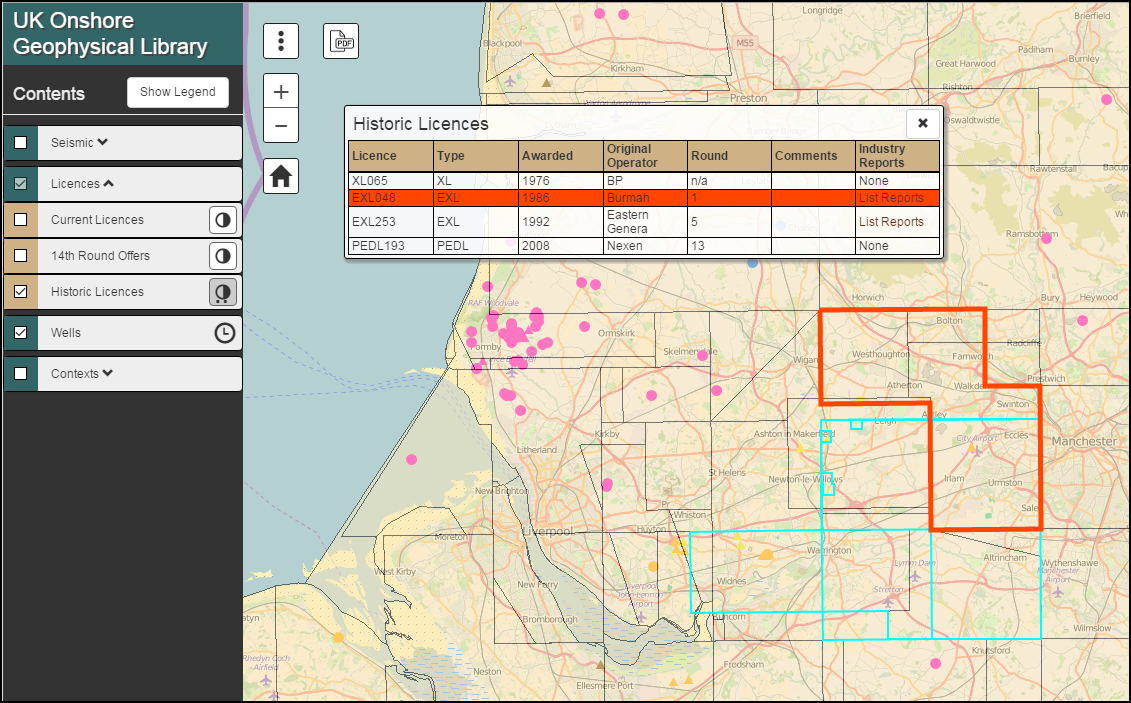
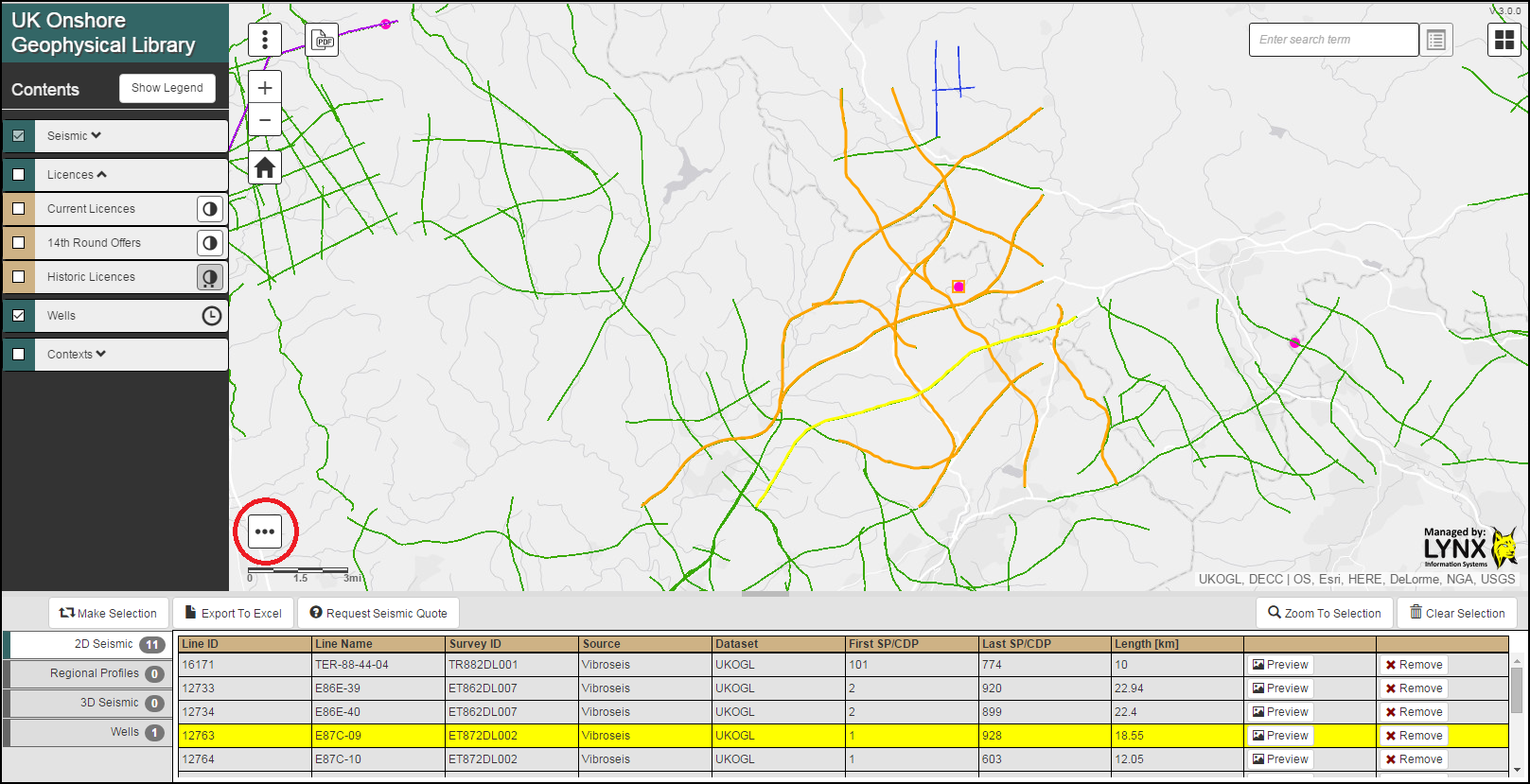
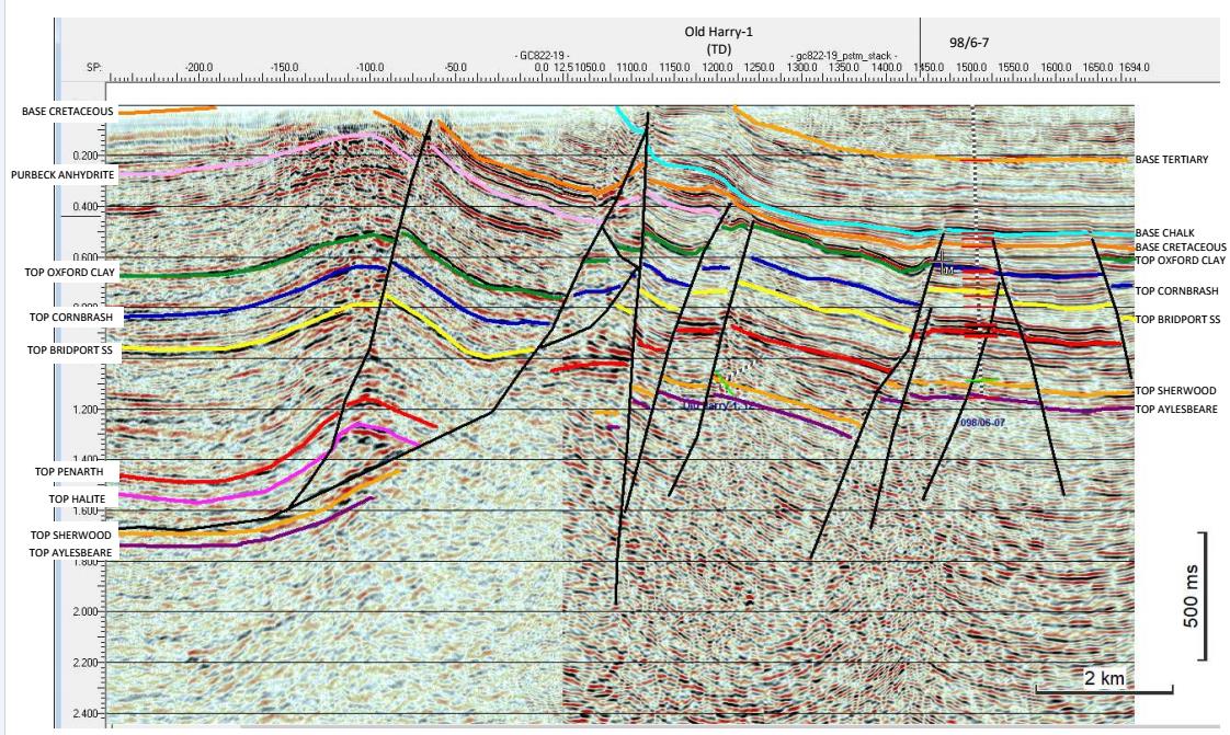
The seismic data can be accessed by selecting the individual 2D lines and 3D surveys or by using the ‘Area Selection’ tool. The seismic data that is available for each line or survey is listed under the ‘SEGY’ tab of the information box. If interpreted versions are available they will be shown under the “IMAGES” tab of this box.
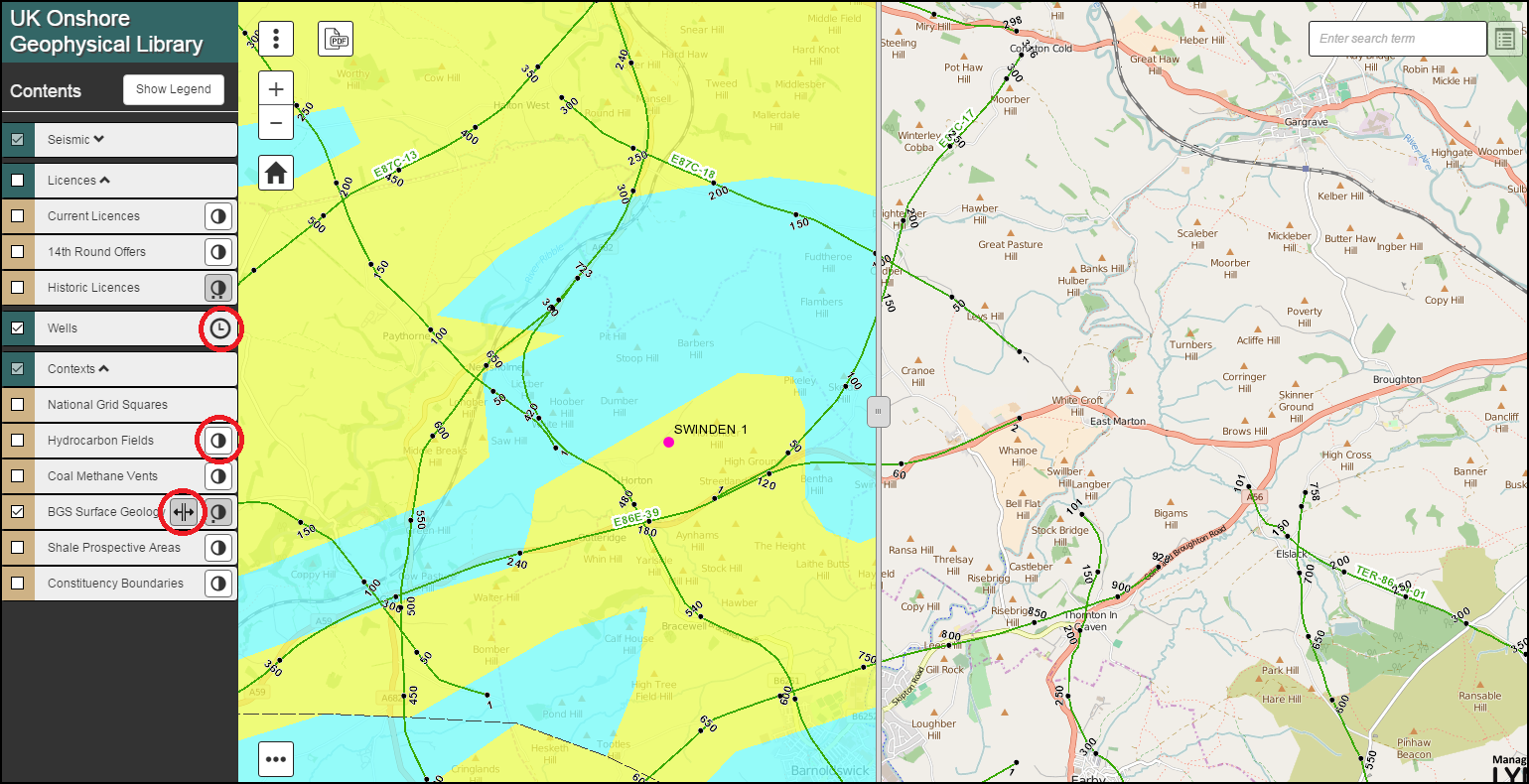
Well Data Access:

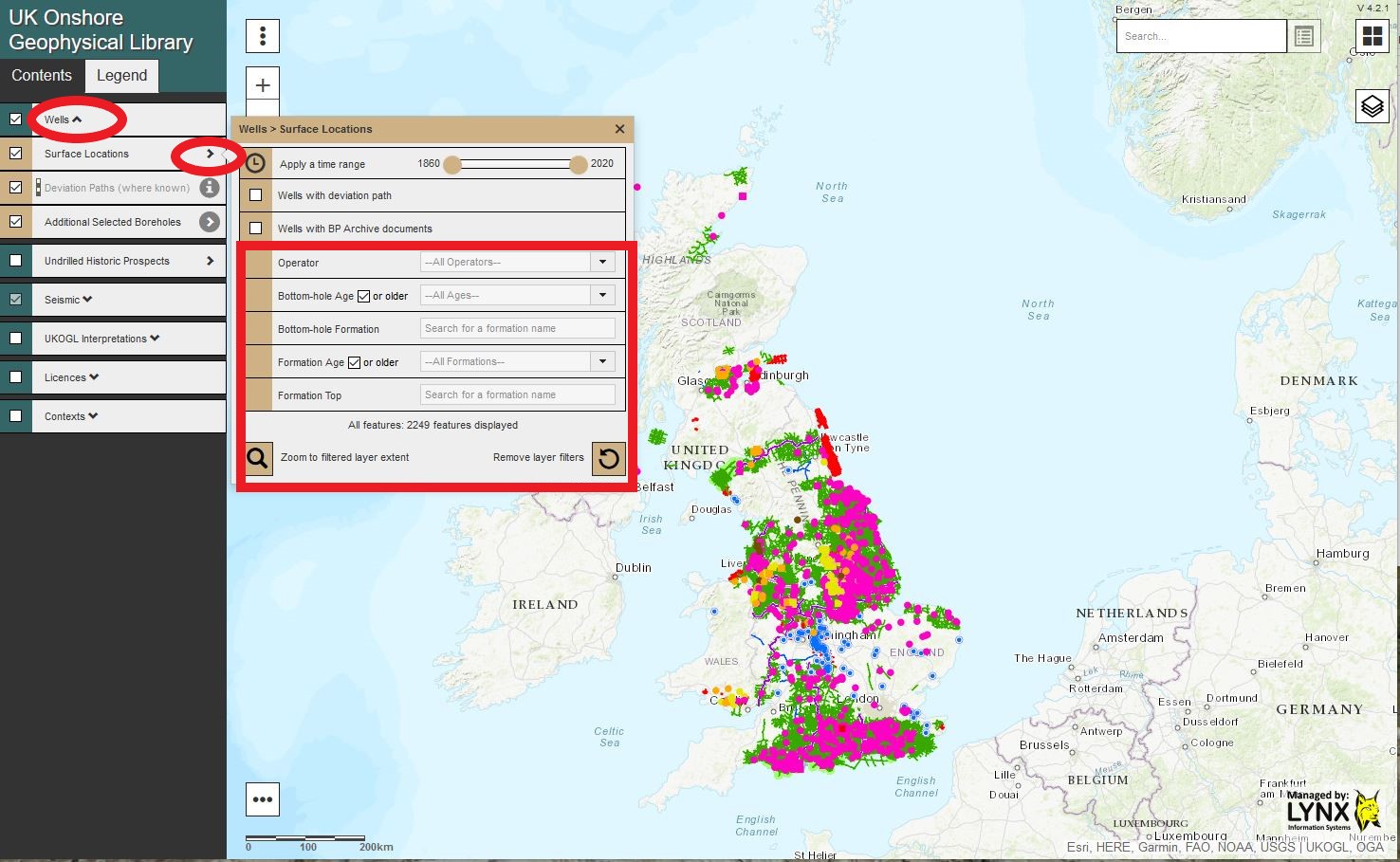
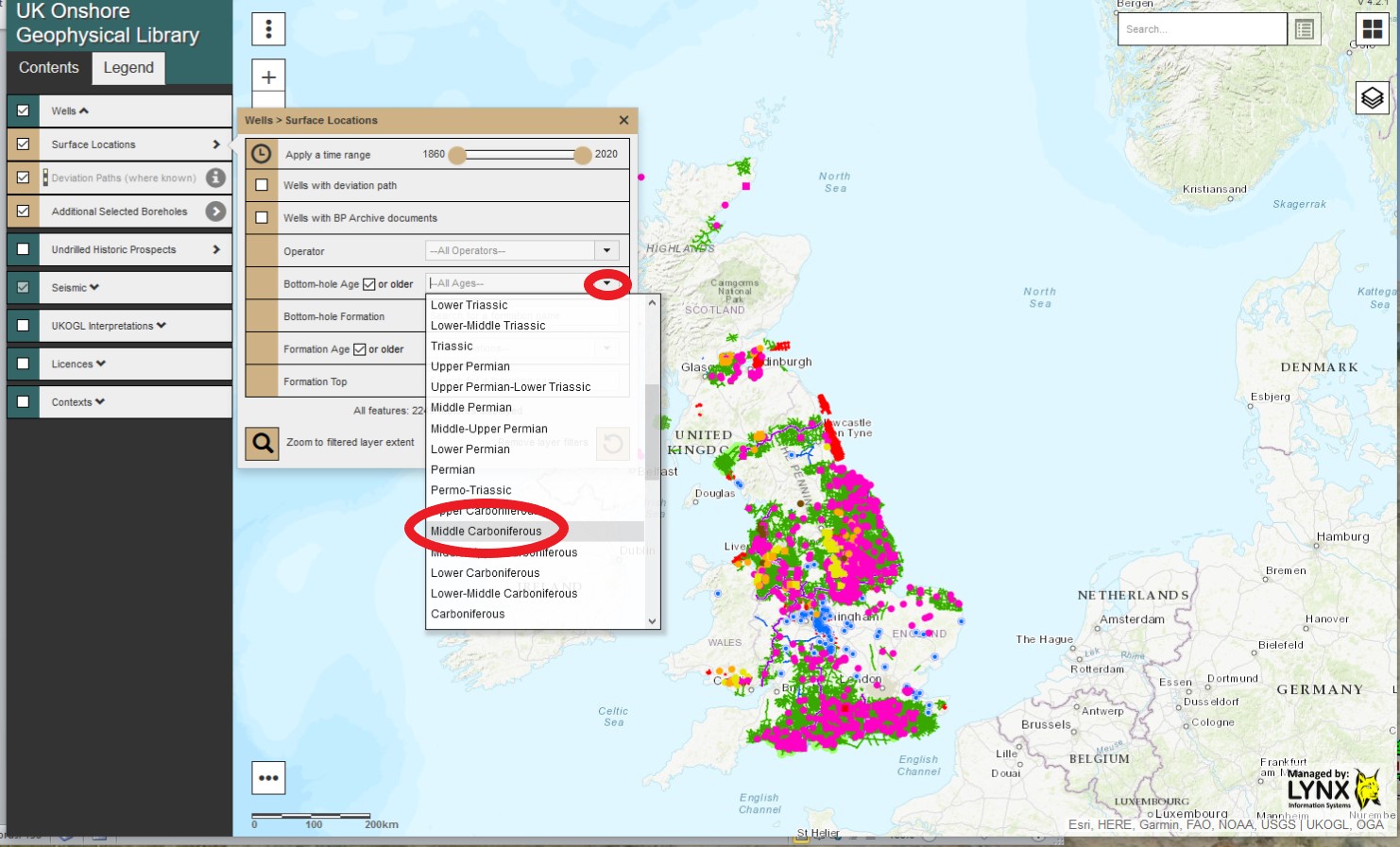
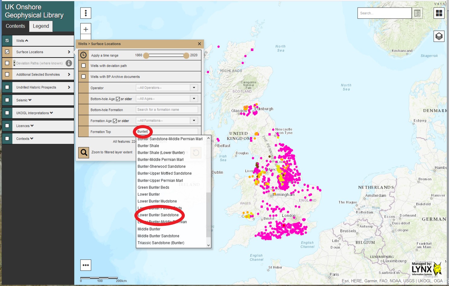
Onshore and ‘Offshore’ wells are presented as separate data layers and can be displayed via the options in the Contents Panel – Wells>Surface Locations>Well class>NSTA (Offshore) Wells.

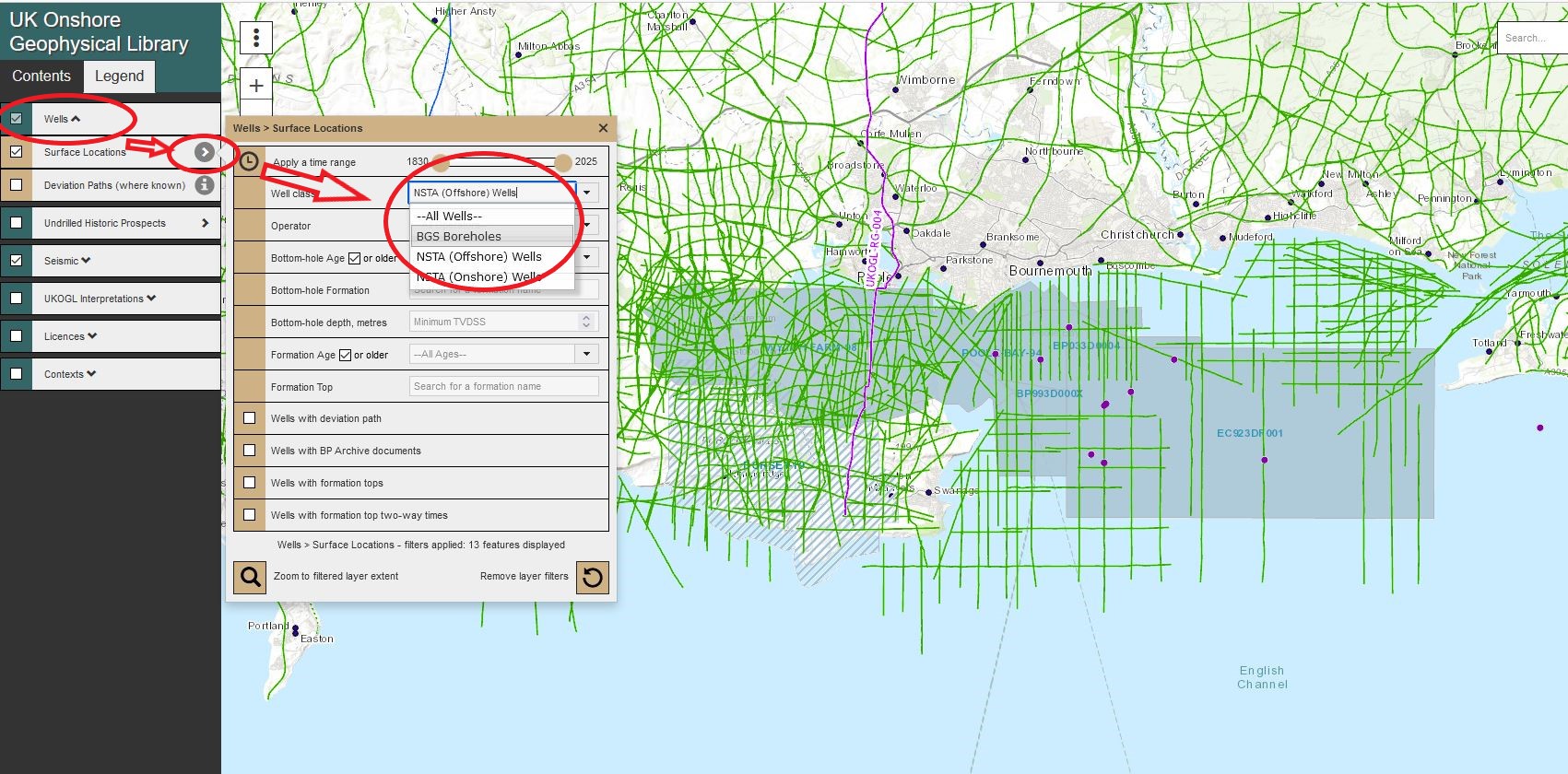
Individual well layers can be displayed and made available for selection by switching each layer ‘on or off’ to filter the well presentation.

To access the available well data, multiple wells can be selected and highlighted using the ‘Area Selection’ tool or individually by selecting just the well spot location.

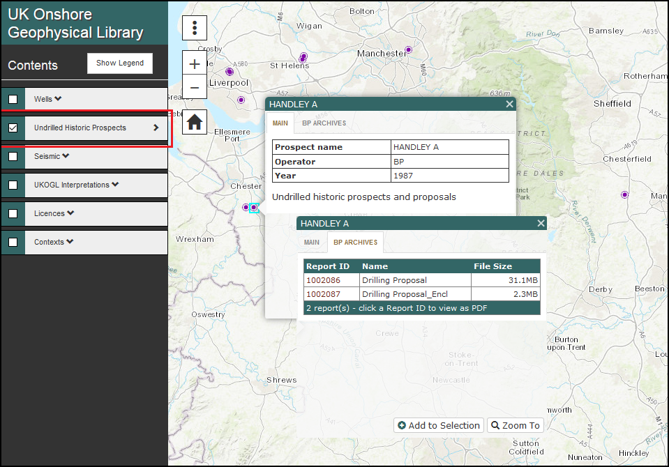
Select the ‘Downloads’ tab in the well information panel to access the list of available files.

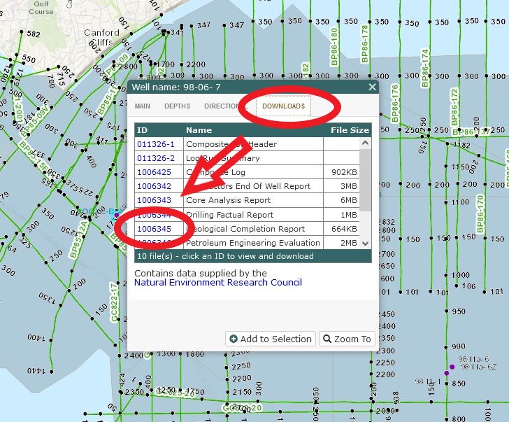
To access, view and download data click on the ‘ID’ information box and follow the instructions provided.

UKOGL Seismic Data – Interpreted Images – Access, View & Download

UKOGL have implemented a new website feature that provides direct access to over 2400 interpreted onshore seismic images.

The interpreted images have been compiled and collated from reports currently held by UKOGL and can be viewed and downloaded  alongside  the seismic images that are already available for each onshore line on the website.

The interpretations may be based on pre- or post-drill prospect assessments and well results may have indicated that changes are necessary. For additional context please view the associated source reports where available, or the drill dates, finalised tops and times for any wells associated with the prospect

Neither the UK Onshore Geophysical Library nor the original interpreters warrant the integrity of these data and will not be liable in contract or in tort for any loss, damage or expense of any nature suffered by the user as a result of the use of, or reliance on, these data

The seismic lines that have interpretation images available can be selected and their locations displayed via the ‘Contents SideBar > UKOGL2D Seismic’ tab:

To access the available interpretations, highlight the displayed seismic line displayed on the UKOGL interactive map and then select the ‘Interpretation – view’ option where available:

A new window will open and display a list of all available interpretation images and associated source reports for the selected line:

Click on Image ID number to display the interpreted line; click on Source Report number to see the report from which the interpretation was extracted.

All available interpreted images can either be viewed on screen….

….. or downloaded and viewed outside your browser by selecting the ‘Download’ link on the listings screen:

Improved Post Stack Seismic Data Access for Non-Commercial Users

UKOGL have implemented new website features that provide more information about the post stack SEGY data archived in UKOGL and allow direct download from the website.  Non-commercial, including academic, users have the ability to download at no cost and with no paperwork after approval of their status by UKOGL; commercial users will also be able to download directly after agreeing the cost and signing a licensing agreement with UKOGL.

Access to information and available post stack data for individual lines can be made via a new ‘SEGY’ Tab option (1) on the seismic line query pop-up box:

Select the ‘Request Download’ button (2) if only a single line is required or select the ‘Add to Selection’ button (3) to select multiple lines and then access your selection via the ‘Selection’ button (4) on the bottom-left of the map screen

Multiple line selections can be made in a single pass via the ‘Selection’ button (1) (see image below), then using the mouse to select the required seismic lines on the map via the ‘Make Selection’ button (2), up to 100 lines can be selected and requested via the ‘Request Download’ button (3).

Selecting the ‘Request Download’ button creates a ‘pop-up form’ that has to be filled in with details about the request.

For non-commercial requests, select the request type ‘ NON-COMMERCIAL’, enter the requested details and confirm that the data is to be used for non-commercial purposes. Please note that, for simplicity, if only scanned sections are required it is still necessary to request the SEGY first: the scans will be sent with the SEGY, which can be discarded if not required (see below)

By selecting ‘Send Request’ for a non-commercial data request an email will be sent to Beneath Britain for assessment and request approval. Once approved, an email will be sent to the email address supplied on the form that will contain a download link to access the requested data.

Both 2D lines and 3D surveys can be requested as part of your non-commercial request.

For commercial requests select the request type ‘Industry Request’ enter the requested details and confirm the data types to be requested:

After all relevant details have been entered, select ‘Send Request’ to be provided with a quote via return email that will provide a license agreement and details of the cost, based on the revised rates announced in January 2022.  Once signed, they will then be able to output the selected data based upon the details provided in the form.

Well Formation Tops – New Search Facility

UKOGL have implemented an expanded and improved well search capability to the online interactive map focusing on the Well Formation Tops information that is held for each well.

Accessible via the contents panel, ‘Wells’ and ‘Additional Selected Boreholes’ can now be searched separately using a new set of filters and search options, these include:

Well Formation & Well Formation Age

Bottom Hole Age & Bottom Hole Formation

Well Operator

To search both the OGA ‘Wells’ and the ‘Additional Selected Boreholes’ separate searches should be performed on each well set.

For each set of wells the selected filters can be combined together and the results are automatically displayed on the map to quickly and easily target the displayed information.

Example Search Summary: The Well Formation Tops search options are located on the content side panel of the interactive map selected via:

Wells > Surface Locations > Search Box or Wells>Additional Selected Boreholes>Search Box

  • The Bottom Hole Age and Bottom Hole Formation can be filtered and searched using the ‘Drop down’ menu or by entering text in to the search box and selecting the filtered context suggestions.

  • On the ‘Bottom-Hole Age or older’ selection click on the ‘tick’ box to display all wells that also have a Bottom-Hole Age ‘older’ than the selected Bottom-Hole Age.
  • The Formation Age and Formation Tops can be filtered and searched using the ‘Drop down’ menu or by entering text in to the search box and selecting the filtered context suggestion.
  • On the ‘Formation Age or older’ selection click on the ‘tick’ box to display all wells that also contain formations older than the selected Formation Age.
  • The filtered results are displayed on the map with the option to zoom to the extent of the returned search results.

All filters can be combined to further refine each search performed upon the wells with each search result depicted by the wells displayed on the interactive map.

Select the ‘Remove layer filters’ icon to cancel all filters and re-display all available onshore wells.

UKOGL – Lynx Interactive 3D ‘Cube’ Viewer – Wytch Farm 3D survey

Following on from the release of the OGA onshore seismic data packages, Lynx Information Systems have updated the seismic viewer for the Wytch Farm 3D seismic data in the Anglo Paris Basin data package.

The 3D Seismic data can now be viewed as a ‘Cube’ using iSeisview.

The new viewer is enabled by default and provides an interactive 3D cube perspective view of the survey, allowing zoom and rotation to view inline and crossline profiles from any angle, with a choice of display styles and scales.

You can try out the new 3D viewer here

Wytch Farm 3D – iSeisview form Lynx

For more information about the Anglo Paris Basin data seismic data please contact UKOGL

If you have any questions about the viewer and its implementation then please contact Lynx.

Undrilled Historic Prospects

We are pleased to announce the addition of  a unique new resource derived from the historic BP Archives.

The ‘Undrilled Historic Prospects’ layer displays the locations of past exploration proposals that were not pursued at the time, whilst also providing access to the recommendations and supplementary documentation put forward during the original assessments.

Coal Authority 3D Surveys

In partnership with the British Geological Survey, we have now added a Coal Authority 3D Seismic Surveys layer to the interactive map as part of our ongoing Post Stack archive.

To date we have identified 6 surveys across the Midlands, South Wales and Scotland.

coa3d_midlandsMidlands

coa3d_walesSouth Wales

coa3d_scotlandScotland

Proprietary Seismic Surveys

In partnership with the Oil & Gas Authority and the UK Onshore Operators Group, the locations of recently acquired 2D and 3D proprietary seismic surveys are now available to view through the On-Line Map.

All are displayed with basic information only, for reference but not for selection and individual surveys will only be added as the finalised locations become available to UKOGL.

Such surveys are held for a proprietary period of between 3 to 5 years depending on the Licence terms under which they were acquired. A prospective release date is provided subject to any representations that may be lodged by the Operator.

prop-v3

Upgraded Interactive Map Application

We are pleased to be able to launch today the first phase of upgrades to our on-line interactive map. This has been designed to provide a streamlined presentation of our resources and an enhanced functionality in support of the end-user.

new-map-001a

All layers have been grouped into Seismic, Licences, Well and Contexts, each of which can be expanded to provide further selectable sub-layers.

New presentational tools have been added to many of the layers allowing for Time Filtering, Transparency Control and a Split Screen Swipe Functionality (BGS Surface Geology).

new-map-004

All layer features can be queried by clicking on the map, providing access to additional information, along with free imagery (Seismic & Wells) and Reports (Fields, Vents & Historic Licences).

new-map-003

The search box function has now been expanded to include the quick location of known Seismic, Wells, Licences, Fields & Vents plus a full Gazetteer & Post Code search.

Our improved Multiple Selection and Request Utility can now be accessed through the icon at the foot of the map.

new-map-005

We hope that the new application is both intuitive to use and clear in presentation, providing easy access to the free resources that the Library is able to offer. This is part of an ongoing enhancement programme and as always we welcome any feedback.