UKOGL have implemented a new website feature that provides direct access to over 2400 interpreted onshore seismic images.
The interpreted images have been compiled and collated from reports currently held by UKOGL and can be viewed and downloaded alongside the seismic images that are already available for each onshore line on the website.
The interpretations may be based on pre- or post-drill prospect assessments and well results may have indicated that changes are necessary. For additional context please view the associated source reports where available, or the drill dates, finalised tops and times for any wells associated with the prospect
Neither the UK Onshore Geophysical Library nor the original interpreters warrant the integrity of these data and will not be liable in contract or in tort for any loss, damage or expense of any nature suffered by the user as a result of the use of, or reliance on, these data
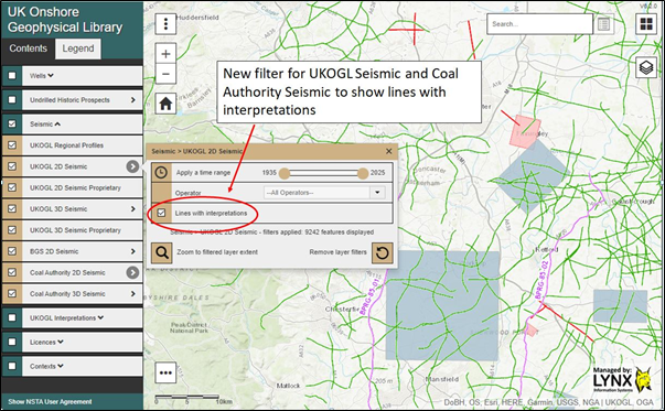
The seismic lines that have interpretation images available can be selected and their locations displayed via the ‘Contents SideBar > UKOGL2D Seismic’ tab:
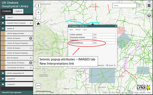
To access the available interpretations, highlight the displayed seismic line displayed on the UKOGL interactive map and then select the ‘Interpretation – view’ option where available:
A new window will open and display a list of all available interpretation images and associated source reports for the selected line:
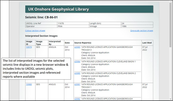
Click on Image ID number to display the interpreted line; click on Source Report number to see the report from which the interpretation was extracted.
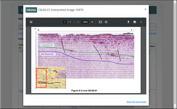
All available interpreted images can either be viewed on screen….
….. or downloaded and viewed outside your browser by selecting the ‘Download’ link on the listings screen: