We are pleased to be able to launch today the first phase of upgrades to our on-line interactive map. This has been designed to provide a streamlined presentation of our resources and an enhanced functionality in support of the end-user.
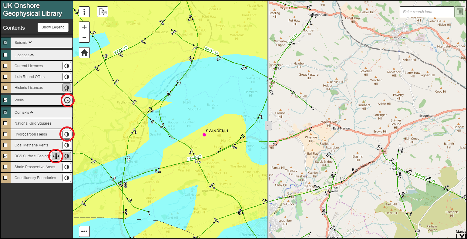
All layers have been grouped into Seismic, Licences, Well and Contexts, each of which can be expanded to provide further selectable sub-layers.
New presentational tools have been added to many of the layers allowing for Time Filtering, Transparency Control and a Split Screen Swipe Functionality (BGS Surface Geology).
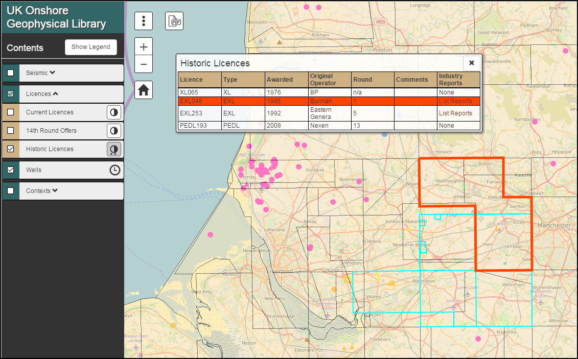
All layer features can be queried by clicking on the map, providing access to additional information, along with free imagery (Seismic & Wells) and Reports (Fields, Vents & Historic Licences).
The search box function has now been expanded to include the quick location of known Seismic, Wells, Licences, Fields & Vents plus a full Gazetteer & Post Code search.
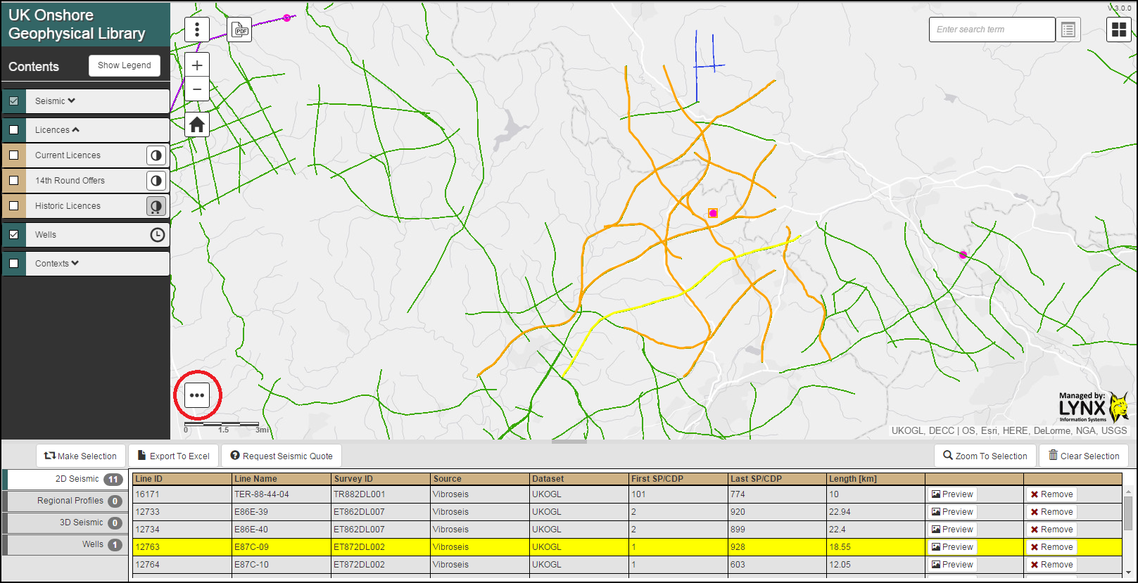
Our improved Multiple Selection and Request Utility can now be accessed through the icon at the foot of the map.
We hope that the new application is both intuitive to use and clear in presentation, providing easy access to the free resources that the Library is able to offer. This is part of an ongoing enhancement programme and as always we welcome any feedback.


