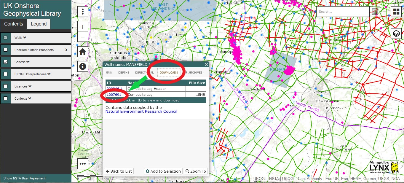
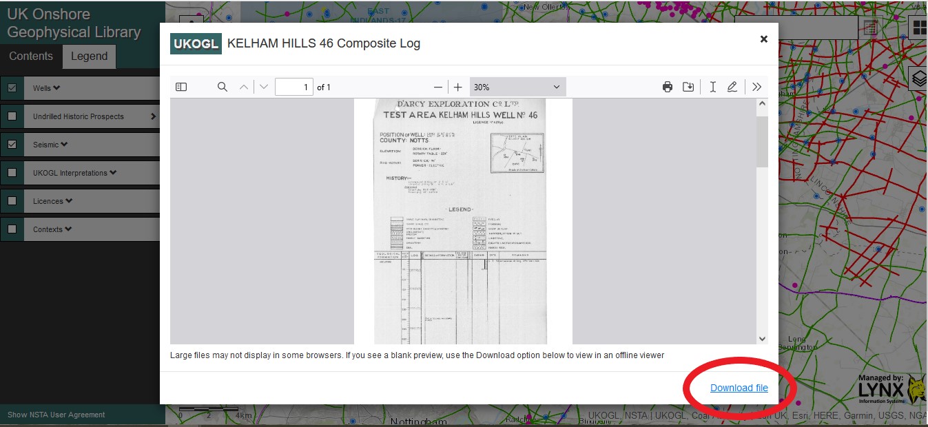
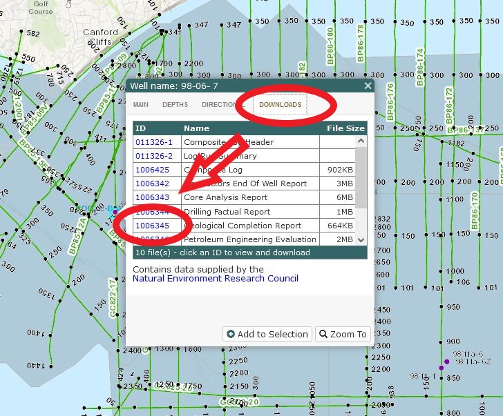
UK onshore composite well log images are now available to be viewed and downloaded from the UKOGL interactive map.
The composite well log images for Conventional Oil and Gas wells can be accessed via the well log information panel, the data is available via the ‘Downloads’ tab.
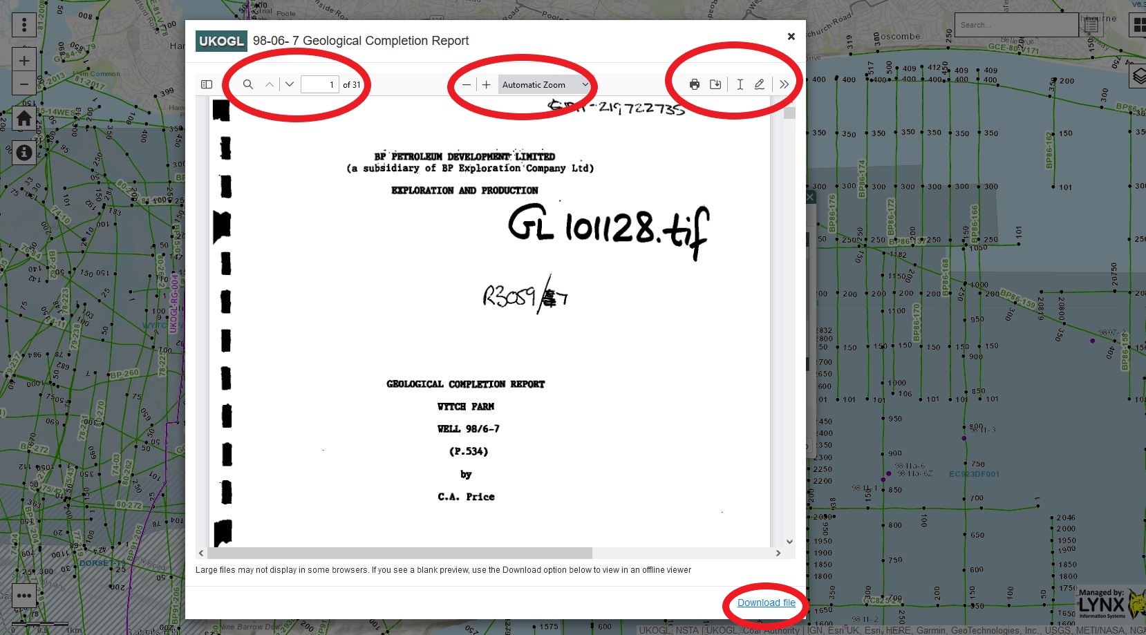
To view and download the available well log image, locate and select the Conventional Oil & Gas well on the interactive map, select the ‘Downloads’ tab and then select the ‘ID’ link to access the composite log.
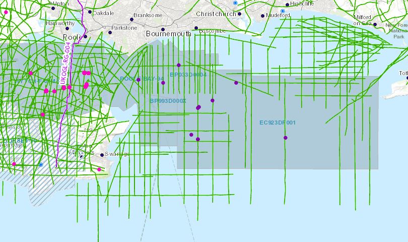
Now that Poole Bay has been designated a “Landward” area, UKOGL has archived and made available for download a selected set of data located in OSGB (National Grid) projection to enable seamless interpretation from onshore to offshore. These data include reprocessed offshore 2D and 3D versions not available in the UK National Data Repository (NDR). Well data, including LAS files, have been copied from the NDR database and relocated in OSGB.
The intention of this exercise is to make it easier for interested parties to study this key area of British Geology. Additional offshore 2D data is available from the NDR but coordinates will need to be transformed to OSGB to match.
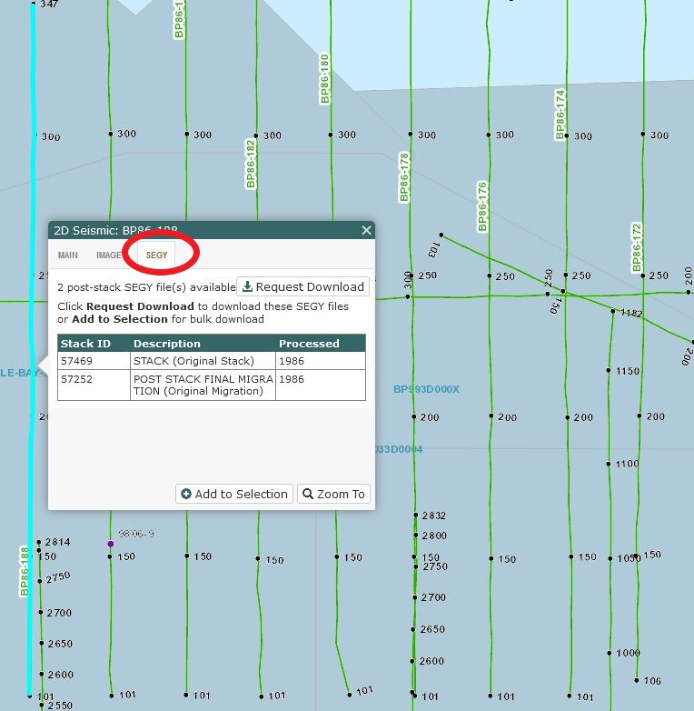
Seismic Data Access:
The seismic data can be accessed by selecting the individual 2D lines and 3D surveys or by using the ‘Area Selection’ tool. The seismic data that is available for each line or survey is listed under the ‘SEGY’ tab of the information box. If interpreted versions are available they will be shown under the “IMAGES” tab of this box.
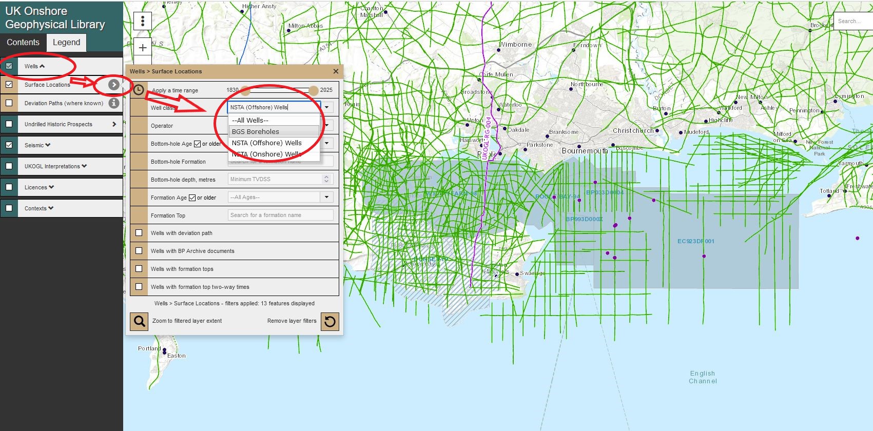
Well Data Access:
Onshore and ‘Offshore’ wells are presented as separate data layers and can be displayed via the options in the Contents Panel – Wells>Surface Locations>Well class>NSTA (Offshore) Wells.
Individual well layers can be displayed and made available for selection by switching each layer ‘on or off’ to filter the well presentation.
To access the available well data, multiple wells can be selected and highlighted using the ‘Area Selection’ tool or individually by selecting just the well spot location.
Select the ‘Downloads’ tab in the well information panel to access the list of available files.
To access, view and download data click on the ‘ID’ information box and follow the instructions provided.
Well Layer Improvements and Two-Way Time Data Generation
UKOGL have improved the appearance and functionality of the
Well Layer displayed on the interactive map, the expanded selection options include
the ability to filter on the well category, wells that reach a certain depth
and wells that penetrate certain formations.
In addition, a new functionality has been embedded as an
option to generate estimated Two-Way Times (TWT) for wells that do not
currently have TWT data available through the site.
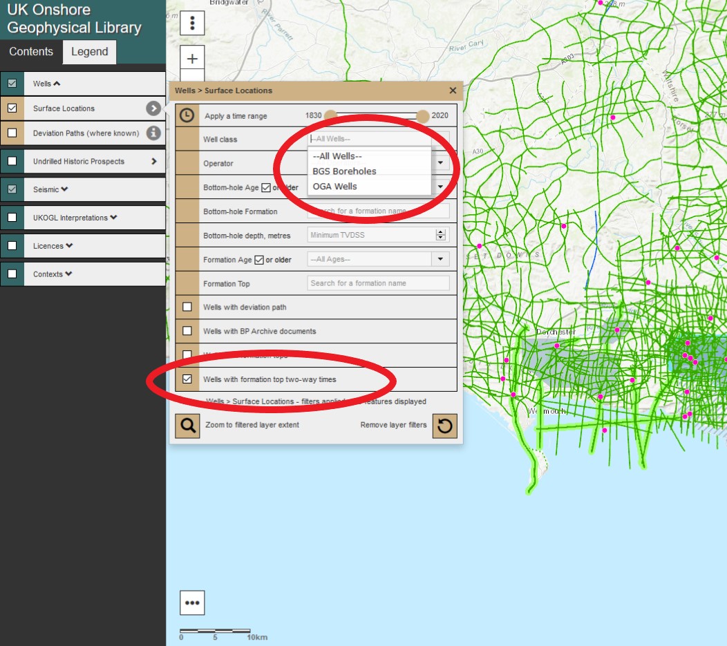
The well category display, search, filter and selection options
on the map can now be controlled via a single user selected ‘drop-down’ menu option,
which combines both the old “Well” layer and the old “Additional Selected
Boreholes” layer in to one layer that now removes the need to run the same query
twice across the two data sets.
All wells with TWT data can now be filtered on the display
via the menu to improve access to TWT information.
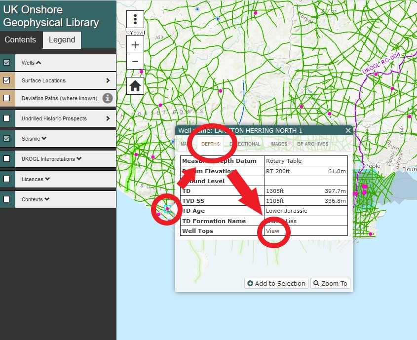
The UKOGL interactive web map now supports ‘on the fly’
generation of TWT data for wells that do not have TWT data currently available.
Using the mouse arrow select a well without TWT data then select the ‘DEPTHS’ – ‘Well Tops – View’ option to launch the well information page.
By selecting the ‘Two-Way Times’ option on the page a list
of ’near-by wells’ is generated that already have TWT data available. A buffer
range can be used to limit the search radius of the donor wells available to
the user.
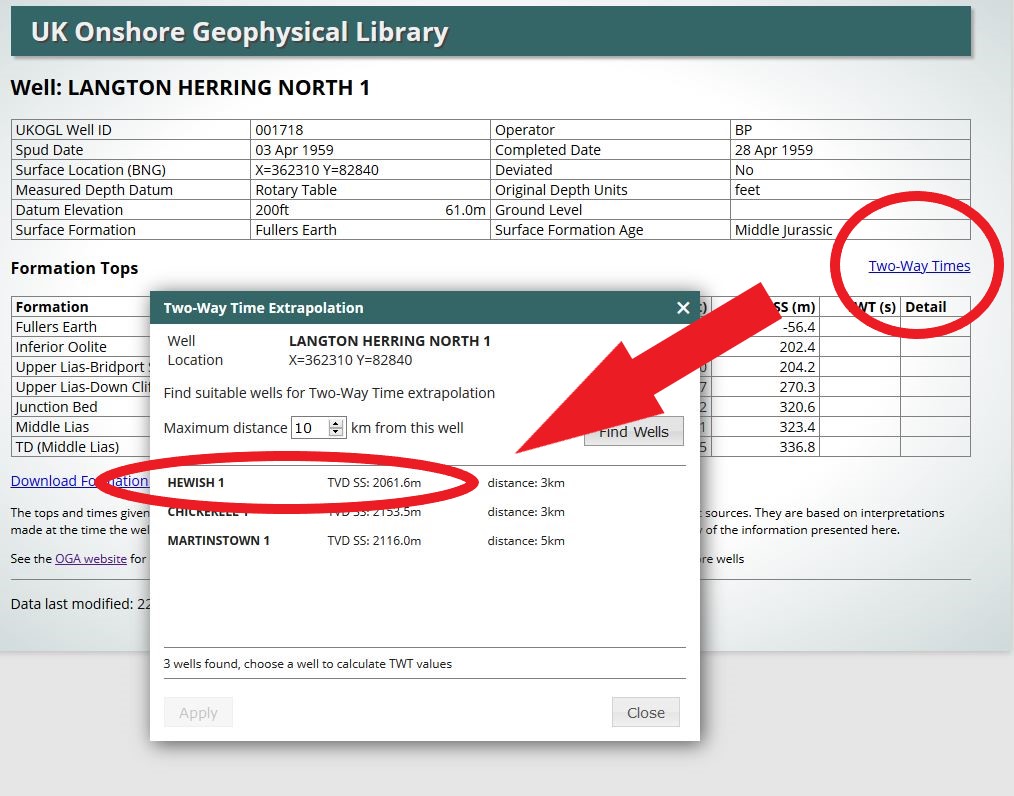
The TWT data is generated by extrapolating the TWT depths from
the user selected well to the corresponding depth of the well that is currently
without TWT data. Data is generated ‘on the fly’ each time a donor well is
selected by the user.
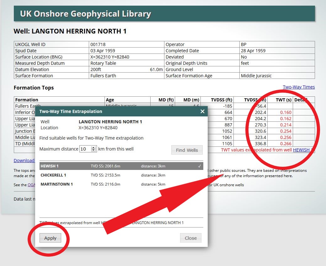
The newly generated TWT data can be downloaded from the UKOGL site as a spreadsheet document. Values generated by the Two-Way Time extrapolation function are not retained by UKOGL but they can be regenerated by the user if required again at a later date.
While a great effort has been made by UKOGL to accurately generate TWT data from extrapolated well depths, use of the generated values is always at the users own discretion.
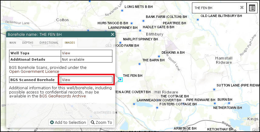
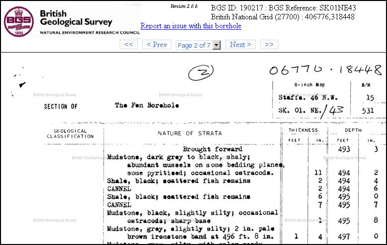
We have now added a direct link from our Wells map layer allowing the user to seamlessly access the equivalent records for each individual well and borehole as held in the BGS GeoRecords Open Licence archives.
The link can be found on the Images tab when querying any location within the Wells Layer.
Whilst records for many of the Exploration wells in the BGS Archives may currently be classified as confidential, for the majority of wells within the UKOGL Additional Boreholes layer supplemental information should be freely available.
For full details of the extensive resources as held by the BGS and also guidance as how to access data, including Confidential Records, please visit the BGS GeoRecords web site.
For a small number of the older legacy wells, recently sourced original Operator records have revealed that these wells were subsequently deepened and that this was not reflected on the graphic Composite Logs as presented at the time of submission.
UKOGL records have now been updated for the following:
EAKRING 34, 39, 70, 73, 74, 75, 76, 80, FORMBY G23, KELHAM HILLS 18 and WEST DRAYTON 2.
Whilst most revisions have been minor and not resulted in a change in the formation at TD, in the cases of EAKRING 34, 39 & 80 total depth is now in the Lower Carboniferous as opposed to the Upper or Middle Carboniferous as previously stated. UKOGL Well Tops presentations have been updated accordingly.
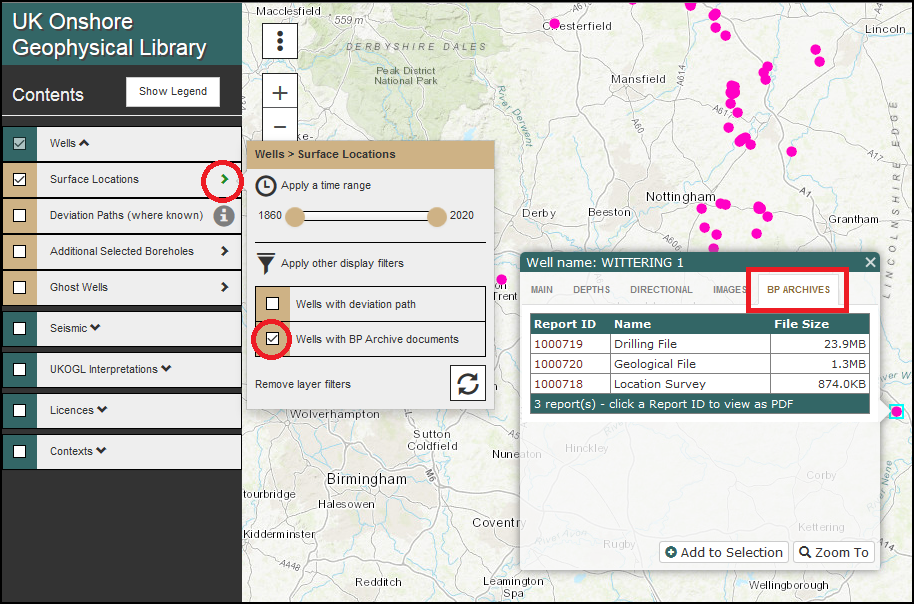
With work on the BP Well Reports donation close to completion we have started to identify items new to the national archives and make them available through the on-line map.
Under agreement, these presently just relate to the older vintage wells as curated by the BGS but do offer an extensive resource dating back to the earliest days of the onshore exploration industry.
This will be an ongoing upload over the coming months and therefore to assist with the identification of wells with related items we have added an extended Filtering Function to the Wells layers as illustrated below.
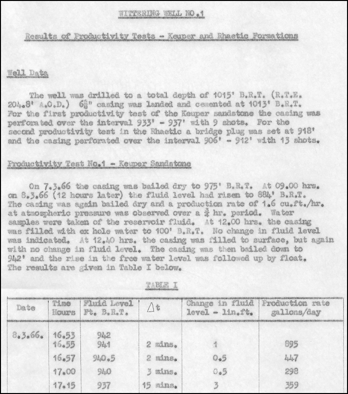
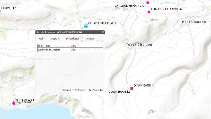
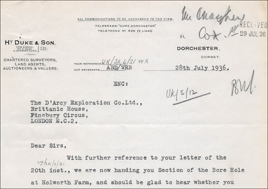
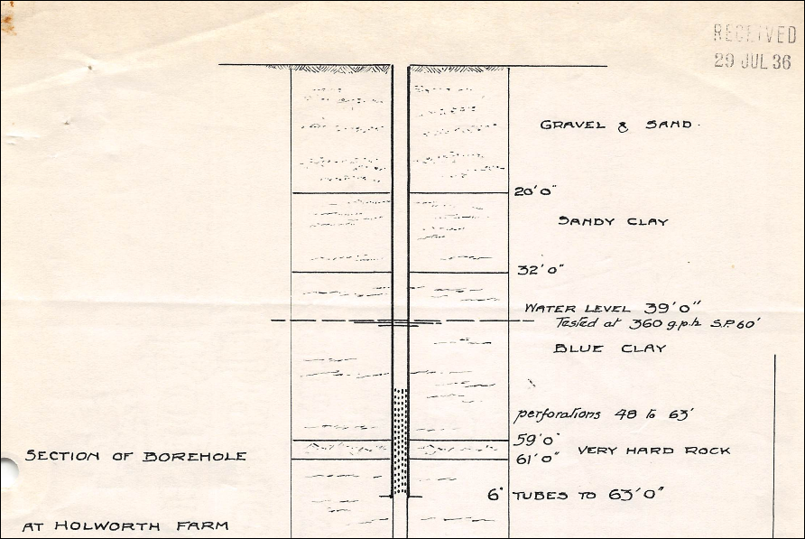
As part of our continued expansion of our Additional Boreholes coverage we are now serving related documents taken from the legacy reports archive as donated to the Library by BP.
These can be accessed via the Additional Details ‘View’ link, as shown below, displayed when a given borehole is searched for or queried directly.
As a supplement to our primary Exploration wells coverage we now serve an additional wells layer of selected additional deep boreholes compiled over areas of limited exisiting coverage and control.
Providing access to an expanded Formation Tops database this resource has been compiled from a number of open access sources and sub surface memoirs, primarily derived from information held within the British Geological Survey’s Borehole Scans archive. For further information and access to extensive source records please visit the BGS site.
This compilation is an ongoing project and is still in its early stages, with the initial focus being across the south of England. New data will be added on a regular basis and this layer, shown as blue ringed well spots, can be displayed on the map via the Wells Tab in the Table of Contents as below.
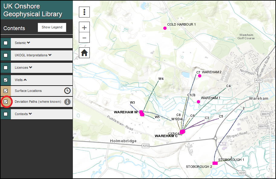
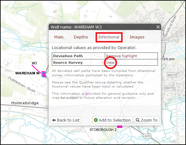
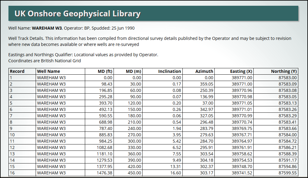
We are pleased to annouce a significant enhancement to the UKOGL On-Line map with the addition of the Well Deviation Paths (where known).
These have been compiled from Directional Survey information published by the Operators and contain both wells where the locational values have been supplied and wells where the locational path has been calculated from the available survey information. For the calculated paths the TD locations may differ from those as reported by the Operators.
By querying individual wells, either directly on the map or via the Search Box, access can be gained to data qualifiers and to the source surveys.
These presentations and downloads are provided for general guidance and may be subject to alteration and revision, especially where new data may become available or where wells are re-surveyed.
We have undertaken a major update of our published well tops files with the addition of two way times for 424 wells as calculated from available well velocity surveys.
As with all such data, these interpretations are provided for guidance only and may be subject to later re-evaluation and revision.
Source documents for all wells are available from the Well Data Release Agents who act on behalf of the Oil & Gas Authority.
This January 2017 update incorporates these wells.