Upgraded Interactive Map Application

We are pleased to be able to launch today the first phase of upgrades to our on-line interactive map. This has been designed to provide a streamlined presentation of our resources and an enhanced functionality in support of the end-user.

new-map-001a

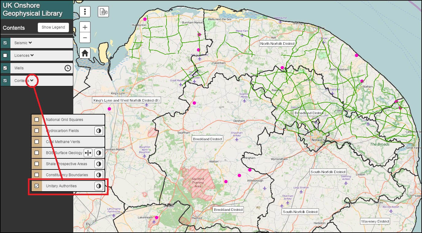
All layers have been grouped into Seismic, Licences, Well and Contexts, each of which can be expanded to provide further selectable sub-layers.

New presentational tools have been added to many of the layers allowing for Time Filtering, Transparency Control and a Split Screen Swipe Functionality (BGS Surface Geology).

new-map-004

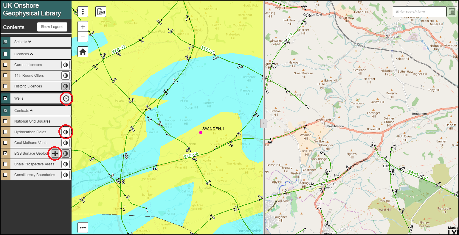
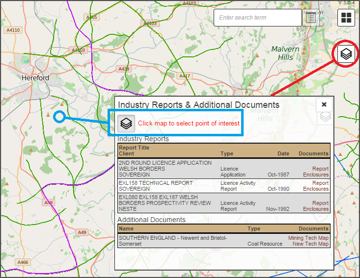
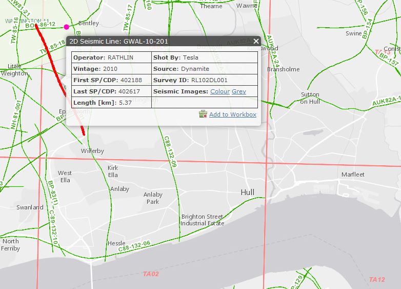
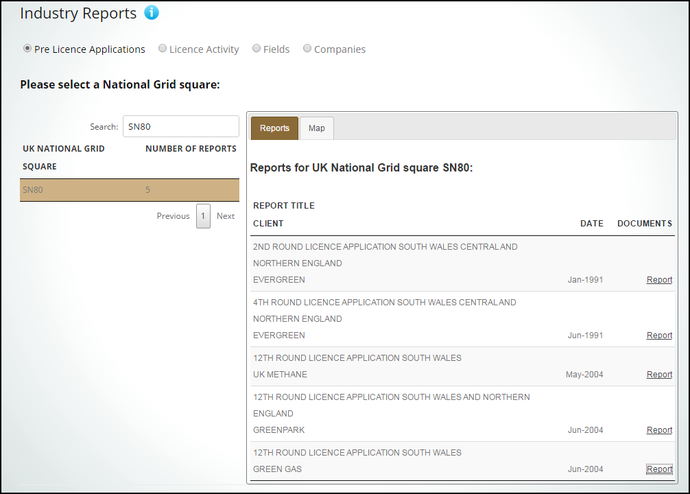
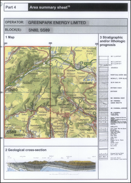
All layer features can be queried by clicking on the map, providing access to additional information, along with free imagery (Seismic & Wells) and Reports (Fields, Vents & Historic Licences).

new-map-003

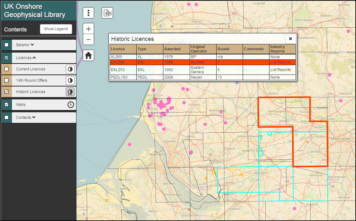
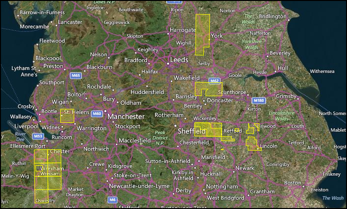
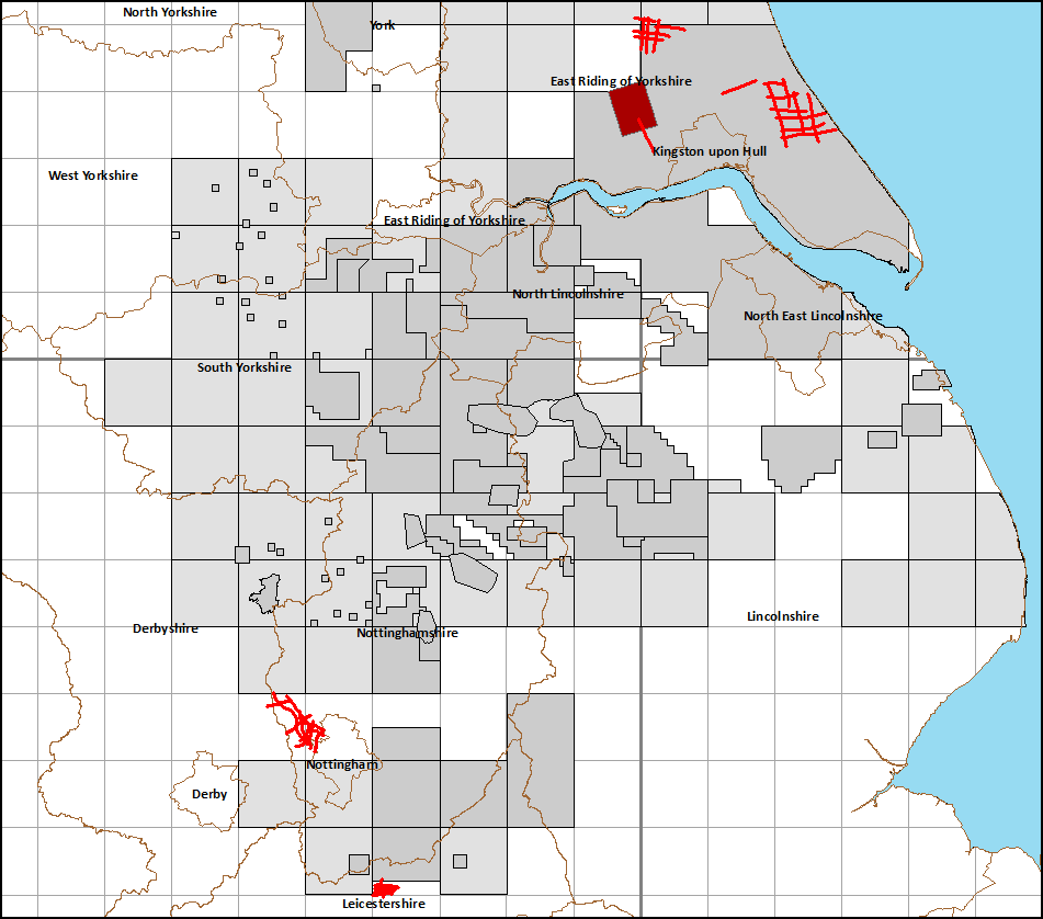
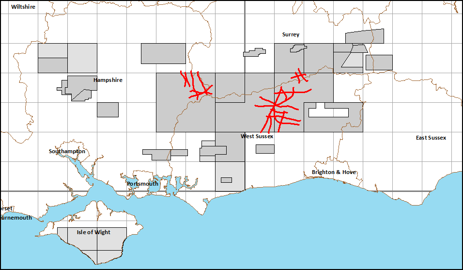
The search box function has now been expanded to include the quick location of known Seismic, Wells, Licences, Fields & Vents plus a full Gazetteer & Post Code search.

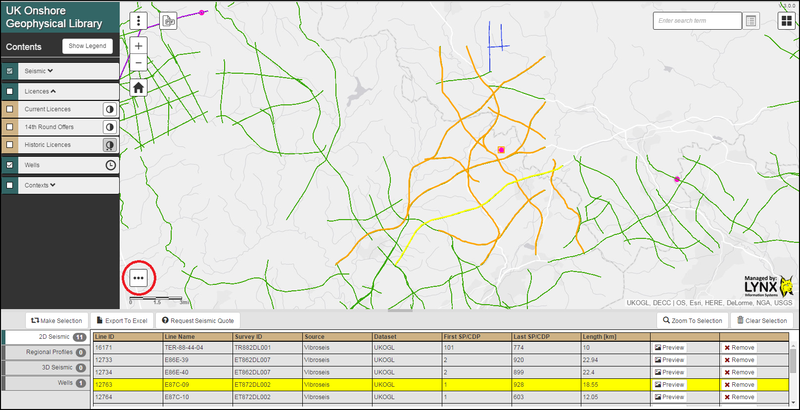
Our improved Multiple Selection and Request Utility can now be accessed through the icon at the foot of the map.

new-map-005

We hope that the new application is both intuitive to use and clear in presentation, providing easy access to the free resources that the Library is able to offer. This is part of an ongoing enhancement programme and as always we welcome any feedback.

UKOGL 2D Archive – January 2016 Archive Update

Line GWAL-10-201 is the latest onshore seismic line to the archived and released through UKOGL.

GWAL-10-201 is a 5.37km 2D seismic line located in East Yorkshire recorded in 2010, the archive is comprised of Pre and Post Stack data, supporting acquisition data and a full digital navigation data set.

GWAL-10-201

GWAL-10-201 was recorded as a 2D test line prior to the shooting of the Walkinton-11 3D onshore seismic survey to the NW.

New Surveys Released

In line with OGA defined confidentiality periods, all seismic surveys as shot in 2010/2011 are now released into the public domain. This covers a total of 53 2D lines (5 surveys) as acquired over the Weald, the East Midlands and north east Yorkshire and 1 3D Survey acquired over north Humberside.

Previews of all lines are now available through the UKOGL Map.

2016-new-p1

2016-new-p2

14th Onshore Licensing Round Offers

The Oil & Gas Authority have today announced the full extent of the 14th Onshore Licensing Rounds offers. A total of 159 onshore blocks are being formally offered to successful applicants. These blocks will be incorporated into into 93 onshore licences.

Full details of the announcement and further information on the 14th Round can be found on the OGA website.

14th Round Offers

Launch Of New Website & Industry Reports

We are implementing a major redesign of the UKOGL website. For Phase 1, launched today, we have built a new site around the Interactive Map, providing easy and clear access to all the Library’s information pages and news feeds.

This redesign has also allowed us to provide additional access outside of the Interactive Map to many of the Library’s free Supplemental Resources. This, for the first time, includes the addition of an extensive archive of Industry Reports, released by the Oil & Gas Authority and covering Licence Applications, Activity Reports, Relinquishments and Field Development Plans.

Phase 2, planned for early 2016, will be the launch of an enhanced Interactive Map.

newfront1

indreps1

locgeol1

Prospex 2015

UKOGL will be exhibiting at the upcoming Prospex 2015 Fair, to be held at the Business Design Centre, Islington, London over the 9th and 10th of December. Full details of the event, run by the PESGB, can be found here.

We hope that you can come and visit, you can find us on Booth 54.

propsex-2015-v1

Coal Authority Post Stack Seismic Archive

UKOGL have recently embarked on a major project, in support of the British Geological Survey, to compile a fully reconciled digital Post Stack archive of Coal Authority seismic surveys, along with a definitive master catalogue of this geophysical data as acquired by the National Coal Board (NCB) and its successor, the British Coal Corporation (BCC).

Even though the project is in its early stages, UKOGL is able to make this data available for selection and purchase through the On-Line Map, although there may be a short time lag to supply surveys not on the shelf at time of request. Over time, as the archive is completed, the list of surveys will be refined and high resolution JPEG images added to the website.

This coverage, detailed in red below, offers a valuable infill to the UKOGL archive of data recorded by Exploration Companies.

coal-new

Mosaic Reports – Proposed Transfer & Release

The Mosaic Archive, managed on behalf of the Oil & Gas Authority, consists of released Licence Applications, Field Assessments and Licence Activity & Evaluation Reports. After successful negotiations between UKOGL and Mosaic Information Solutions, it has been agreed that this important data set is to be transferred into the UKOGL archives.

In the longer term, individual reports will be made freely available through the UKOGL web site, however during the transfer and re-classification, please contact UKOGL for access and further details.

Mosaic-2

Mosaic-3