14th Onshore Licence Applications

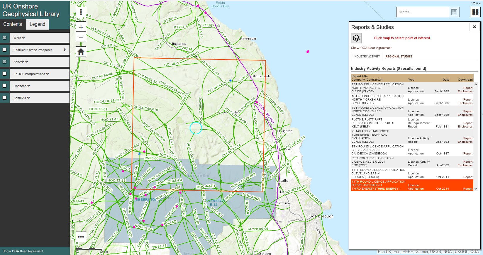
The 14th Onshore Licence Applications have been released by the Oil & Gas Authority and can now be accessed via the UKOGL website.

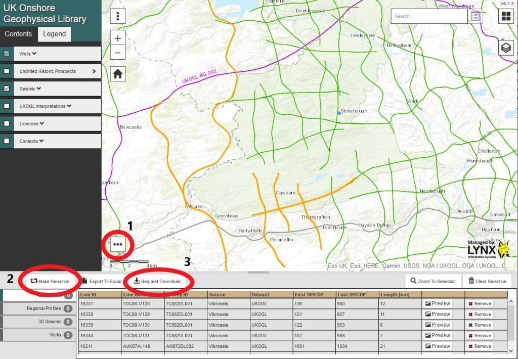
Applications can be searched and downloaded either geographically via the ‘Catch all reports’ icon on the interactive map or via a text based search using the ‘Industry Activity Reports’ link on the UKOGL home page.

UKOGL Office Temporarily Closed.

Following the latest Governement guidelines, the UK Onshore Geophysical Library office will be temporarily closed until further notice.

All staff will be working from home during this period. For all enquiries please use either our email address (contact@ukogl.org.uk) or email direct via the contact details here.

Wishing everyone a Merry Christmas and a Happy New Year from UKOGL.

2D Seismic Data Update – New Migrated Data Coverage

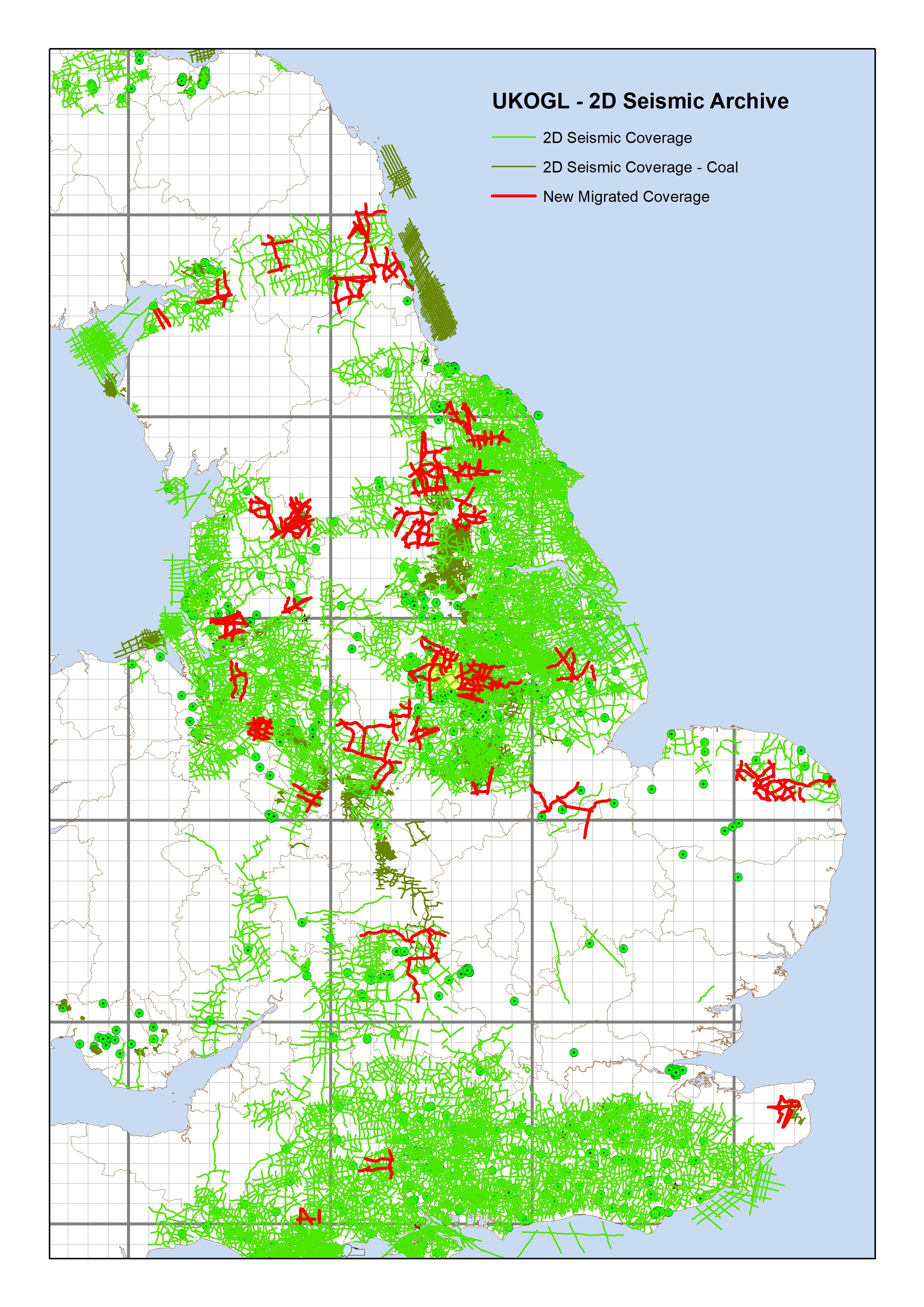
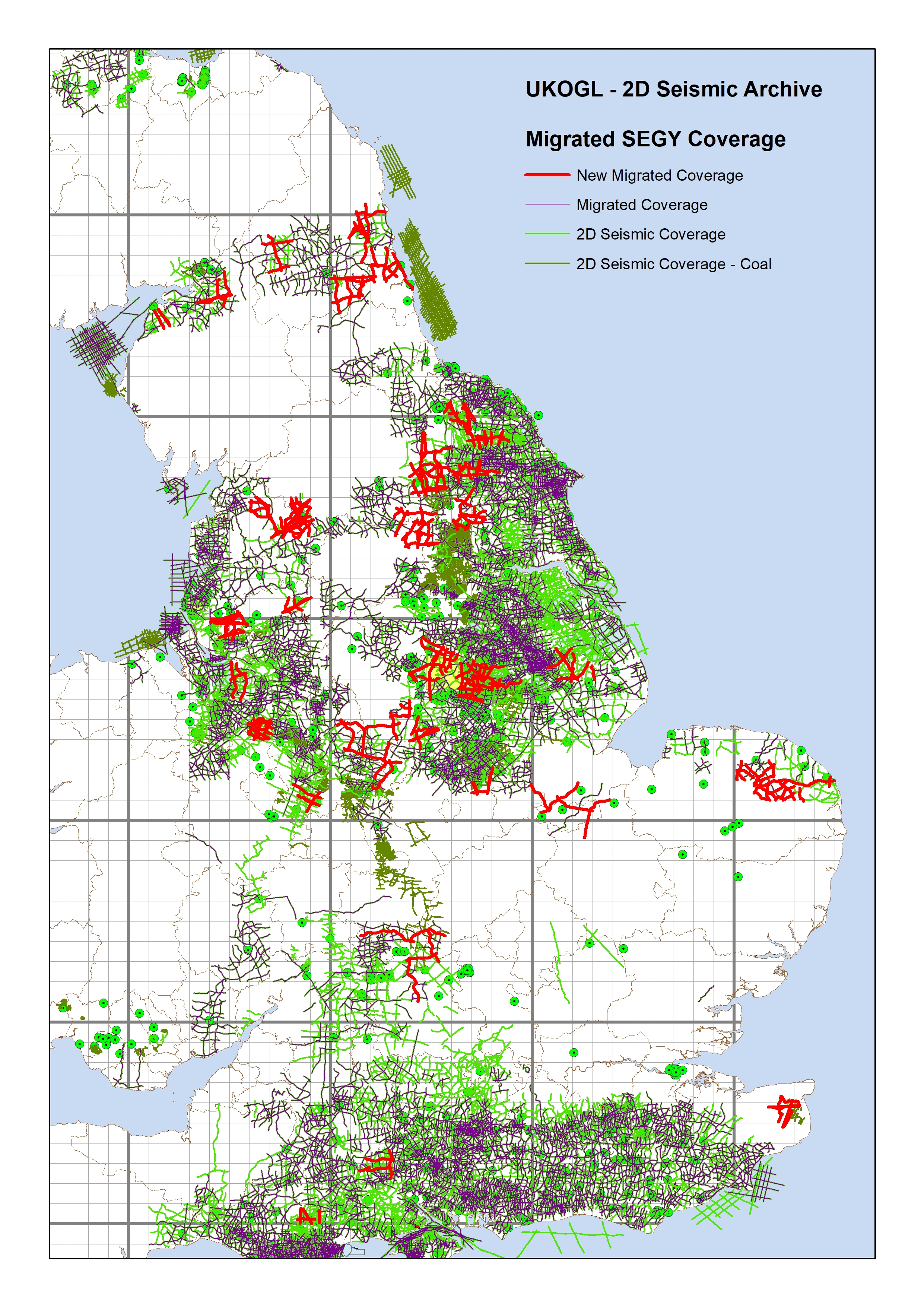
UKOGL have recently completed a project to improve the coverage of 2D SEGY format migrated seismic data available in UKOGL. Migrated hardcopy sections for 219 lines have been scanned and vectorised to SEGY and are now available for release. The lines were selected to ‘infill’ areas that previously lacked migrated SEGY data coverage.

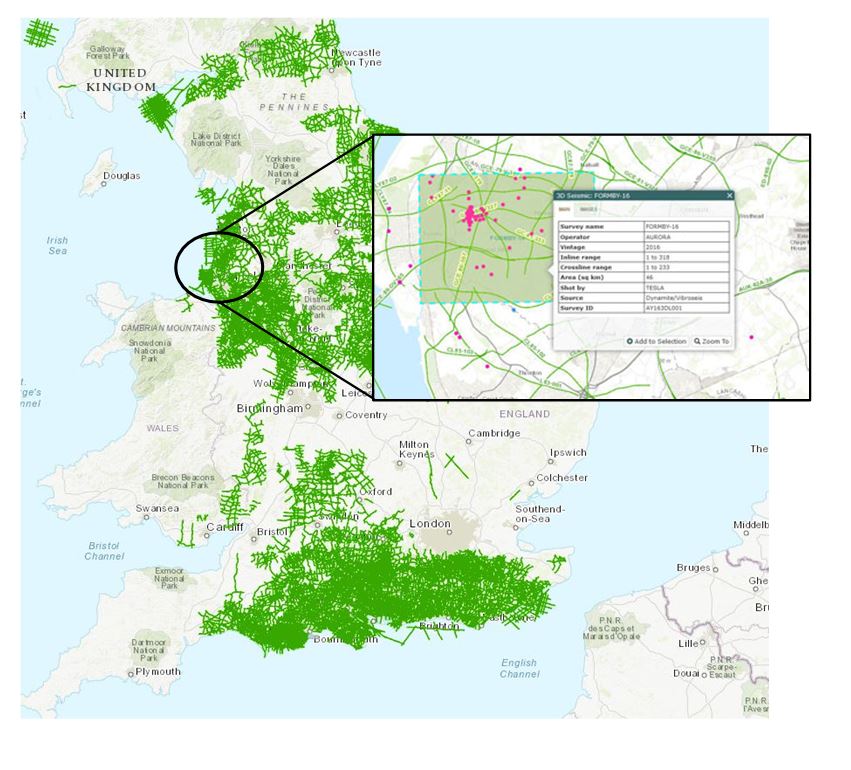
The image below displays the 219 lines selected over England overlaid on top of the complete 2D onshore seismic coverage available through UKOGL.

The image below displays the new 2D data set (red lines) that improves and complements the comprehensive 2D migrated coverage (purple lines) already available in UKOGL; infilling areas that previously had limited SEGY format migrated data.

Please contact UKOGL for more information about the new update to the post stack SEGY archive or for any other questions that you may have about UKOGL.

The migrated hardcopy sections were scanned and vectorised by Lynx Information Systems, output to SEGY and are now ready for workstation loading.

UKOGL Interactive Map Developments:

Well Layer Improvements and Two-Way Time Data Generation

UKOGL have improved the appearance and functionality of the Well Layer displayed on the interactive map, the expanded selection options include the ability to filter on the well category, wells that reach a certain depth and wells that penetrate certain formations.

In addition, a new functionality has been embedded as an option to generate estimated Two-Way Times (TWT) for wells that do not currently have TWT data available through the site.

The well category display, search, filter and selection options on the map can now be controlled via a single user selected ‘drop-down’ menu option, which combines both the old “Well” layer and the old “Additional Selected Boreholes” layer in to one layer that now removes the need to run the same query twice across the two data sets.

All wells with TWT data can now be filtered on the display via the menu to improve access to TWT information.

The UKOGL interactive web map now supports ‘on the fly’ generation of TWT data for wells that do not have TWT data currently available.

Using the mouse arrow select a well without TWT data then select the ‘DEPTHS’ – ‘Well Tops – View’ option to launch the well information page.

By selecting the ‘Two-Way Times’ option on the page a list of ’near-by wells’ is generated that already have TWT data available. A buffer range can be used to limit the search radius of the donor wells available to the user.

The TWT data is generated by extrapolating the TWT depths from the user selected well to the corresponding depth of the well that is currently without TWT data. Data is generated ‘on the fly’ each time a donor well is selected by the user.

The newly generated TWT data can be downloaded from the UKOGL site as a spreadsheet document. Values generated by the Two-Way Time extrapolation function are not retained by UKOGL but they can be regenerated by the user if required again at a later date.

While a great effort has been made by UKOGL to accurately generate TWT data from extrapolated well depths, use of the generated values is always at the users own discretion.

Prospex 2019

UKOGL will be exhibiting at the upcoming PESGB Prospex Conference to be held at the Business Design Centre Islington on December 11th & 12th 2019.

We hope that you can visit us at Booth Number 6 where representatives of the UKOGL Trustees along with the Lynx Administration Team would very much welcome the opportunity to meet you and provide details of our current activities, updates and the wide range of resources that UKOGL & Lynx have to offer.

Links to BGS GeoRecords

We have now added a direct link from our Wells map layer allowing the user to seamlessly access the equivalent records for each individual well and borehole as held in the BGS GeoRecords Open Licence archives.

The link can be found on the Images tab when querying any location within the Wells Layer.

Whilst records for many of the Exploration wells in the BGS Archives may currently be classified as confidential, for the majority of wells within the UKOGL Additional Boreholes layer supplemental information should be freely available.

For full details of the extensive resources as held by the BGS and also guidance as how to access data, including Confidential Records, please visit the BGS GeoRecords web site.