The UK Onshore Geophysical Library (UKOGL) are pleased to announce as part of the William Smith Bicentennial Celebrations, the launch of the William Smith Interactive website at http://www.strata-smith.com/
The WILLIAM SMITH’S MAPS-Interactive website, sponsored by UKOGL and developed by Lynx Information Systems Ltd. is a free-to-all educational resource designed for teachers, students, academics and anybody with an interest in the life and work of William Smith.
Officially launched on the 23rd March 2015 at The Geological Society in London, the launch attended by Sir David Attenborough, was held as part of a series of events marking the bicentennial celebration of the publication William Smith’s 1815 geological map.
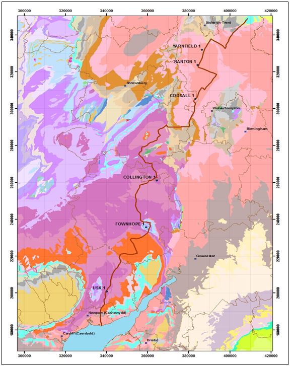
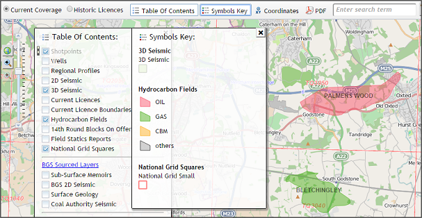
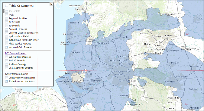
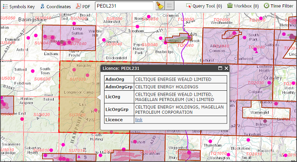
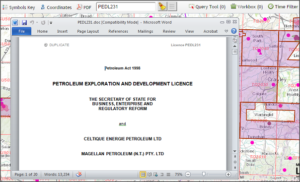
The website has been developed specifically to host a number of fine examples of William Smith’s 1815 map and are available together with all of Smith’s published county geological maps and a number of unpublished county maps. The principal feature of the website is a ‘live’ interactive map viewer which enables users not only to view the maps but also to overlay one against another and compare them with modern geology, wells, seismic (using Lynx’s online SEGY viewer) and current topographic maps. Users can display Smith’s geological sections and view 3D animations of his maps.
The website also has information on the map sources, Smith’s biography, stratigraphy, coordinates and maps in 3D. There is a section concerning the “Map That Might Have Been”. Using a mosaic of images from Smith’s county maps (published and manuscript), and other Cary county maps enhanced by Smith’s 1815 geology, a composite geological map has been made. This map might have resembled a more detailed edition of his great map which Smith could have made were it not for his dire financial situation at the time. The digital images of maps used in this website have been provided by: The Geological Society, Oxford University Museum of Natural History, National Museum of Wales, Stanford University and Nottingham University.
Help on how to use the site is available via a youtube tutorial and the development team can be contacted via email at contact@ukogl.org.uk
The WILLIAM SMITH’S MAPS-Interactive website online team consists of Peter Wigley (Editor), Peter Dolan, Tom Sharpe, Hugh Torrens, Dave Williams (HOGG), Neil Anderton (UKOGL) and Christoph Schramm (LYNX)