One new seismic surveys has been released onshore in January 2021 and is now available through UKOGL. The Formby-16 3D seismic survey is located onshore in Lancashire.
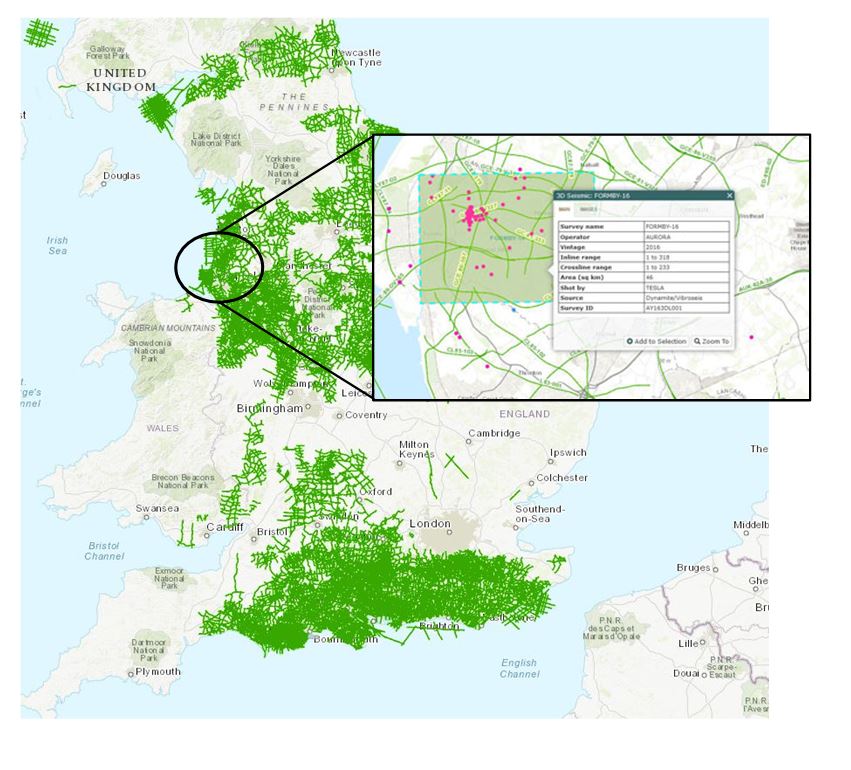
One new seismic surveys has been released onshore in January 2021 and is now available through UKOGL. The Formby-16 3D seismic survey is located onshore in Lancashire.
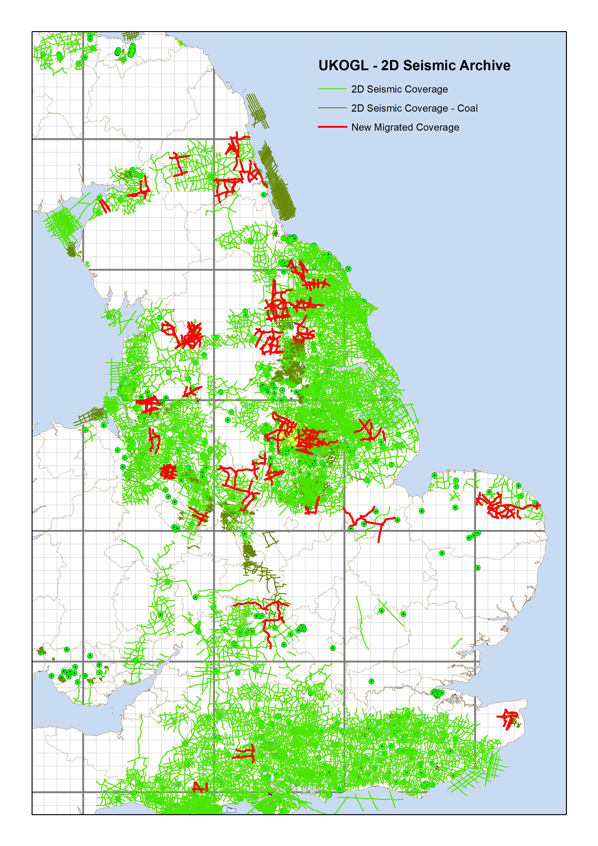
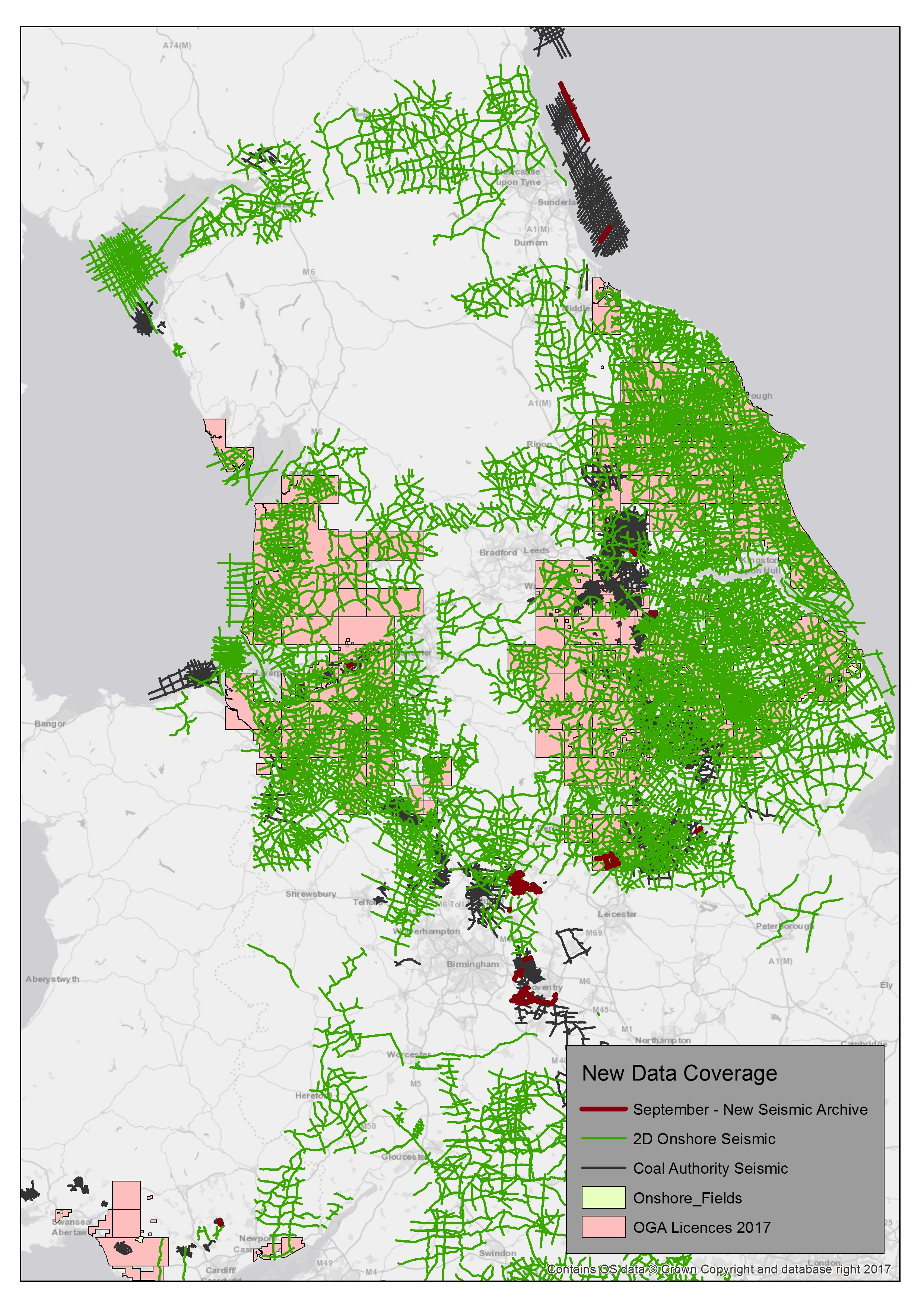
UKOGL have recently completed a project to improve the coverage of 2D SEGY format migrated seismic data available in UKOGL. Migrated hardcopy sections for 219 lines have been scanned and vectorised to SEGY and are now available for release. The lines were selected to ‘infill’ areas that previously lacked migrated SEGY data coverage.
The image below displays the 219 lines selected over England overlaid on top of the complete 2D onshore seismic coverage available through UKOGL.
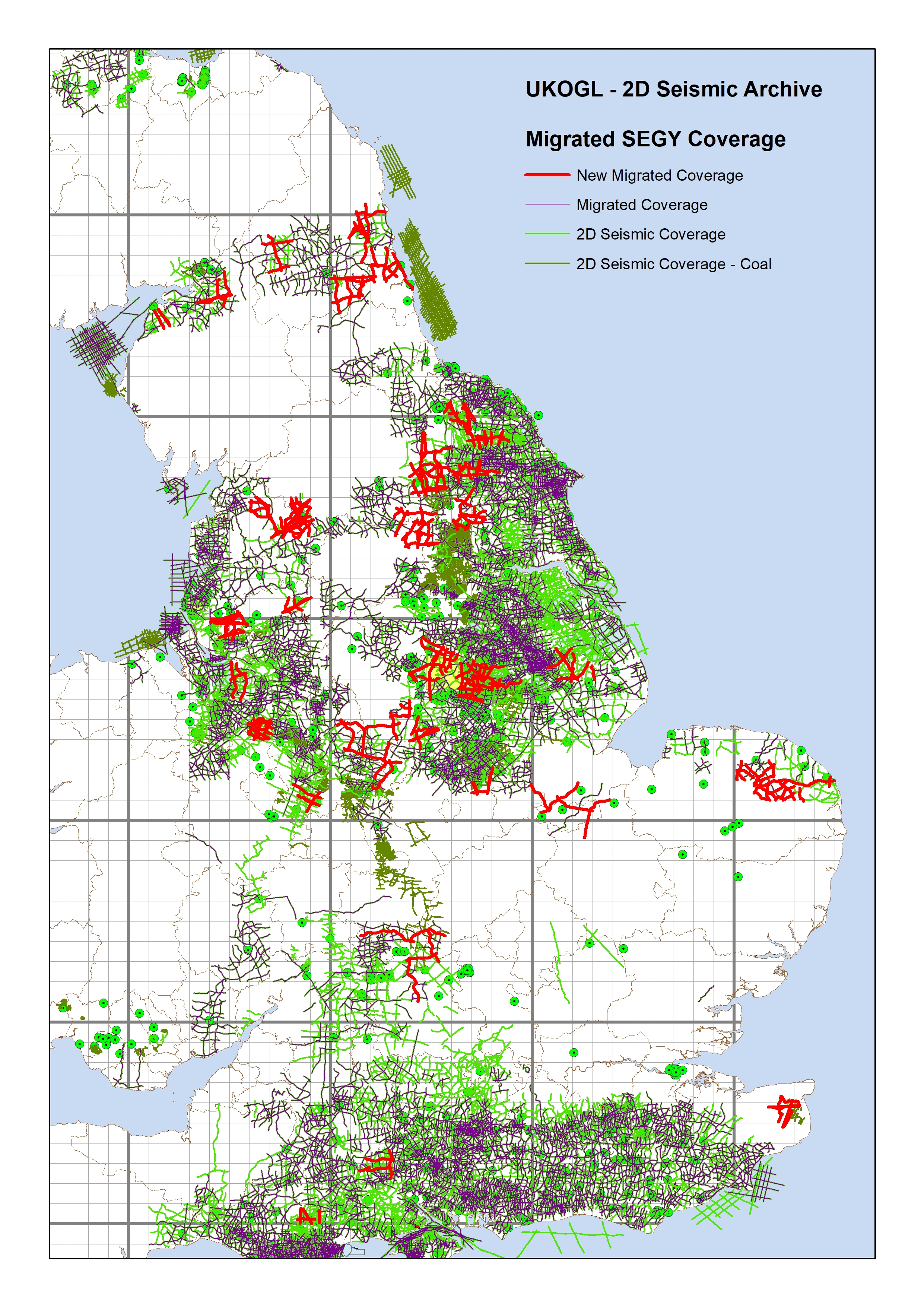
The image below displays the new 2D data set (red lines) that improves and complements the comprehensive 2D migrated coverage (purple lines) already available in UKOGL; infilling areas that previously had limited SEGY format migrated data.
Please contact UKOGL for more information about the new update to the post stack SEGY archive or for any other questions that you may have about UKOGL.
The migrated hardcopy sections were scanned and vectorised by Lynx Information Systems, output to SEGY and are now ready for workstation loading.
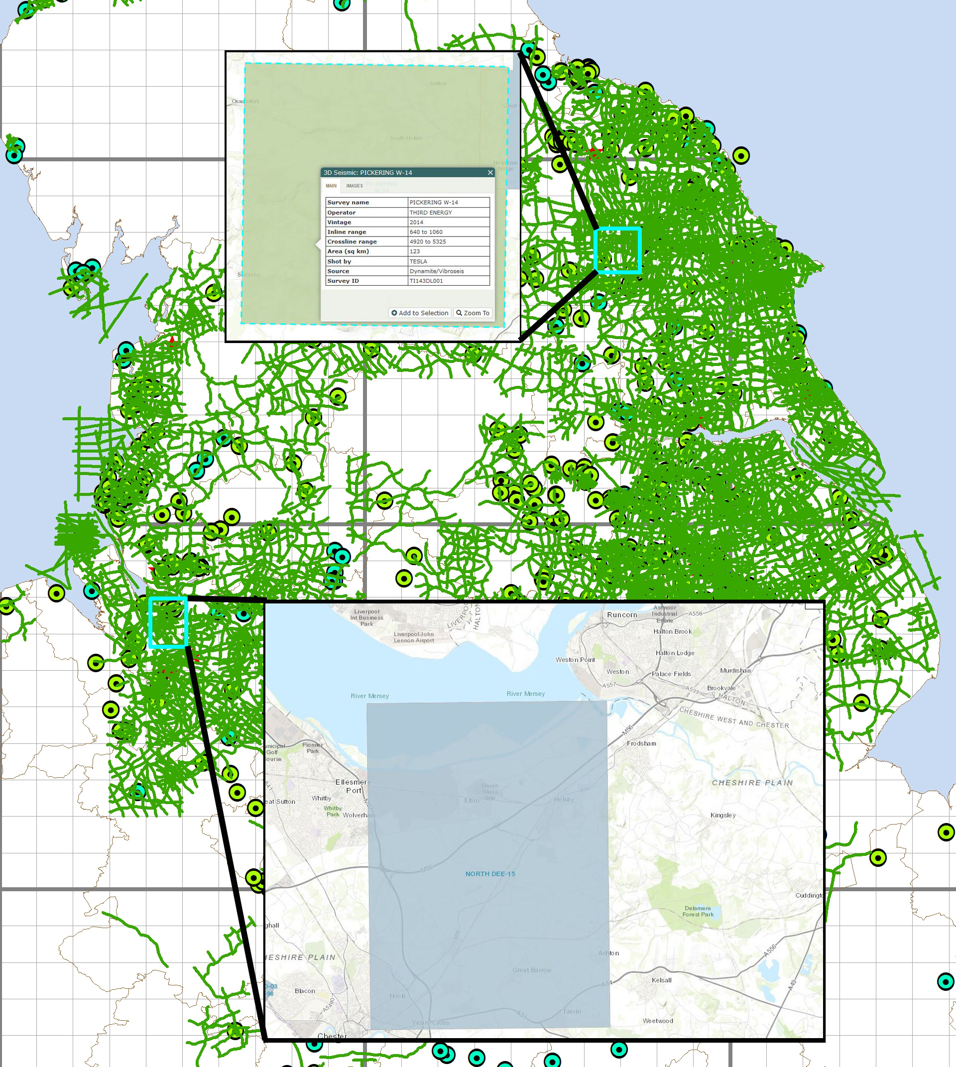
Two new seismic surveys have been released onshore and are now avaialble through UKOGL. The 3D surveys are located in Cheshire and North Yorkshire.
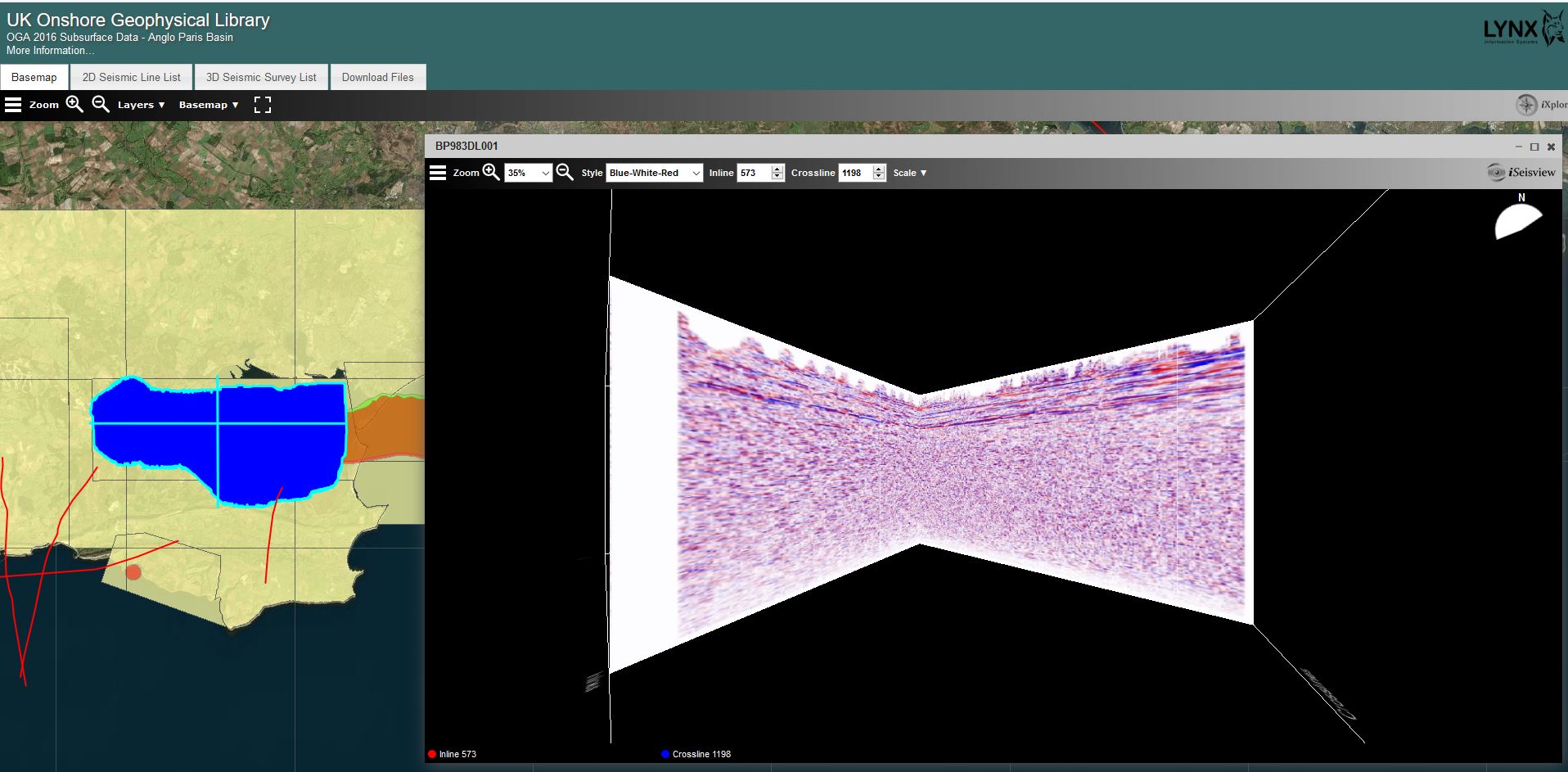
Following on from the release of the OGA onshore seismic data packages, Lynx Information Systems have updated the seismic viewer for the Wytch Farm 3D seismic data in the Anglo Paris Basin data package.
The 3D Seismic data can now be viewed as a ‘Cube’ using iSeisview.
The new viewer is enabled by default and provides an interactive 3D cube perspective view of the survey, allowing zoom and rotation to view inline and crossline profiles from any angle, with a choice of display styles and scales.
You can try out the new 3D viewer here
For more information about the Anglo Paris Basin data seismic data please contact UKOGL
If you have any questions about the viewer and its implementation then please contact Lynx.
With the turning of the year, a number of seismic surveys are now eligible for archive and release. These incorporate two 2D surveys acquired during 2014 over Cheshire and East Yorkshire along with three 3D surveys from 2013-14 acquired over East Yorkshire, Nottinghamshire and Dorset.
The Bath Spa Geothermal Project was commissioned by Bath & NE Somerset council in 1999. As part of the work to gain an enhanced understanding and management of the hot springs that flow into the city, a new seismic survey was designed to investigate the deep geology of the Bath area with special emphasis on the Carboniferous Limestone, the thermal water aquifer.
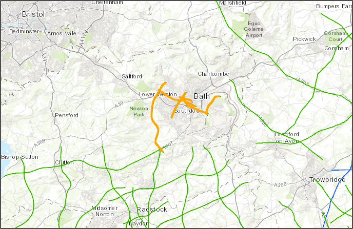
A total of 6 new 2D seismic lines (20.64 km) were shot in and around the city centre and both the Pre Stack and Processed data sets have been provided for the UKOGL archives.
UKOGL would like to extend our sincere gratitude to Bath & NE Somerset Council for granting permission for this key data set to be made available through the Library.
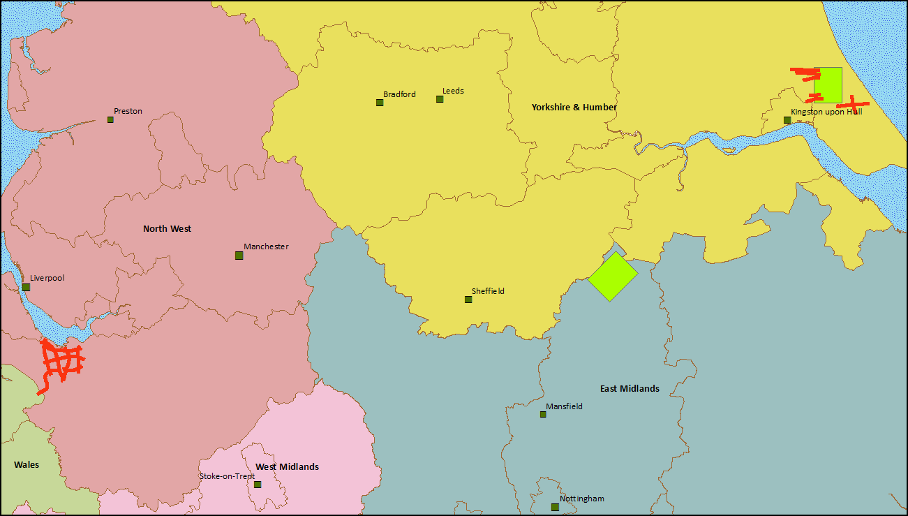
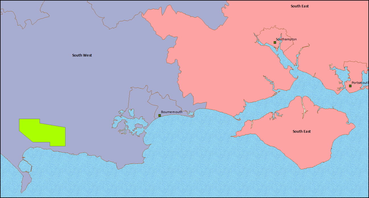
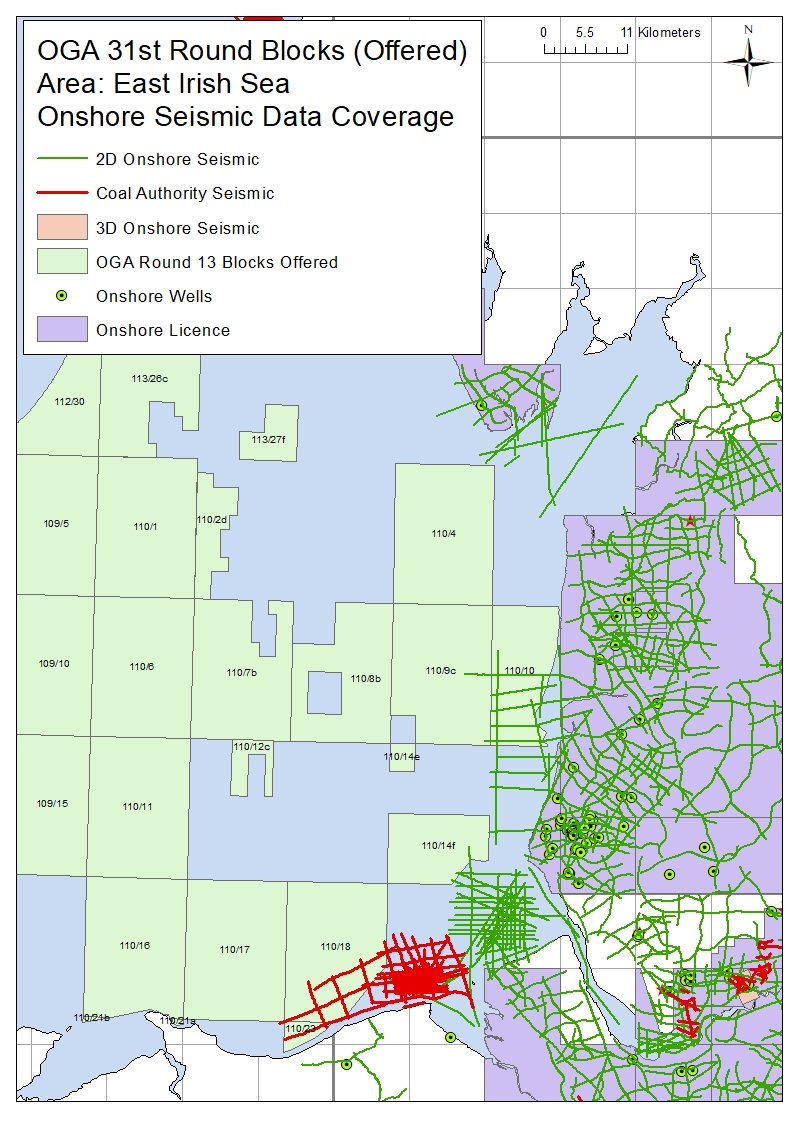
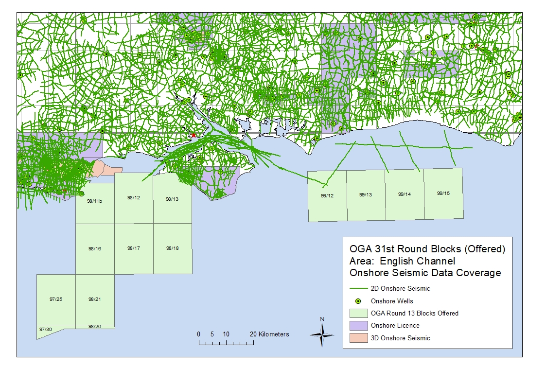
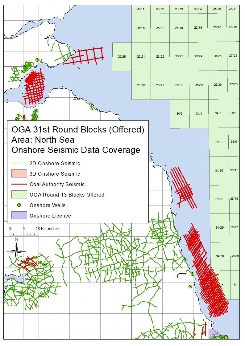
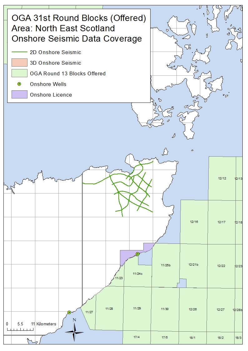
Following on from the Oil & Gas Authority launch of the 31st Offshore Licensing Round, a number of the offshore blocks offered in this round are located ‘near-shore’ adjacent to areas that have onshore seismic coverage available from UKOGL.
Recorded for the exploration of oil, gas and coal, the data sets include both onshore, transition zone and offshore surveys adjacent to or over the blocks offered.
The coal data is available to be licensed through UKOGL under agreement with the BGS and The Coal Authority.
Please contact either UKOGL direct or use our online interactive map and viewer for more information or to compile a data request.
The maps below displays the areas of onshore data located adjacent to the blocks on offer.
The 2016 OGA UK onshore seismic data release packages are now available to be downloaded via the UKOGL Interactive Map website.
The UKOGL Interactive map provides immediate access to the onshore reprocessed data packages and the post stack 2D and 3D SEG-Y data can be viewed before downloading using iSeisview – An online seismic data viewer developed by Lynx Information Systems Ltd. that enables the user to interactively view the Post Stack SEG-Y in real-time.
Only the reprocessed 2D post stack SEG-Y and 3D data that forms part of the 2016 OGA data can be viewed in iSeisview.
The seismic viewer developed by Lynx enables SEG-Y data in 2D or 3D inline and crossline profiles to be displayed interactively in a web browser and allows the user to select display styles, zoom levels, horizontal and vertical scales and trace amplitudes of the SEG-Y data.
Access to the 2016 OGA onshore data packages via the UKOGL Interactive map does not require a login.
The freely available government funded reprocessed onshore data is comprised of UK onshore reprocessed 2D post stack SEG-Y data, SEG-Y gathers, navigation data and supporting processing reports located over three onshore areas of the UK:
The original processed 3D Wytch-Farm-98 post stack SEG-Y data is also available as part of the South Coast data set with all inlines and crosslines available to be assessed interactively using iSeisview before downloading.
How to Access the Data
Access to the OGA Onshore data packages is via the contents sidebar on the UKOGL Interactive Map as indicated below.
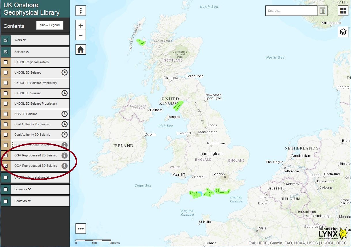
2016 OGA Reprocessed 2D and 3D Seismic displayed via the ‘tick’ box
The reprocessed 2D Post Stack SEG-Y data and 3D Post-Stack SEG-Y survey can be viewed immediately by selecting the “Live Seismic Viewer” option to assess the data using iSeisView or, by selecting the “View and Download Files” option a Virtual Data Room developed by Lynx will be launched for each area to easily access all onshore files that have been made available as part of the 2016 Government-Funded UK onshore reprocessed data packages.
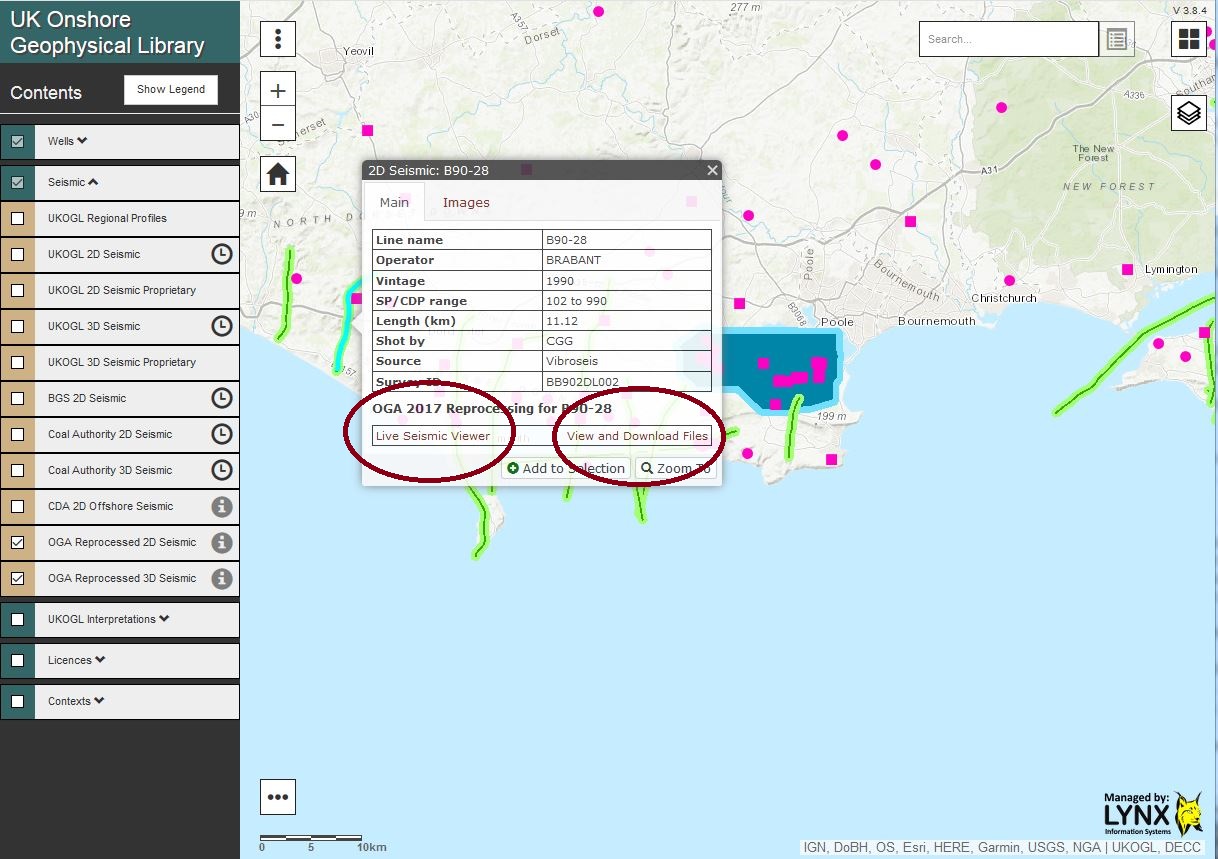
Following line selection – Option to interactively view the available SEG-Y data or access and download the data
The “View and Download Files” option launches the Lynx Virtual Data Room: 2D lines can be selected and the SEG-Y data viewed interactively via iSeisview either by selecting each line from the “Map” or via a “2D Seismic Line List” view.
Virtual Data Room – The selection of a 2D line enables the SEG-Y data to viewed interactively using iSeisview
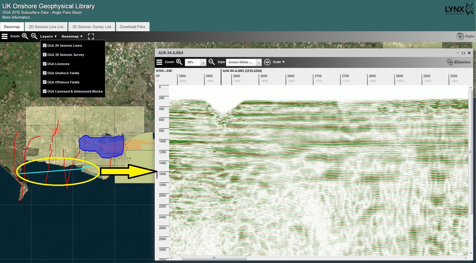
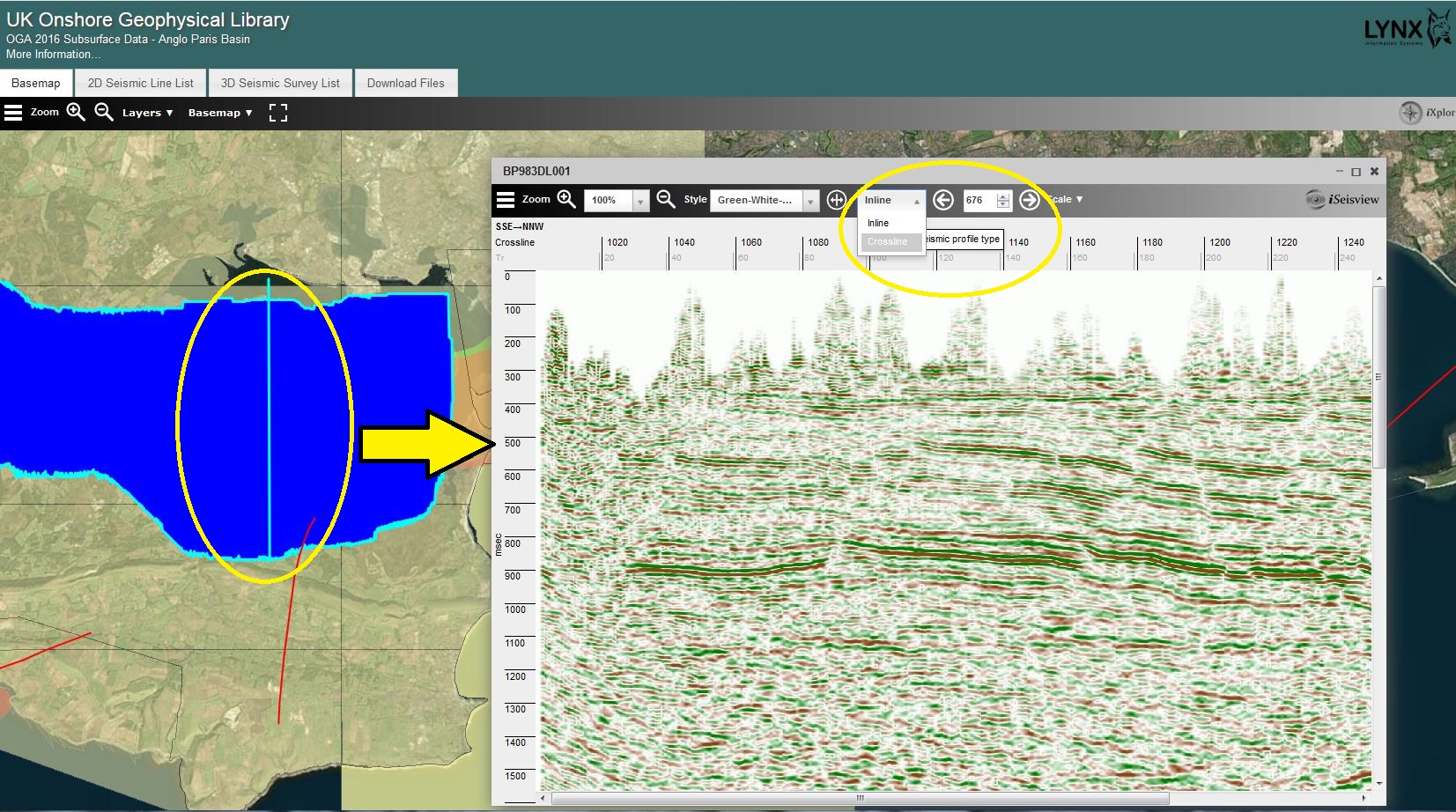
To view inlines or crosslines from the available 3D survey in iSeisview, ‘hover’ over and ‘click’ on the 3D survey and then use the left mouse button to select an inline or the right mouse button to select a crossline.
The left mouse button is used to select an inline to view via iSeisview from the 3D survey.

The right mouse button is used to select a crossline to view via iSeisview from the 3D survey.
EBCDIC header information, inlines and crosslines can also be selected using the options via the SEG-Y viewer.
To download the available data select the “Download Files” tab. The data for each package can be quickly and easily selected for download using the ‘tick’ boxes. Data for each area and line has been grouped and “pre-zipped” in to associated processed versions, SEG-Y gathers, reports, velocity files and navigation data files to streamline access to the data packages.
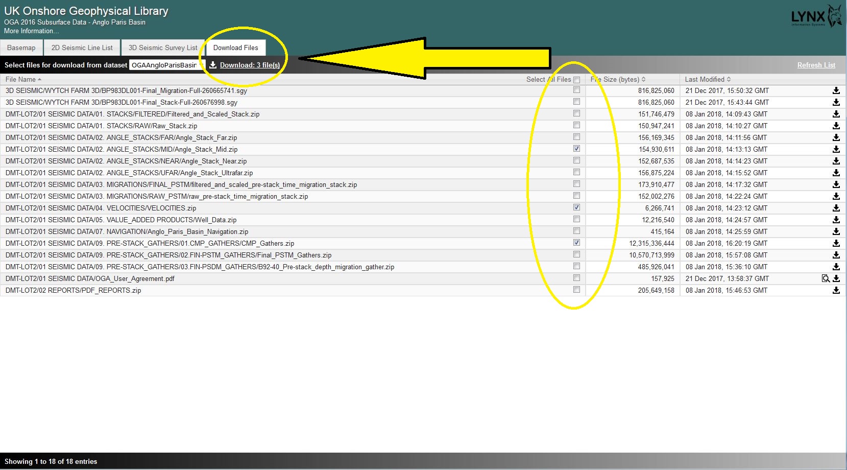
Select files and download via the “Download Files” tab.
The terms of the use of the data as supplied as part of the 2016 OGA data release packages can be found in: Oil and Gas Authority user Agreement.
The 2016 offshore data packages are available from download via the UKOilandGasData portal.
Over 70 new seismic lines have been added to the UKOGL archive this month. Ranging from offshore Country Durham, the Midlands to South Wales this brings the total Coal Authority post stack line coverage now available through UKOGL to over 3000 lines in both SEG-Y and scanned hard copy section images.
The digital data was not available for these lines and was created by scanning, and vectorizing the hard copy sections to SEG-Y by Lynx Information Systems. UK British National Grid co-ordinates have been inserted in to the trace headers to ensure that the lines are ready for workstation loading and interpretation.

A new batch of Coal Authority post stack seismic data has been archived and made available to view and license through the UKOGL website.
This adds 112 new lines to the UKOGL coverage and is comprised of both stack and migrated versions. Many of these lines were previously only available as hardcopy sections as the digital data was not available. The SEGY data has been either loaded from the original files or reconstructed by scanning and vectorizing the sections by Lynx Information Systems to recreate the lines.
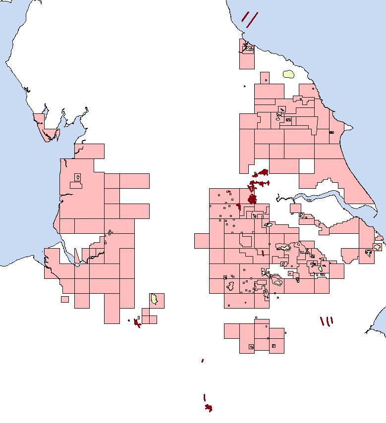
The majority of the lines highlighted in maroon in the image above, were recorded in the 1990’s. All lines have British National Grid X-Y co-ordinates inserted in to the trace headers and are available to be licensed immediately. Please contact UKOGL for more information regarding these lines or for any of the other data sets available from UKOGL.