Update: 10th August 2020 – The UK Onshore Geophysical Library office has now re-opened, but with a reduced level of office based staff. Contact can now be made with UKOGL by both phone and by email, via our general email address (contact@ukogl.org.uk) or direct via the contact details here.
Category Archives: UKOGL news
UKOGL Interactive Map Developments:
Well Layer Improvements and Two-Way Time Data Generation
UKOGL have improved the appearance and functionality of the Well Layer displayed on the interactive map, the expanded selection options include the ability to filter on the well category, wells that reach a certain depth and wells that penetrate certain formations.
In addition, a new functionality has been embedded as an option to generate estimated Two-Way Times (TWT) for wells that do not currently have TWT data available through the site.
The well category display, search, filter and selection options on the map can now be controlled via a single user selected ‘drop-down’ menu option, which combines both the old “Well” layer and the old “Additional Selected Boreholes” layer in to one layer that now removes the need to run the same query twice across the two data sets.
All wells with TWT data can now be filtered on the display via the menu to improve access to TWT information.
The UKOGL interactive web map now supports ‘on the fly’ generation of TWT data for wells that do not have TWT data currently available.
Using the mouse arrow select a well without TWT data then select the ‘DEPTHS’ – ‘Well Tops – View’ option to launch the well information page.
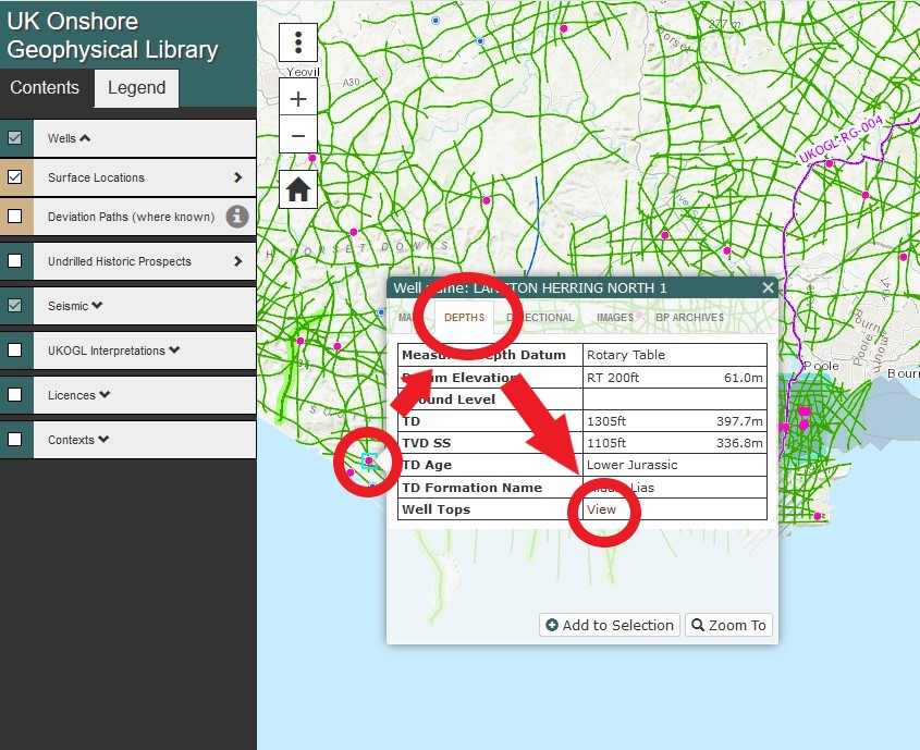
By selecting the ‘Two-Way Times’ option on the page a list of ’near-by wells’ is generated that already have TWT data available. A buffer range can be used to limit the search radius of the donor wells available to the user.
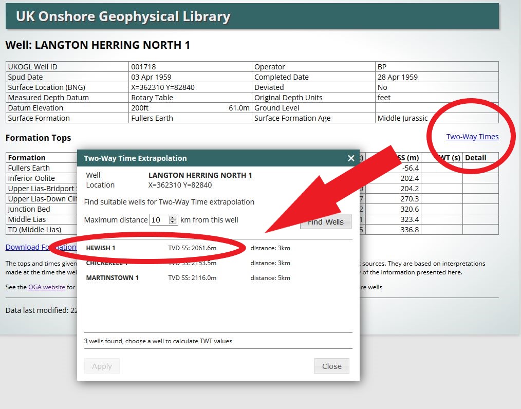
The TWT data is generated by extrapolating the TWT depths from the user selected well to the corresponding depth of the well that is currently without TWT data. Data is generated ‘on the fly’ each time a donor well is selected by the user.
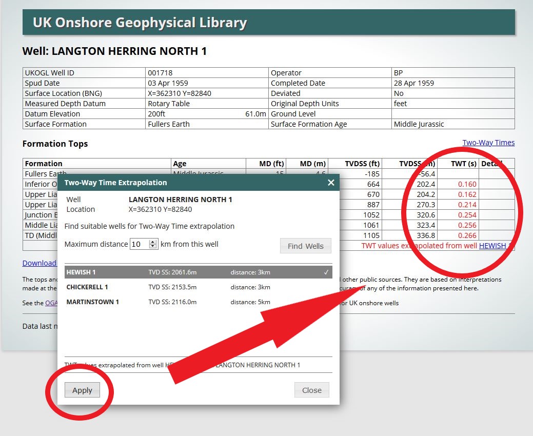
The newly generated TWT data can be downloaded from the UKOGL site as a spreadsheet document. Values generated by the Two-Way Time extrapolation function are not retained by UKOGL but they can be regenerated by the user if required again at a later date.
While a great effort has been made by UKOGL to accurately generate TWT data from extrapolated well depths, use of the generated values is always at the users own discretion.
UK Onshore Seismic Release
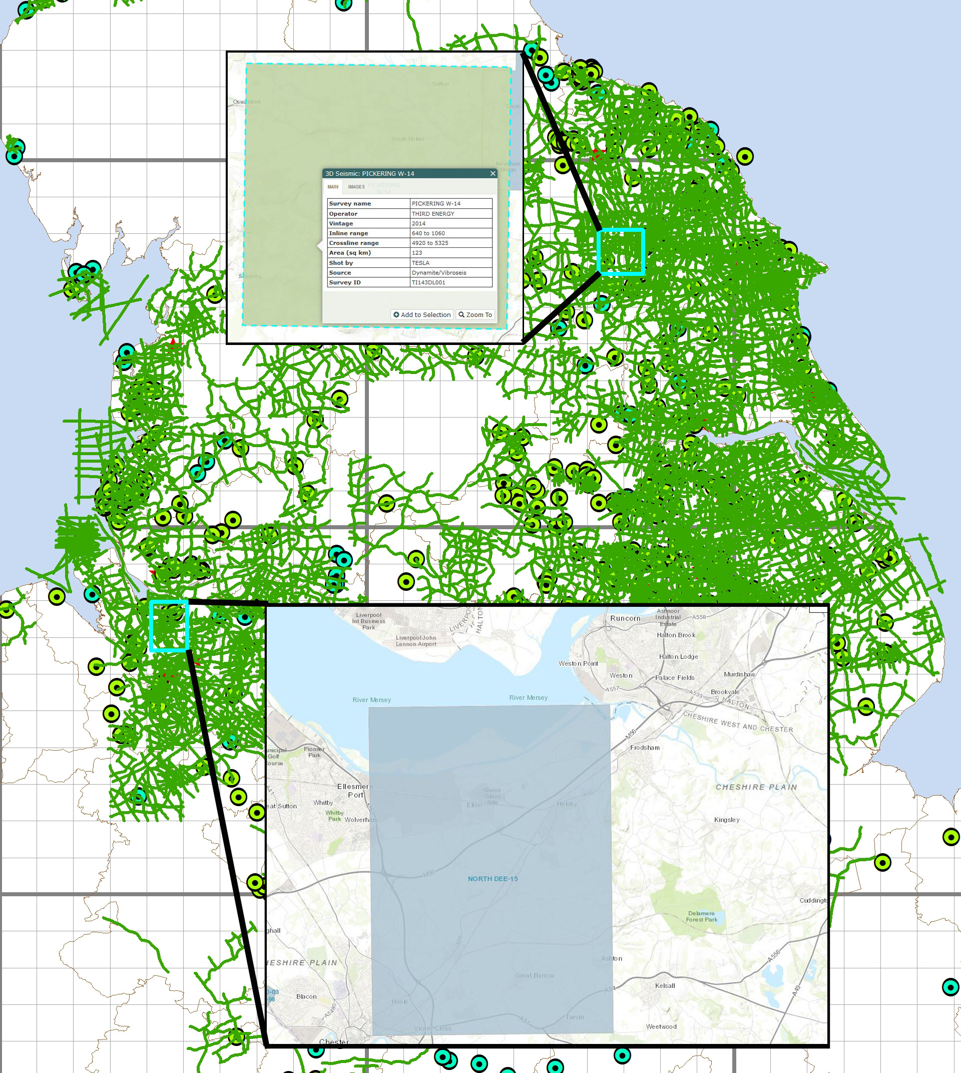
Two new seismic surveys have been released onshore and are now avaialble through UKOGL. The 3D surveys are located in Cheshire and North Yorkshire.
Well Formation Tops – New Search Facility
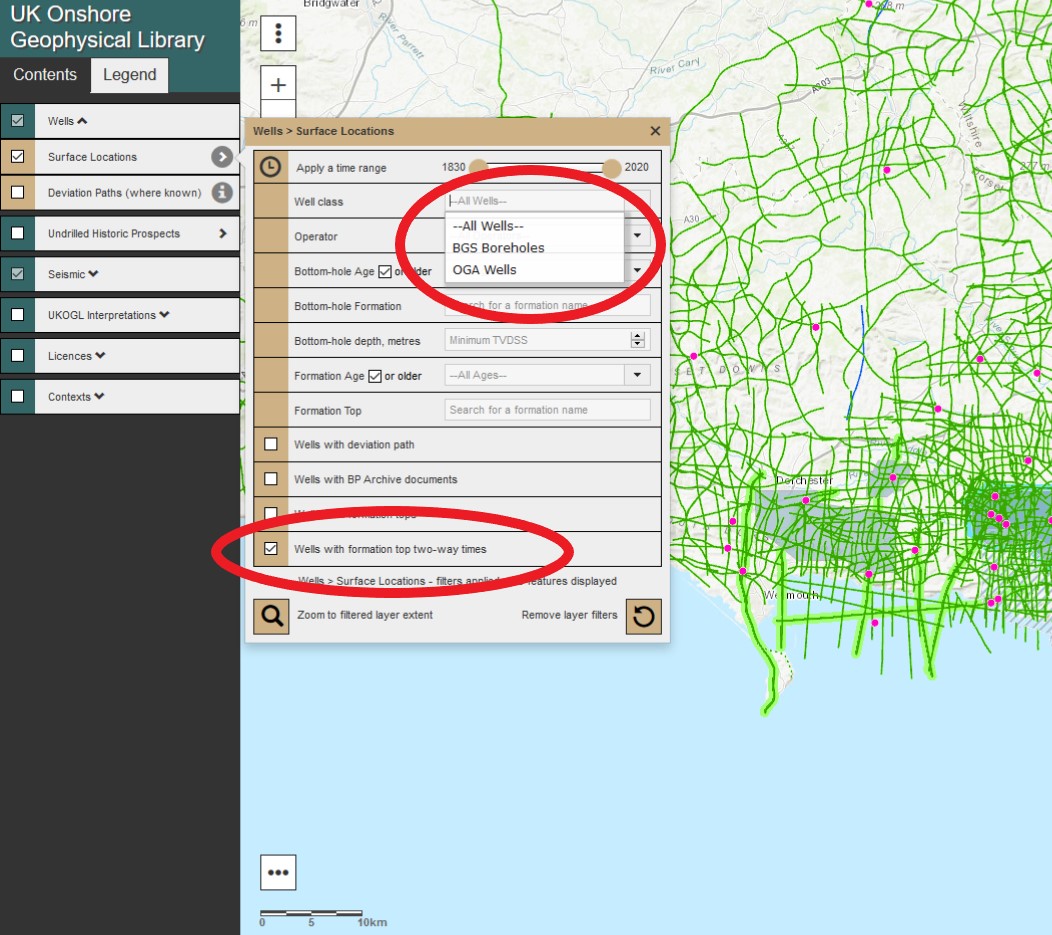
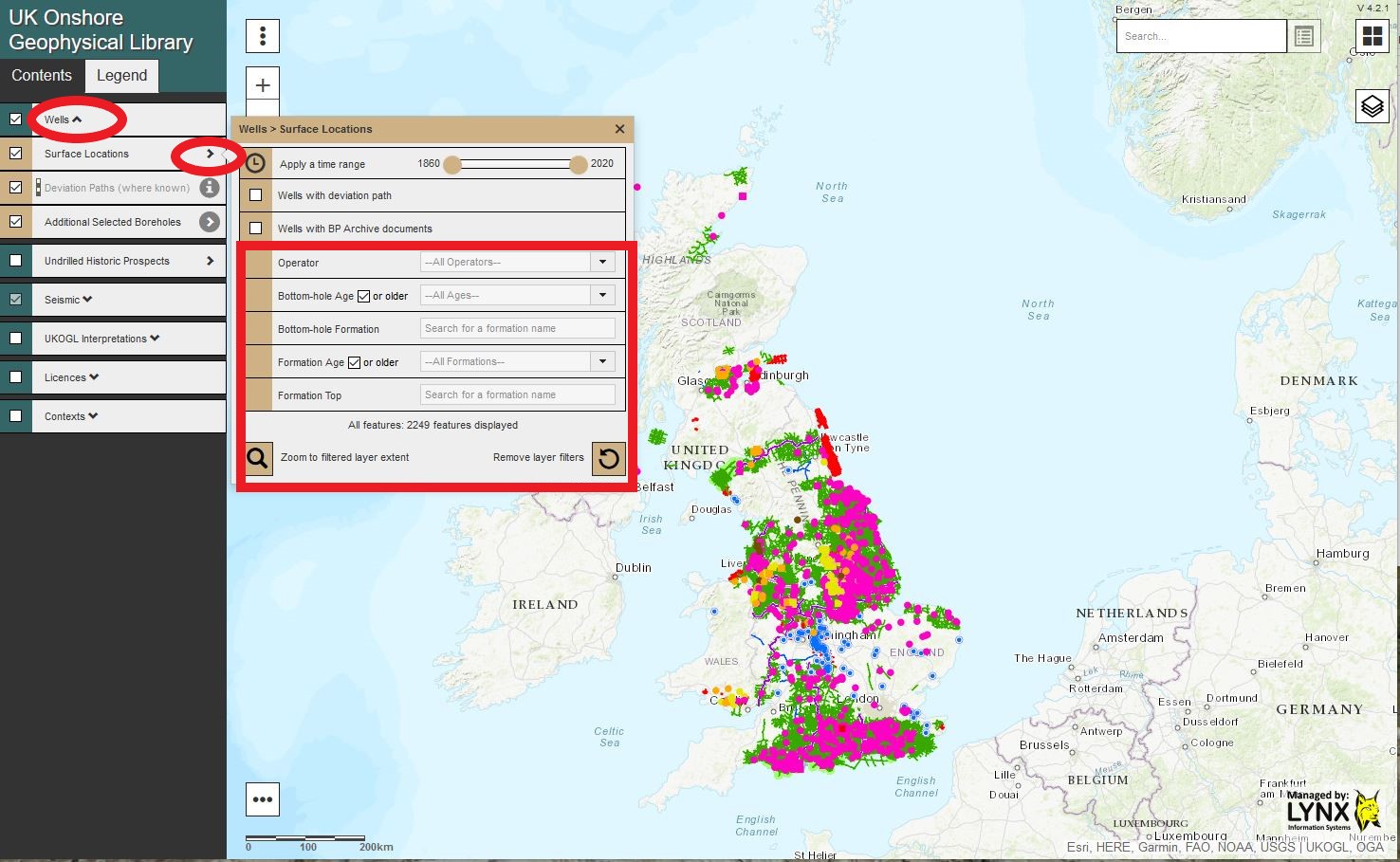
UKOGL have implemented an expanded and improved well search capability to the online interactive map focusing on the Well Formation Tops information that is held for each well.
Accessible via the contents panel, ‘Wells’ and ‘Additional Selected Boreholes’ can now be searched separately using a new set of filters and search options, these include:
Well Formation & Well Formation Age
Bottom Hole Age & Bottom Hole Formation
Well Operator
To search both the OGA ‘Wells’ and the ‘Additional Selected Boreholes’ separate searches should be performed on each well set.
For each set of wells the selected filters can be combined together and the results are automatically displayed on the map to quickly and easily target the displayed information.
Example Search Summary: The Well Formation Tops search options are located on the content side panel of the interactive map selected via:
Wells > Surface Locations > Search Box or Wells>Additional Selected Boreholes>Search Box
- The Bottom Hole Age and Bottom Hole Formation can be filtered and searched using the ‘Drop down’ menu or by entering text in to the search box and selecting the filtered context suggestions.
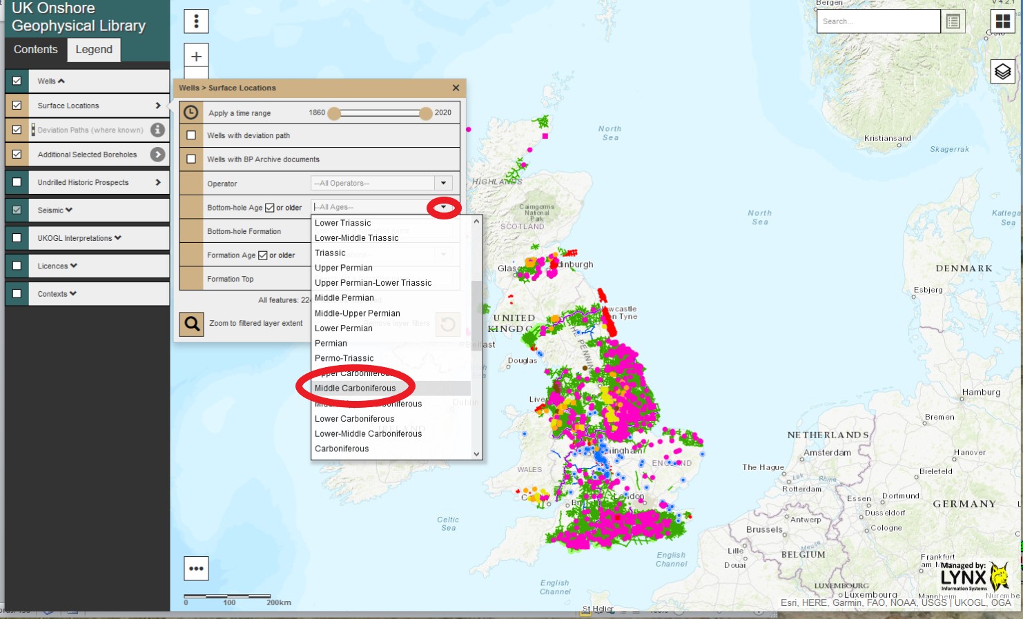
- On the ‘Bottom-Hole Age or older’ selection click on the ‘tick’ box to display all wells that also have a Bottom-Hole Age ‘older’ than the selected Bottom-Hole Age.
- The Formation Age and Formation Tops can be filtered and searched using the ‘Drop down’ menu or by entering text in to the search box and selecting the filtered context suggestion.
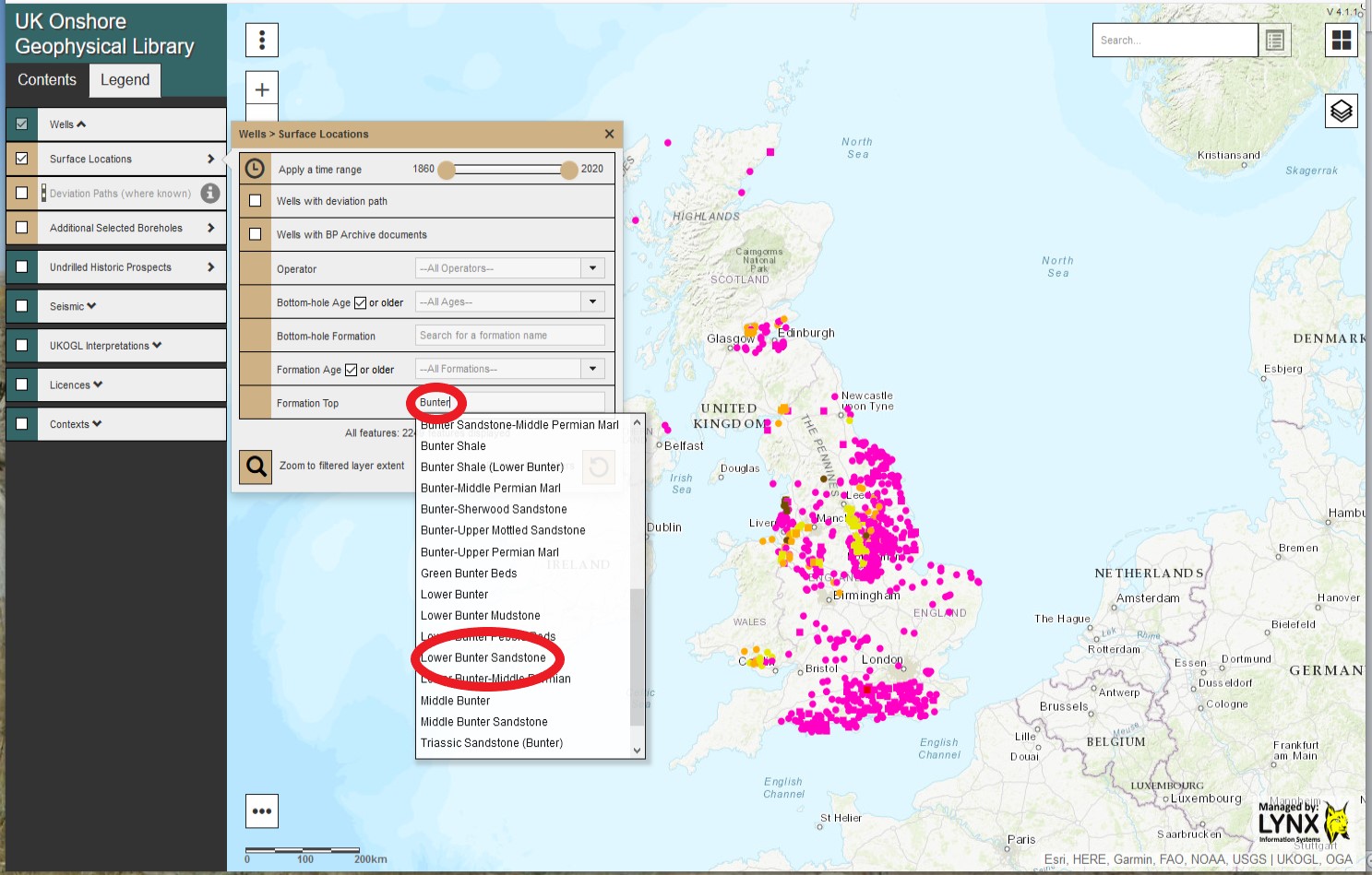
- On the ‘Formation Age or older’ selection click on the ‘tick’ box to display all wells that also contain formations older than the selected Formation Age.
- The filtered results are displayed on the map with the option to zoom to the extent of the returned search results.
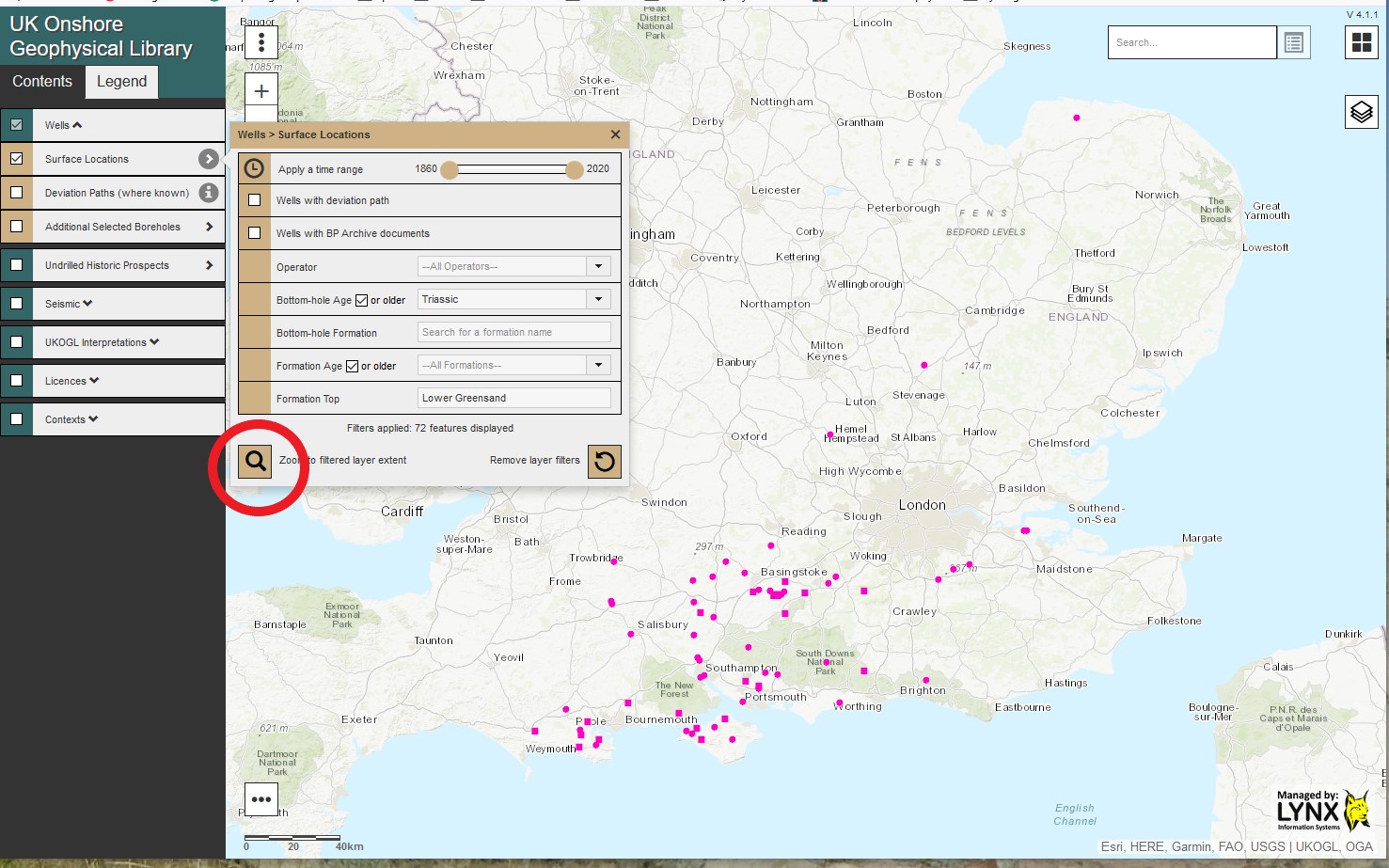
All filters can be combined to further refine each search performed upon the wells with each search result depicted by the wells displayed on the interactive map.
Select the ‘Remove layer filters’ icon to cancel all filters and re-display all available onshore wells.
Regional Study – Report Release
New Regional Study Release
UKOGL are pleased to be able to release and make available a new regional report that utilises the seismic images that are freely available on the UKOGL website. The independent report: The Value of UKOGL Seismic Lines in major engineering projects: The HS2 High-Speed Rail Project by Robin Grayson demonstrates the potential value of the seismic data that is archived and held by the UK Onshore Geophysical Library in planning large engineering projects in the UK.
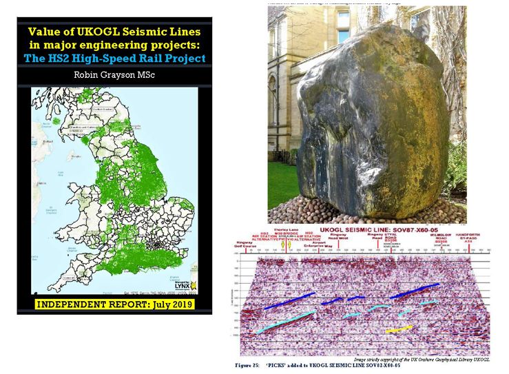
The Value of UKOGL Seismic Lines in major engineering projects: The HS2 High-Speed Rail Project by Robin Grayson
UKOGL data is available for use by all interested parties, not just educational and commercial organisations but also the general public. In this case, the seismic lines show elements of the underlying deep geological structure that can have a large influence on the stability of major construction work and it is very encouraging to see our data utilised in this manner.
The report can be accessed either via the ‘Supplemental Resources’ side panel on the UKOGL home page, followed by selecting the ‘Regional and Government Studies’ link and then the ‘Northern England’ option, or by using the ‘Catch All Reports Search’ icon on the UKOGL interactive map and clicking on the map over the Manchester area.
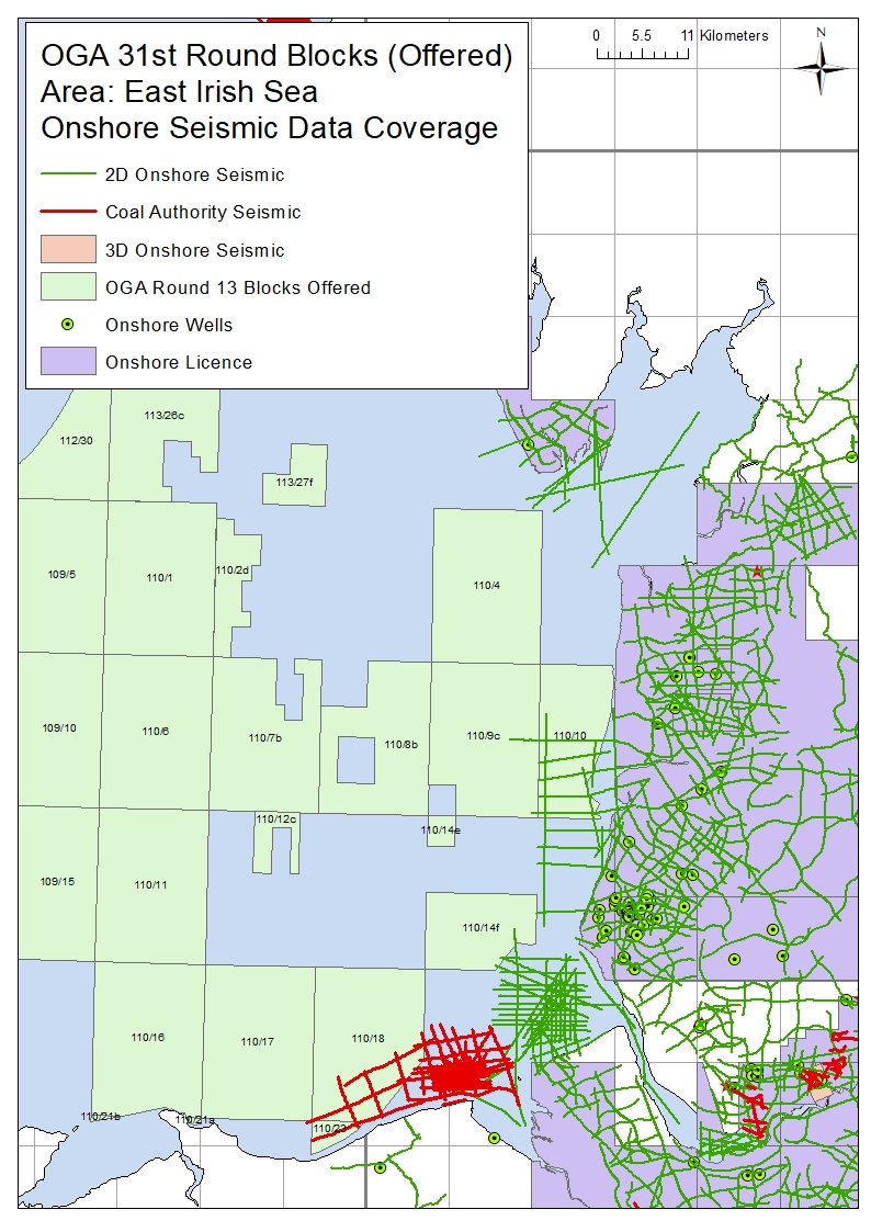
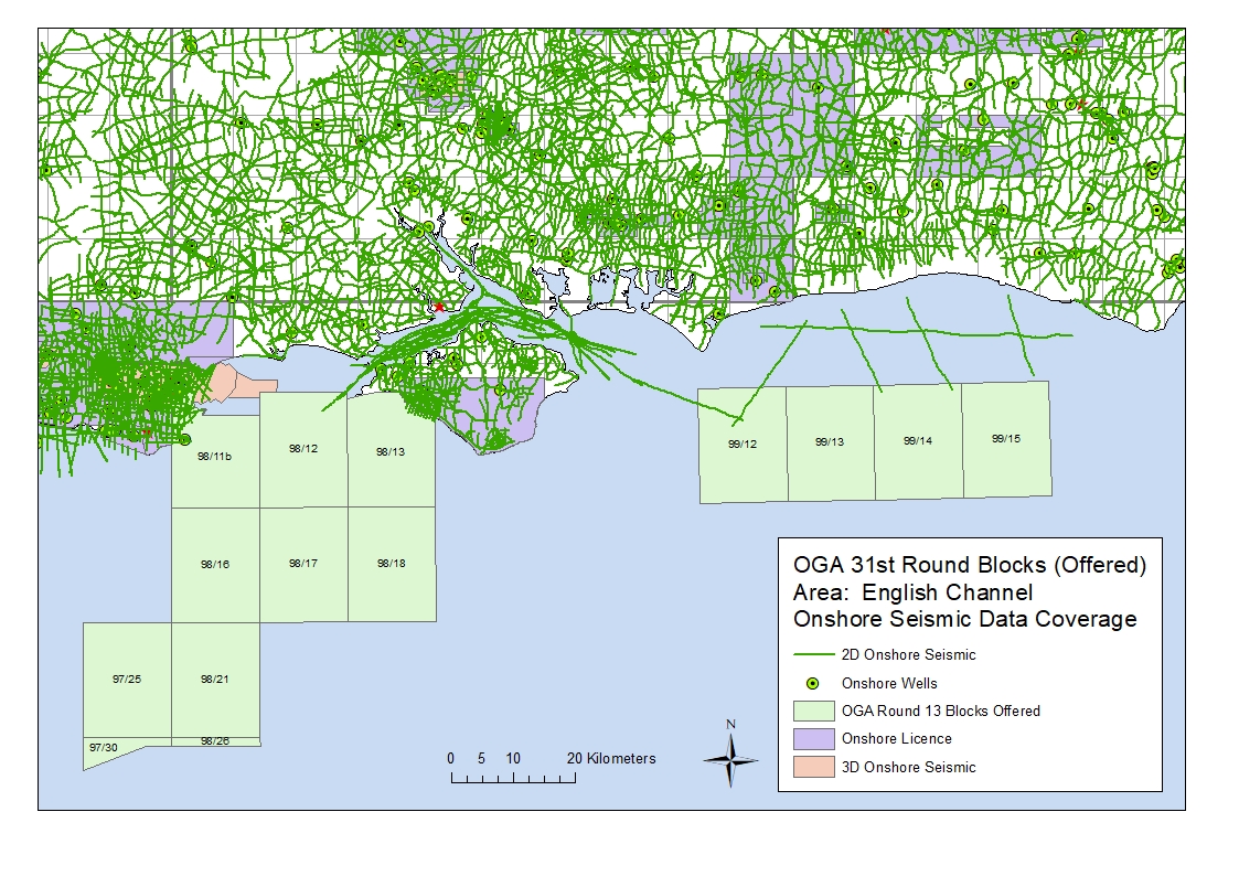
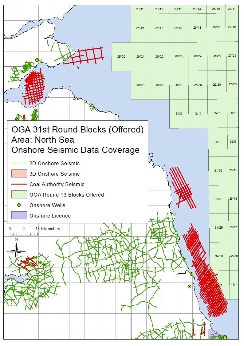
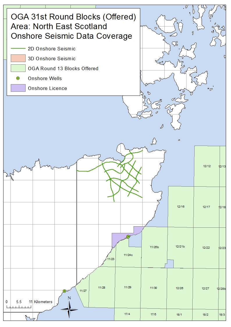
OGA 31st Round – Blocks Offered – Onshore Seismic Data
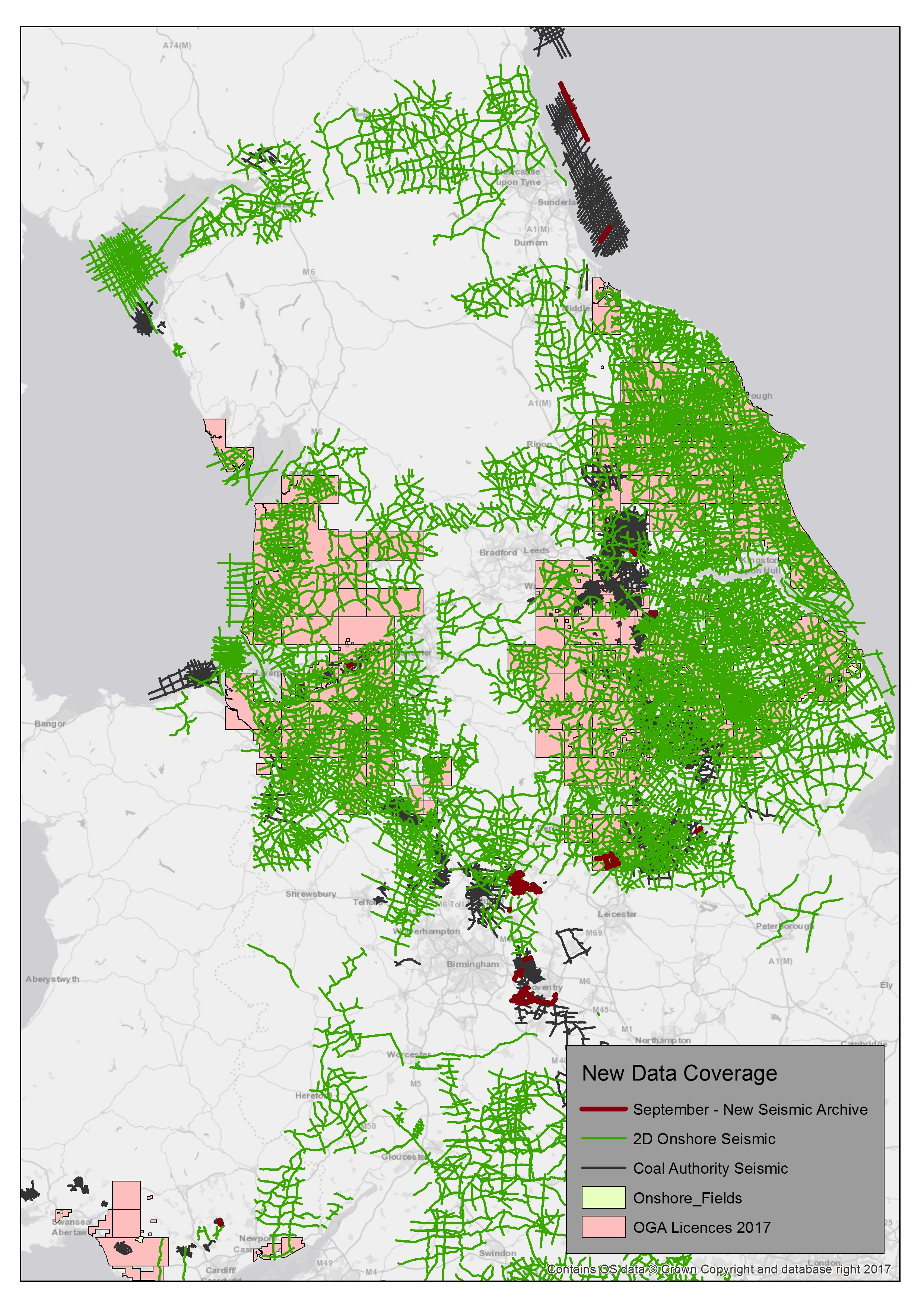
Following on from the Oil & Gas Authority launch of the 31st Offshore Licensing Round, a number of the offshore blocks offered in this round are located ‘near-shore’ adjacent to areas that have onshore seismic coverage available from UKOGL.
Recorded for the exploration of oil, gas and coal, the data sets include both onshore, transition zone and offshore surveys adjacent to or over the blocks offered.
The coal data is available to be licensed through UKOGL under agreement with the BGS and The Coal Authority.
Please contact either UKOGL direct or use our online interactive map and viewer for more information or to compile a data request.
The maps below displays the areas of onshore data located adjacent to the blocks on offer.
UKOGL Privacy and Cookie Policy
UKOGL has expanded and updated its Privacy and Cookie Policy
If you have any comments, questions or require more information then please contact UKOGL via these methods.
2016 OGA UK Onshore Seismic Data Download
The 2016 OGA UK onshore seismic data release packages are now available to be downloaded via the UKOGL Interactive Map website.
The UKOGL Interactive map provides immediate access to the onshore reprocessed data packages and the post stack 2D and 3D SEG-Y data can be viewed before downloading using iSeisview – An online seismic data viewer developed by Lynx Information Systems Ltd. that enables the user to interactively view the Post Stack SEG-Y in real-time.
Only the reprocessed 2D post stack SEG-Y and 3D data that forms part of the 2016 OGA data can be viewed in iSeisview.
The seismic viewer developed by Lynx enables SEG-Y data in 2D or 3D inline and crossline profiles to be displayed interactively in a web browser and allows the user to select display styles, zoom levels, horizontal and vertical scales and trace amplitudes of the SEG-Y data.
Access to the 2016 OGA onshore data packages via the UKOGL Interactive map does not require a login.
The freely available government funded reprocessed onshore data is comprised of UK onshore reprocessed 2D post stack SEG-Y data, SEG-Y gathers, navigation data and supporting processing reports located over three onshore areas of the UK:
- Isle of Skye
- Solway Firth
- South Coast of England.
The original processed 3D Wytch-Farm-98 post stack SEG-Y data is also available as part of the South Coast data set with all inlines and crosslines available to be assessed interactively using iSeisview before downloading.
How to Access the Data
Access to the OGA Onshore data packages is via the contents sidebar on the UKOGL Interactive Map as indicated below.
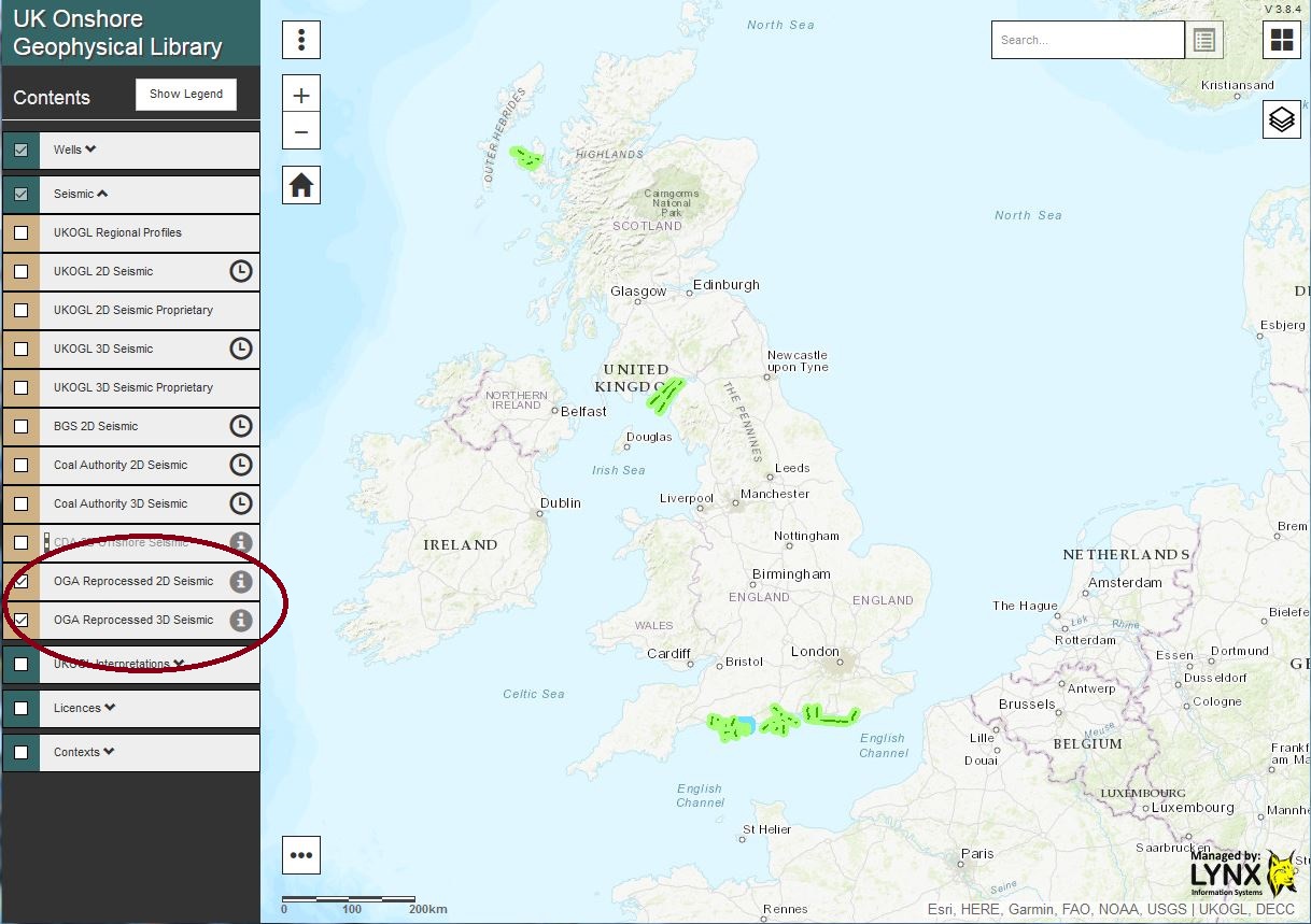
2016 OGA Reprocessed 2D and 3D Seismic displayed via the ‘tick’ box
The reprocessed 2D Post Stack SEG-Y data and 3D Post-Stack SEG-Y survey can be viewed immediately by selecting the “Live Seismic Viewer” option to assess the data using iSeisView or, by selecting the “View and Download Files” option a Virtual Data Room developed by Lynx will be launched for each area to easily access all onshore files that have been made available as part of the 2016 Government-Funded UK onshore reprocessed data packages.
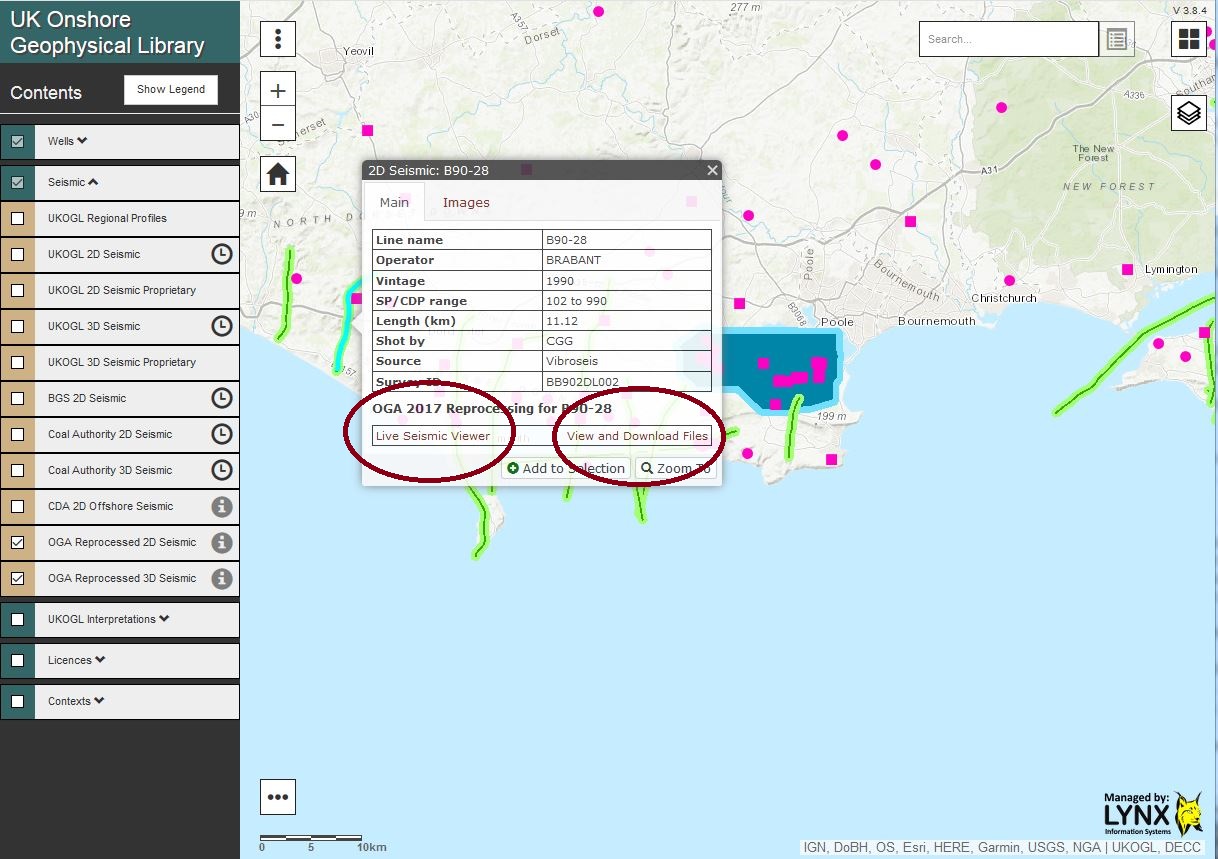
Following line selection – Option to interactively view the available SEG-Y data or access and download the data
The “View and Download Files” option launches the Lynx Virtual Data Room: 2D lines can be selected and the SEG-Y data viewed interactively via iSeisview either by selecting each line from the “Map” or via a “2D Seismic Line List” view.
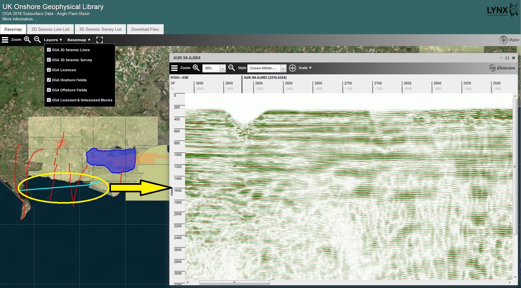
Virtual Data Room – The selection of a 2D line enables the SEG-Y data to viewed interactively using iSeisview
To view inlines or crosslines from the available 3D survey in iSeisview, ‘hover’ over and ‘click’ on the 3D survey and then use the left mouse button to select an inline or the right mouse button to select a crossline.
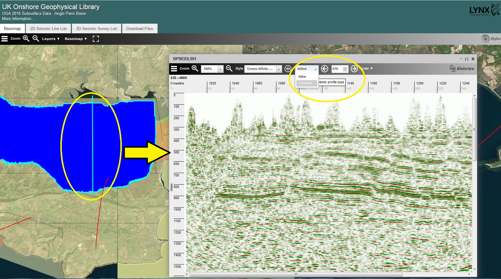
The left mouse button is used to select an inline to view via iSeisview from the 3D survey.

The right mouse button is used to select a crossline to view via iSeisview from the 3D survey.
EBCDIC header information, inlines and crosslines can also be selected using the options via the SEG-Y viewer.
To download the available data select the “Download Files” tab. The data for each package can be quickly and easily selected for download using the ‘tick’ boxes. Data for each area and line has been grouped and “pre-zipped” in to associated processed versions, SEG-Y gathers, reports, velocity files and navigation data files to streamline access to the data packages.
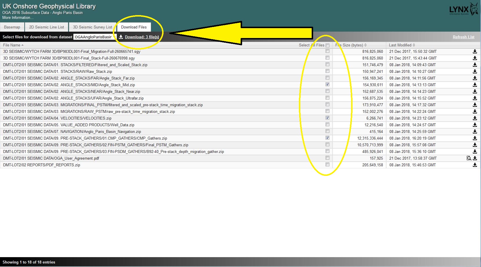
Select files and download via the “Download Files” tab.
The terms of the use of the data as supplied as part of the 2016 OGA data release packages can be found in: Oil and Gas Authority user Agreement.
The 2016 offshore data packages are available from download via the UKOilandGasData portal.
UKOGL Archive – New Lines – September 2017
Over 70 new seismic lines have been added to the UKOGL archive this month. Ranging from offshore Country Durham, the Midlands to South Wales this brings the total Coal Authority post stack line coverage now available through UKOGL to over 3000 lines in both SEG-Y and scanned hard copy section images.
The digital data was not available for these lines and was created by scanning, and vectorizing the hard copy sections to SEG-Y by Lynx Information Systems. UK British National Grid co-ordinates have been inserted in to the trace headers to ensure that the lines are ready for workstation loading and interpretation.

UKOGL Twitter Account
The UK Onshore Geophysical Library now has a Twitter account. Follow UKOGL to keep up to date with our latest UKOGL news and updates to the national archive. @ukoglnews