Category Archives: Seismic

Coal Authority Seismic On-Line Images

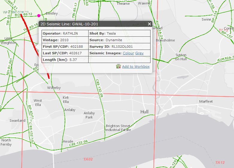
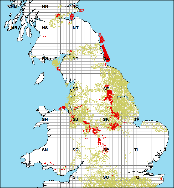
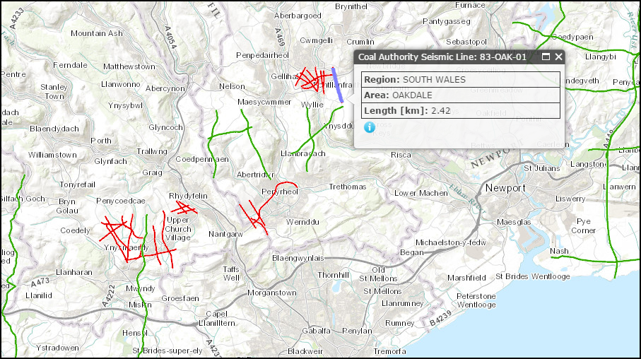
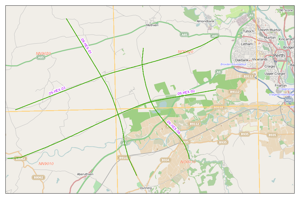
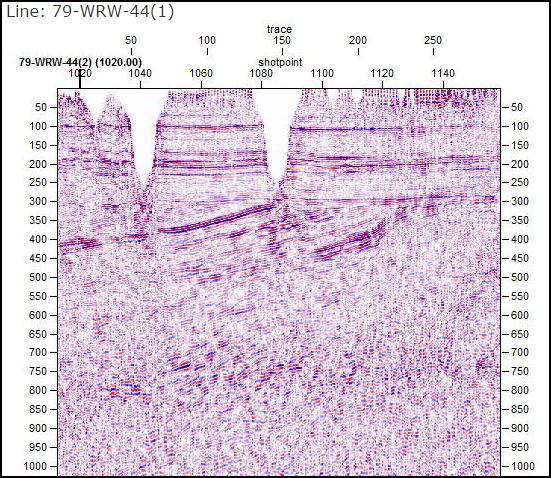
As part of our ongoing reconciliation of the Coal Authority Post Stack seismic archive, we are pleased to announce that, along with the provision of an updated map layer, we have started to upload seismic images of this coverage. Side-labels have been created for all lines and the seismic images will continue to be added over 2016 as the archive is completed.

coal-new1

coal-new2

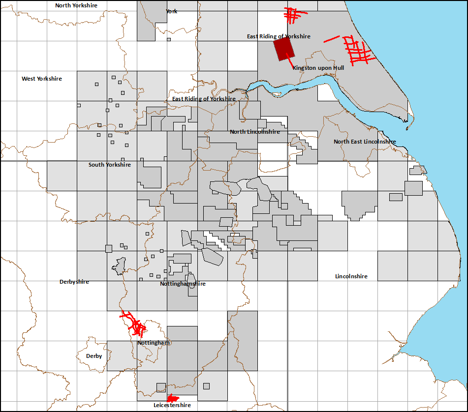
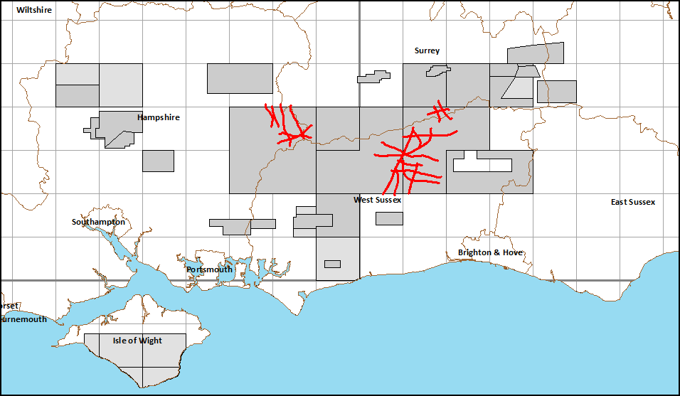
This coverage offers a valued addition to the national archive, providing infill for many areas of the UK not surveyed by the Oil & Gas sector.

Presently, the map coverage displays the Coal Authority lines for which Post Stack data exists but we aim to add an additional layer showing lines that have been acquired but not processed to date.

This work is being carried out in partnership with the British Geological Survey (BGS). Post Stack data can be Licensed directly through UKOGL, however Pre Stack Field Data is only available directly from the BGS at present.

UKOGL 2D Archive – January 2016 Archive Update

Line GWAL-10-201 is the latest onshore seismic line to the archived and released through UKOGL.

GWAL-10-201 is a 5.37km 2D seismic line located in East Yorkshire recorded in 2010, the archive is comprised of Pre and Post Stack data, supporting acquisition data and a full digital navigation data set.

GWAL-10-201

GWAL-10-201 was recorded as a 2D test line prior to the shooting of the Walkinton-11 3D onshore seismic survey to the NW.

New Surveys Released

In line with OGA defined confidentiality periods, all seismic surveys as shot in 2010/2011 are now released into the public domain. This covers a total of 53 2D lines (5 surveys) as acquired over the Weald, the East Midlands and north east Yorkshire and 1 3D Survey acquired over north Humberside.

Previews of all lines are now available through the UKOGL Map.

2016-new-p1

2016-new-p2

Coal Authority Post Stack Seismic Archive

UKOGL have recently embarked on a major project, in support of the British Geological Survey, to compile a fully reconciled digital Post Stack archive of Coal Authority seismic surveys, along with a definitive master catalogue of this geophysical data as acquired by the National Coal Board (NCB) and its successor, the British Coal Corporation (BCC).

Even though the project is in its early stages, UKOGL is able to make this data available for selection and purchase through the On-Line Map, although there may be a short time lag to supply surveys not on the shelf at time of request. Over time, as the archive is completed, the list of surveys will be refined and high resolution JPEG images added to the website.

This coverage, detailed in red below, offers a valuable infill to the UKOGL archive of data recorded by Exploration Companies.

coal-new

UKOGL ARCHIVE – 1984 BP Survey Archived

The BP survey ( BP842DL027) recorded in 1984 has recently been added to the UKOGL archive. This survey consists of 25 2D seismic lines (totaling 288km in length) and consists of both Pre & Post stack data, SP navigation, scanned hard copy images and supporting acquisition data.

bp-84

BP 1984 Firth of Clyde 2D seismic Survey

The survey is located in the Firth of Clyde but was recorded by BP over their Licence: PL262

pl262

Location of the 1984 BP Licence PL262 in the Firth of Clyde.

For more information about this or any of the other surveys or data available from UKOGL, please contact us here


UKOGL-RG-007 – New UKOGL Regional Line

A new regional profile, UKOGL-RG-07 has been compiled and loaded to the UKOGL Map.

map

The line, a  SSW-NNE profile extending from near Newport, on the Bristol Channel, through the Lower Paleozoic basins of the Welsh Borderlands into the Upper Paleozoic basins of Shropshire and Staffordshire, where it intersects with Profiles UKOGL-RG-005 and UKOGL-RG-006.

The free high resolution JPEG images of the 254km line are available as colour and grey scale versions and the digital SEGY data is available under licence for this regional profile at the standard rate of £1000.00 / profile. (Please contact UKOGL for more details.)

A detailed overview of the line and an interpreted version will be added to the website in the near future.

Coal Authority Seismic

With kind permission of the British Geological Survey, we are now able to provide identification and additional meta data for the Coal Authority Seismic layer.

coal-popup

The BGS act as data custodians for the Coal Authority and the information button provides a direct link to the relevant BGS web page, with details for data access to all interested parties.

coal-bgs-page

Regional Profiles Seminar

In January, UKOGL chaired a discussion group at the Geological Society, to share knowledge of the deep geology of the onshore UK and to discuss new insights that had been raised with the production by UKOGL of a series regional seismic transects across the main landward basins.

The meeting was attended by:
Malcolm Butler (UKOGL), Chris Pullan (UKOGL-Celtique), Gary Kirby (UKOGL-ex BGS), Dorothy Satterfield (UKOGL-University Of Derby), Toni Harvey (DECC), Nigel Smith (BGS), Tim Pharaoh (BGS), John Underhill (Heriot-Watt University), Rachel Jamieson (Heriot-Watt University) and Ian Roche (Aurora).

Piltdown

Photograph by kind permission of Professor John Underhill. Any similarities to John Cooke’s 1915 painting ‘Piltdown Gang’ in the background is purely coincidental.

2014 Seismic Release

With the turning of the year, 1 additional seismic survey has been released into the public domain and is now available to view through the UKOGL web map.

2009 2D survey as acquired by Hurricane west of Perth.

09-hex