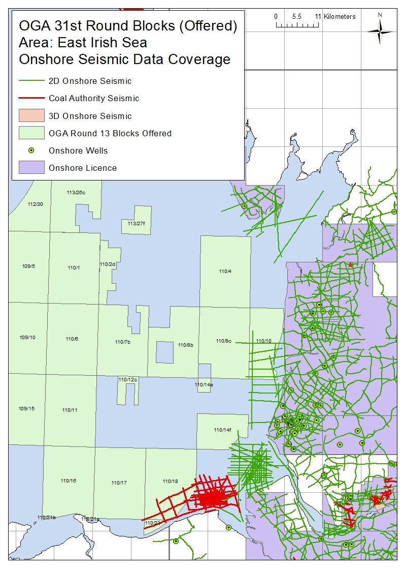
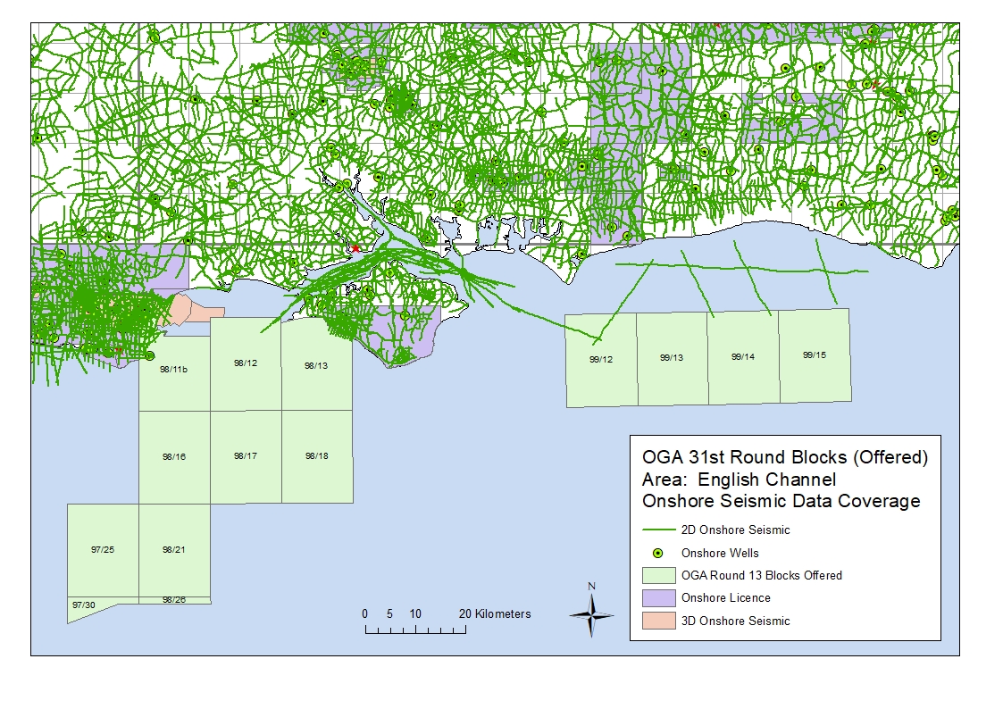
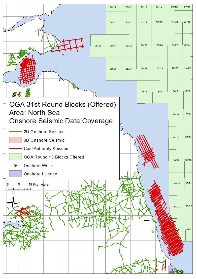
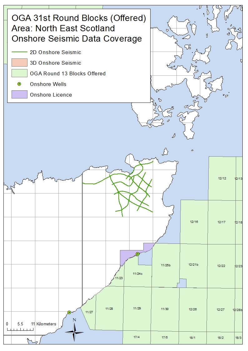
Following on from the Oil & Gas Authority launch of the 31st Offshore Licensing Round, a number of the offshore blocks offered in this round are located ‘near-shore’ adjacent to areas that have onshore seismic coverage available from UKOGL.
Recorded for the exploration of oil, gas and coal, the data sets include both onshore, transition zone and offshore surveys adjacent to or over the blocks offered.
The coal data is available to be licensed through UKOGL under agreement with the BGS and The Coal Authority.
Please contact either UKOGL direct or use our online interactive map and viewer for more information or to compile a data request.
The maps below displays the areas of onshore data located adjacent to the blocks on offer.


